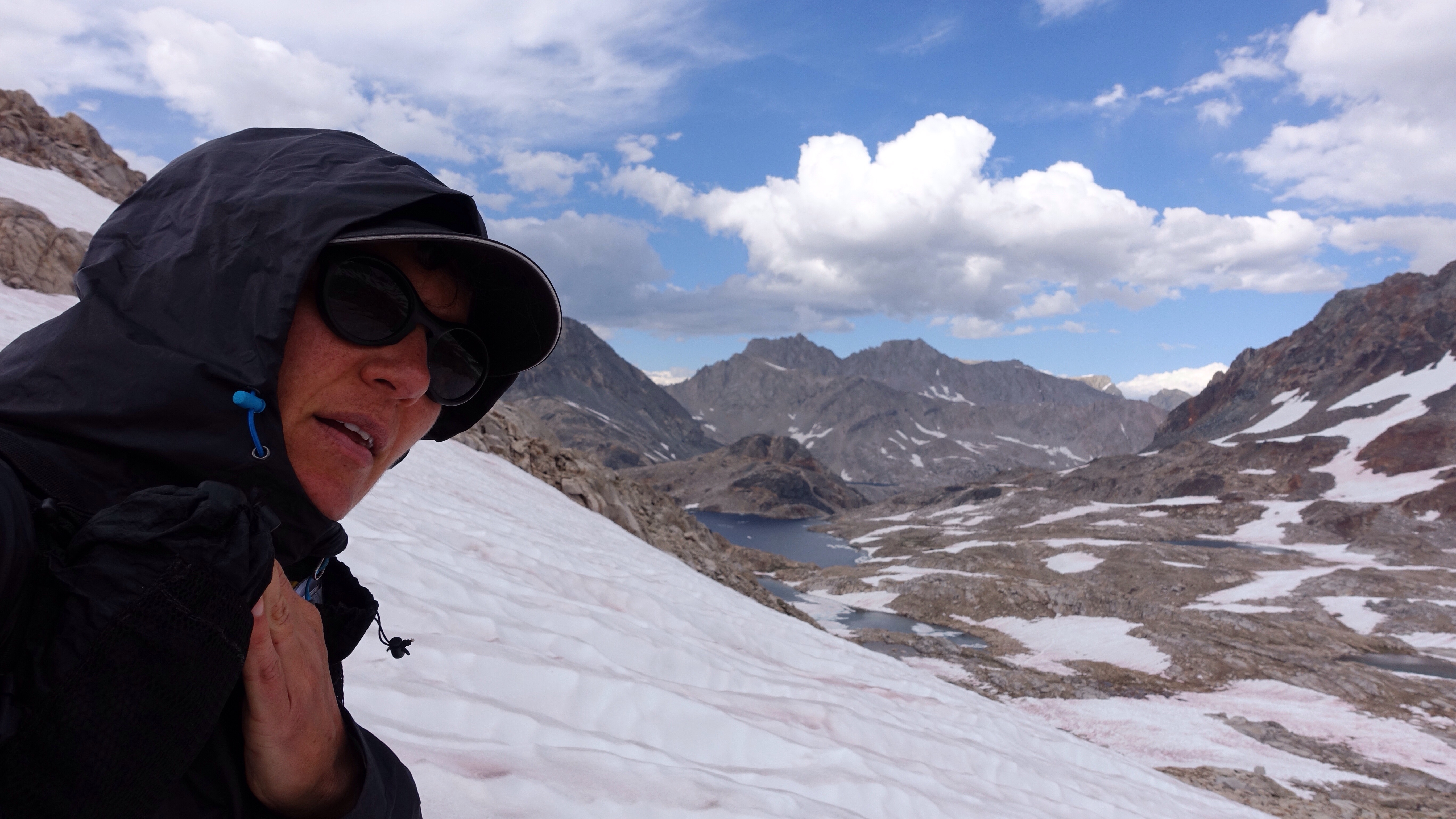
Author: Katherine

  • Day 11: from hard to easy

    Day 11: from hard to easy

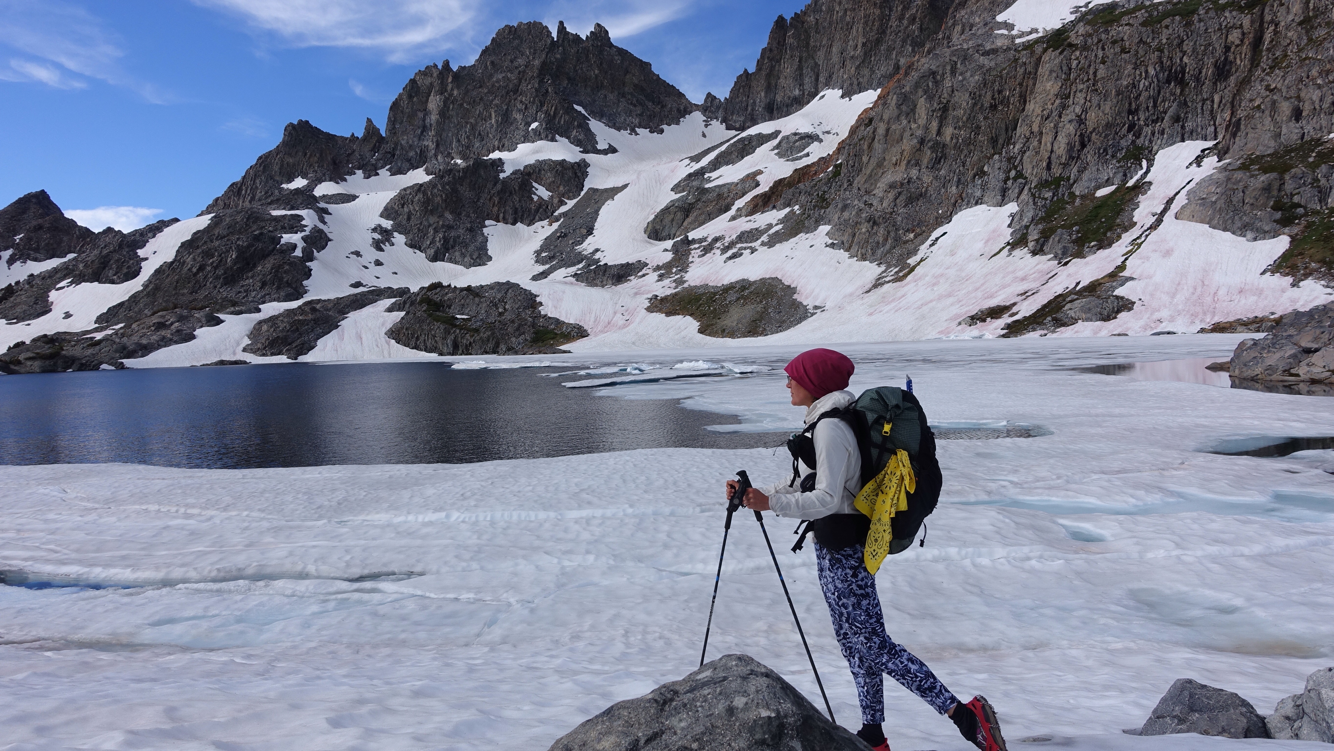
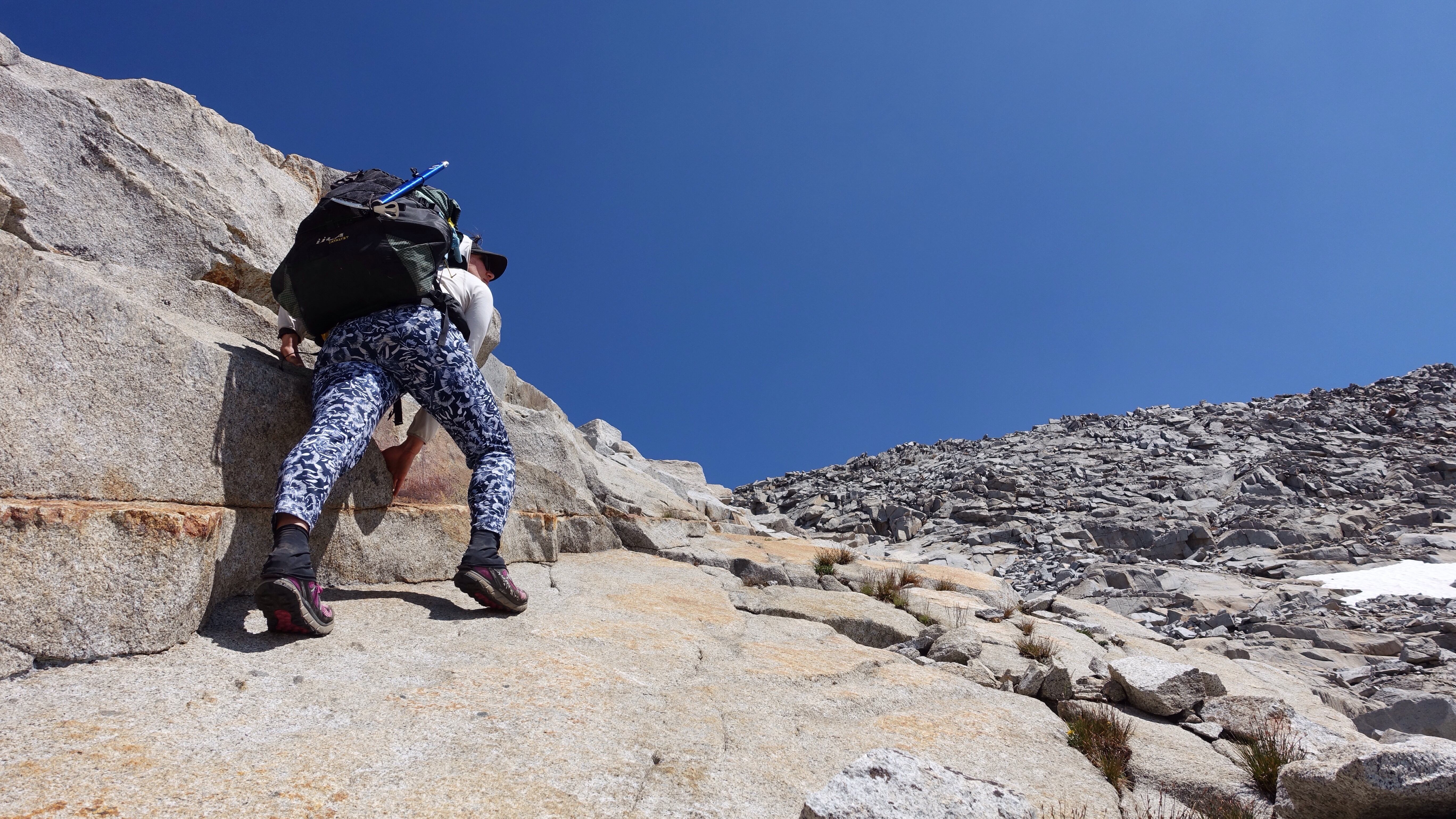
    Today I climbed over Snow-Tongue Pass, the obstacle that has been silently shaping the last three days of travel as I arranged to wake up this morning ready to begin the ascent before the snow became too soft in the sun. Roper describes Snow-Tongue as the most difficult pass on the Sierra High Route, and I was concerned about the effect all the extra lingering snow would have on the climb. I woke up ready to find out, and began winding up through talus fields, around Wahoo Lakes, up snow and more talus. I slipped once on a steeply angled piece of talus, scraping the skin off my ankle on both sides and tearing a hole in my sock. The ease with which a person could seriously injure a leg out here by leaping from rock to rock is considerable. Aside from that small mishap, I easily made it to the base of the last 300 feet of the climb, where the route changes from one involving walking upright, homo sapien style, to one involving a mix of crawling and climbing like a lizard up a boulder. The last of the ascent is very steep and very loose. Roper suggests going up a gully on the far left, which is shared most years by the snow-tongue from which the pass gets its name. But this year that gully looked like nothing but snow tongue. One big fat wide snow tongue streaked red with watermelon snow, taking up the whole gully. And treacherously steep. I didn’t want to mess with it, feeling that the mix of dirt chutes, scree, and wedged boulders to the right looked eminently more doable. It even looked easier than some of the other passes have so far. Roper is clear when he says not to descend this side of the pass (remember that he writes for the opposite direction), saying it’s dangerously steep and loose. In retrospect, now having crawled up through those dirt trenches, I would have to agree. This was one of those times where the route was not easier than it looked, rather was actually harder. My misadventure on Whitebark Pass, ascending the adjacent mountain face to skirt around a massive snowfield, is the other such instance of difficulty far outpacing appearance. In any case, scrabbling up the soft dirt, grabbing rocks to hold onto only to have them wrench free from the mountain and violently clatter several hundred feet down below me, and an unsettling sense of being unattached to the mountain and back heavy towards the open drop behind me–that was my trip up. Followed by topping out with a hoot of joy. No big deal. Harder than it looked, but all told not that hard. As hard goes, anyway.

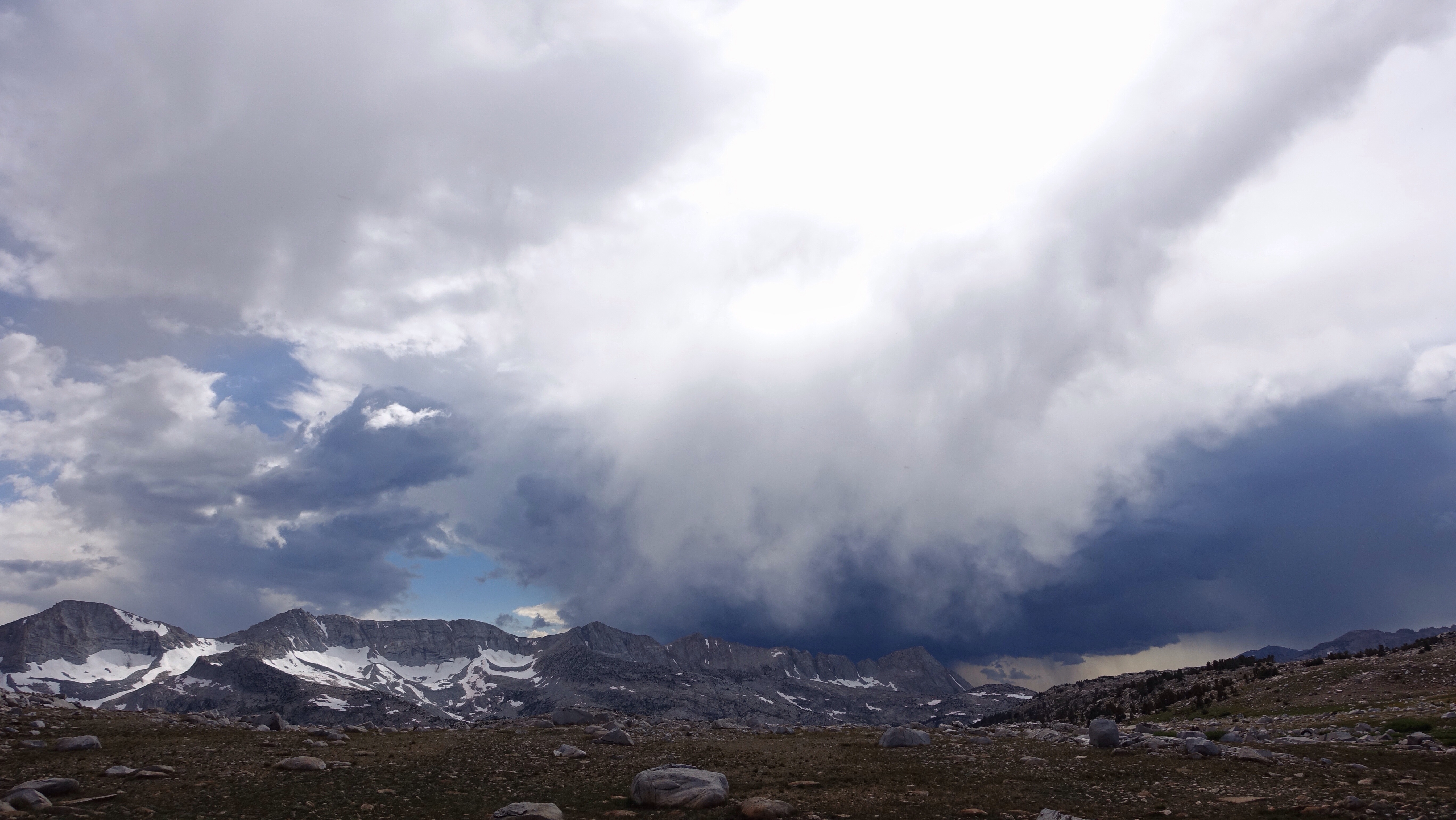
    Snow-Tongue Pass is the middle notch above, and the snow tongue is the large snow patch just to its left.
    Self portrait number one.
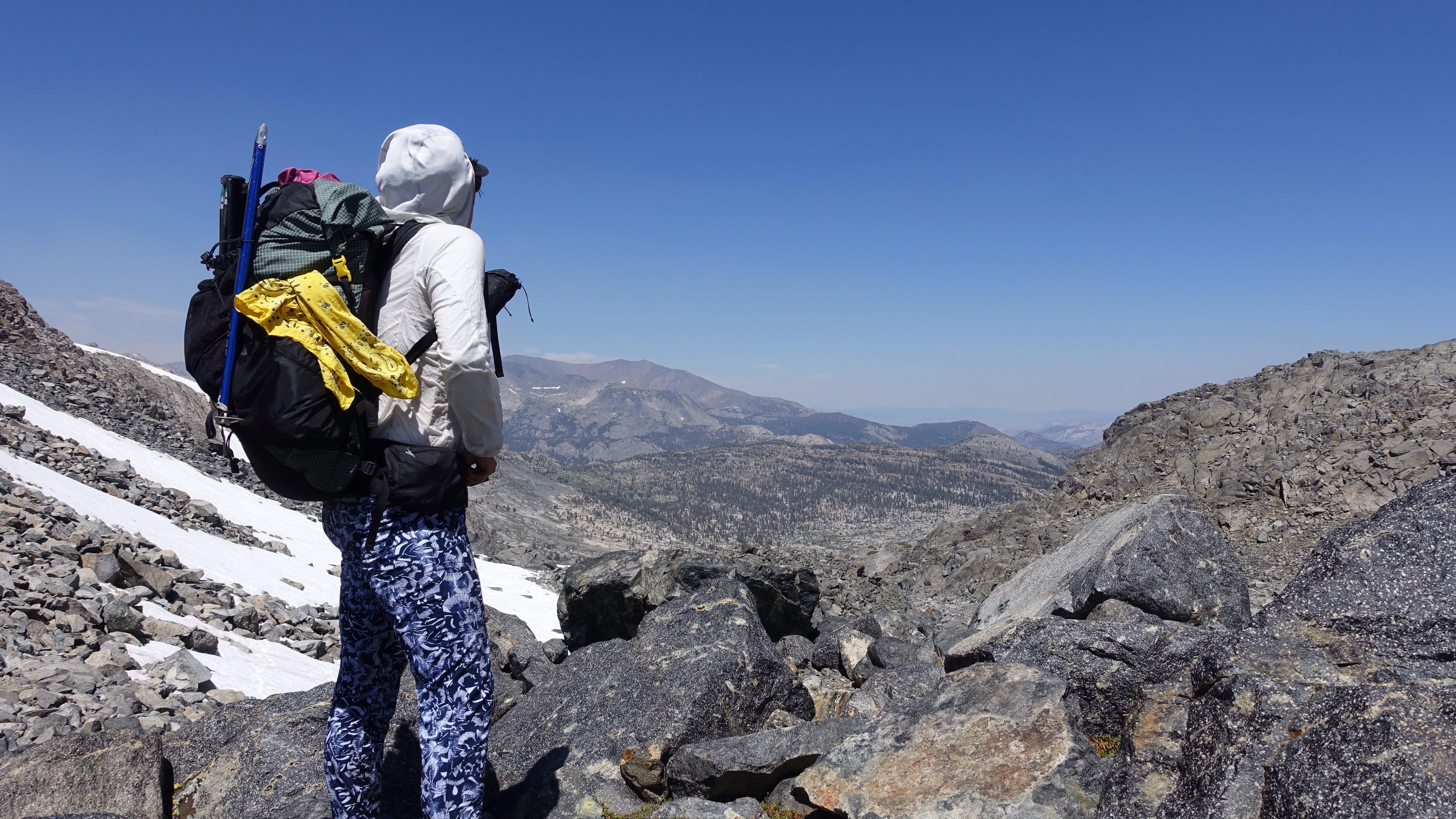
    On Snow-Tongue Pass, looking northeast from whence I came. The steepness of this side of the pass is difficult to see in the photo. Climbing it was like going up a ladder made of loose dirt and rock.
    Hail the victorious lizard.


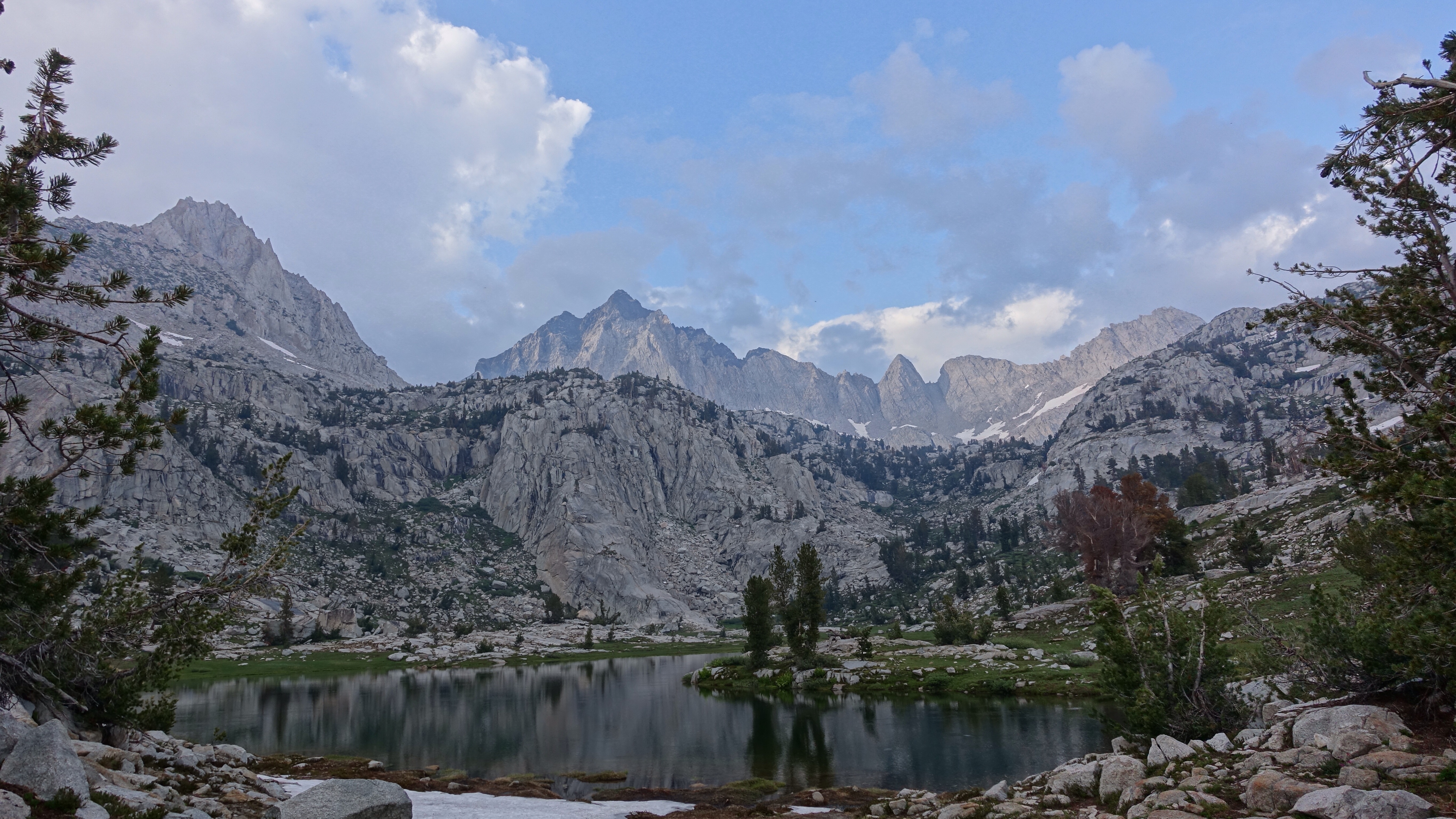
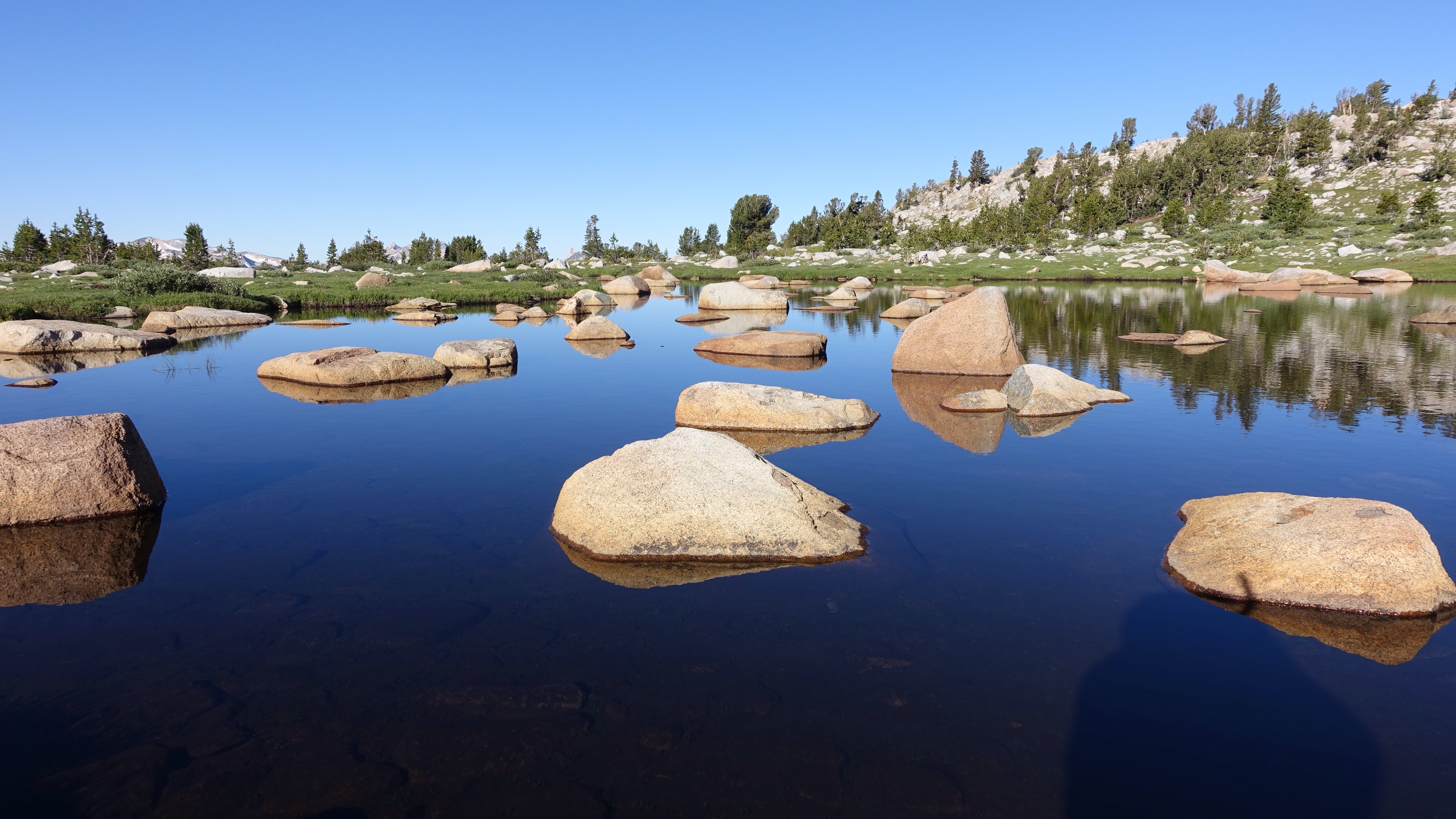
    Mountain architecture in Wahoo Lakes.

    The descent to the west was easy, gentle. I dropped down past Frances Lake and then walked a long traverse high up on the side of Evolution Valley, staying between 10,700 ft. and 11,000 ft. as I navigated a mix of forested benches, willow-choked cascades tumbling down from above, and impassible granite outcroppings. I was making such good time today, and I didn’t have much farther that I needed to go, so I ambled. I rested. I ate an entire can of Pringles. I watched an ant carry a stick. And still, I popped out on the Pacific Crest Trail, my path for the next fifteen miles, around 12:30p.

    I and the PCT, we headed southeast through Evolution Basin, past Mount Darwin and Mount Frick and Mount Huxley (there is a Lamarck Ridge nearby, for the biology history buffs). The lakes were beautiful blue gems, pots of scattered sunlight held in depressions on the surface of the earth. As the trail slowly climbed toward Muir Pass, yet another storm was building to the west, marking my fourth day in a row with thunder storms complicating travel. I hurried upward to beat it there, unsure if it was even traveling east as I was. Under a smattering of rain and chill wind I arrived at the pass, the thunder staying far west, and stepped into the Muir Hut, a stone building that waits on the top of Muir Pass for travelers who seek temporary shelter from a storm. The hut and I, we filled a need in the other. I ate some salami and crackers, and chatted with a pair of PCT hikers who arrived shortly before I left. I had assumed that I wouldn’t see any PCTers on this trip, since they’ve usually all long been through the Sierras by now, but so many of them skipped it earlier in the year due to snow and are now back to finish it off. We compared our PCT experiences, mine from twelve years ago to theirs now. A different time, a different trail.

    Evolution Basin along the JMT/PCT.
    Muir Hut on Muir Pass.
    Muir Hut roof from inside.

    From the Muir Hut, the trail drops southeast and, to my squelchy delight, actually gets a little gnarly. There is so much snow, and there is so much snow melt, that the trail is buried or flooded, there are ugly snow bridges and some fleet-footed stream crossings. I encountered a family on the way down, first because they were yelling at me from across a lake not to go the way I was going. I was startled to be instructed in how to travel the trail, and yelled back to assure them that everything was ok. Later, I caught up to them at a stream crossing and understood why they were so concerned. They were JMT hikers in a profound struggle with the rigors of this snowy descent. The woman was paralyzed with fear on some talus near a stream, and the man was carrying the younger child, maybe seven, across the stream. After setting her down, he returned for the woman’s pack, carried it across, and then returned for the woman to escort her from her state of paralysis and down from the rocks. Off to the side stood a teenager, who seemed discomfited by the troubles of the rest of her family. I offered to help, and the man kindly waved me off, saying it’s just been a hard descent and they’d be fine as soon as they made camp at the lake up ahead. I went on, made it to the lake around the bend, and saw it was completely, dishearteningly snowbound. I slowed through the next few snow slopes and flooded trail crossings, keeping an eye on the family behind me. The young child was tired and hungry, the woman increasingly immobilized, the man ferrying back and forth, back and forth through water, over snowfields, across talus. It was getting on 6:30, and I didn’t know how much longer the snow would go on. The descent is winding and wedged between steep mountain ridges, so we weren’t granted the gift of sight, of knowing what to expect. I finally turned around, went back to them as they repeated this complicated and slow navigation of yet another flooded, snowy steam crossing.

    Can I be of some assistance? I asked. I can carry a pack or walk with someone.

    No, the man snapped. I know what I’m doing.

    Ok, I just don’t want you to get stuck up here as night comes on, I said.

    I know what I’m doing, thanks, he said. The woman just stared down at her feet.

    I had struggled with even offering to help at all. I know a kind-hearted offer of assistance can feel undermining (a very close person in my life is very sensitive to my offers to help coming across as patronizing, so it’s a habit I’ve tried to learn more skill around). But I was genuinely worried about them, and only hope that my offer didn’t make a difficult situation worse by wedging in a psychic splinter that will fester for days. Such things happen. Good intentions are sometimes not enough.

    I acquiesced and continued the descent, knowing I would stop at the next campsite and make sure they arrived. As I descended, another hiker approached. He asked about campsites at the next lake up. I told him he either needed to be fast to make it all the way over Muir Pass before dark or be comfortable sleeping on snow. He decided to turn back and walk the quarter mile downhill to the last snow-free campsite he had passed. I walked along with him, chatting about his experience so far. He had a very nice hat, a red shirt, and sturdy boots. He had a family back home. He was living in day-to-day bliss as he hiked the entire John Muir Trail. I told him about the family, asked him to keep an eye out for them, and waved goodbye at the campsite, carrying on downhill to a little scratched-out spot on the hillside above the trail.

    I wanted to tell the woman that she was feeding the wolf of fear. My husband tells a parable, based I think on a Native American story, of a person with two wolves inside them. One is the wolf of anger, one is the wolf of compassion. Both wolves live side by side, and cannot be eradicated. But the person has a choice about which wolf to feed, and thus which wolf will be the stronger one. In some Buddhist traditions, this is similar to the idea of the echo, that we create our psychic environment by the emotional tenor we tend to. I understand why the family was so concerned for me: they were feeding the wolf of fear, and that was the animal that was thus residing most vibrantly within them. All they could perceive was fearful situations. Fear is not to be underrated, and out here in the mountains is fundamental to survival. I empathize with her feelings of paralysis. I think in part what I’m doing out here cultivating my relationship to my fear, studying it, understanding my own wolf of fear, its loping carriage, the smell of its breath, the haunting glow of its eyes. How I feed it, or not, and when.

    As I was sitting out cooking dinner, another rain cloud unburdened over my patch of earth, and I quickly shoved everything that was spread out on the rocks into the tent pell-mell, finished my dinner, and then zipped up tight for the night.

    Dinner and camp.

    Trying a new way to put my pack on.

  • Day 10: I can’t believe it already be ten days

    Day 10: I can’t believe it already be ten days

    I was a bit worried that I wouldn’t sleep well last night after seeing White Bear Pass (11800 ft), the very vertical and snow-patched wall right in front of me that I would be climbing this morning. Sheer, vertical, intimidating: all apt words. However, even though it looked difficult or impossible, I found to my surprise (and delight!) that I wasn’t that worried about it. If it didn’t go, I wouldn’t go. No big deal.

    So it was a good night of sleep after all, and as I was breaking camp the sun was just starting to illuminate the tops of the peaks ringing the west side of my small lake basin. Immediately I began the climb, a scant 800 feet, but of rather dedicated verticality. A steep talus slope was followed by a short bushwhack up steep willow-covered ledges which was followed by more steep talus and steep ledges. In other words, steep. (That’s the same word, I know, but it does the job.) I did the job too, cresting the top of the pass with no major problems, and immediately skirting a huge snow drift blocking most of the top of the pass (I could see it from the bottom, and climbed far to the left to avoid encountering it at the top). White Bear Lake sits perched right at the top of the pass, a small pond with dramatic drop offs on two of its sides. I scooted around the east shore and began traversing the labyrinthine Bear Lakes Basin, where every lake is named for bears: Teddy Bear Lake, Brown Bear Lake, White Bear Lake, Black Bear Lake, Ursa Lake, and Bear Paw Lake are just the ones I passed. The map shows also a Claw Lake and Tooth Lake and Den Lake and Beartrap Lake and so on. Cute, cuddly Bear Basin, very remote and can’t be accessed by trails, and I very much doubt it’s accessed by bears either, who don’t tend to visit the higher regions of the range which are difficult to get to and lacking in food. I came into the basin by way of a pass. I would of course leave by one.

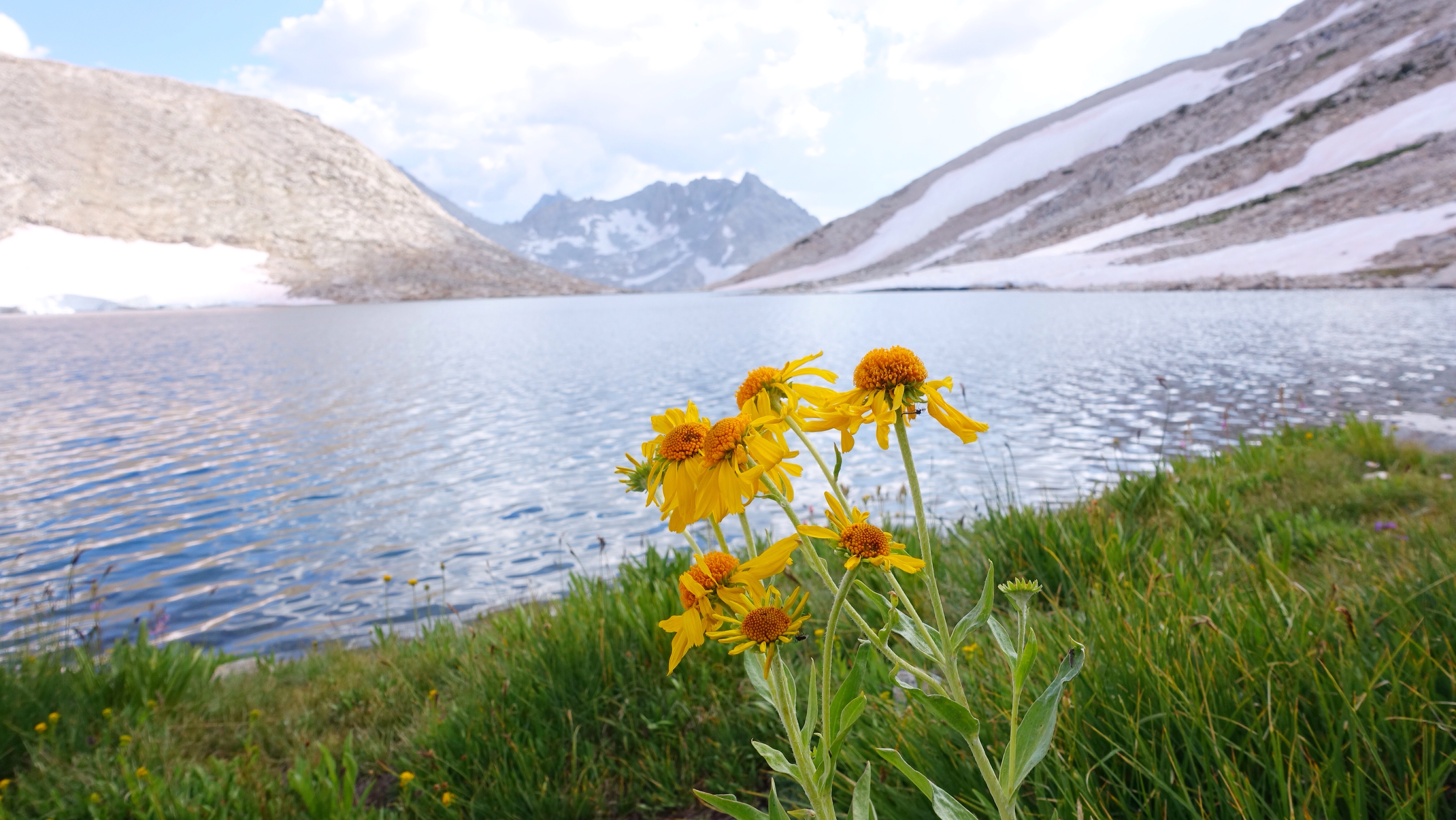
    Columbine on White Bear Pass.
    More Columbine.
    White Bear Lake at the top of White Bear Pass.

    I maneuvered up and down and around and through (and over and under and in and out) the convoluted terrain of the basin until I was in the primary drainage that I would climb up to Feather Pass (12375 ft). Snow plastered the way, paving over the talus and making for a straightforward ascent. I stopped to rest often, as I do climbing up all these passes out here because even though it’s been so many days I still gasp like a fish out of water, but I was at the top by 10:30a and looking south over gentle grass-covered granite benches. The passes are typically steep and rugged on their north sides, when I am climbing up them, and gentle and comfortable on their south sides, when I am descending them. I think this works ok in my favor, because when the terrain becomes more technical, going up is usually easier than going down. There is reason behind this natural patterning, which is that north sides hold snow longer, so freeze and thaw more, and over millennia these contractions work like a mechanical pump to slowly lever free rock from the mountain side, pulling down more and more of it until the north sides are steep and rugged. At least I think this is true.

    Lakes in Bear Basin. Feather Pass is the U-shaped dip in the ridge right of the jagged (feathered) ridge crest.
    The view looking up climbing up to Feather Pass. Talus is a kinetic puzzle of the best kind.
    Looking south from Feather Pass toward LaSalle Lake. Note the gentle terrain. Perfect for ankle rolling.

    And yet, even while going down such gentle benches among the grassy clumps and wistful colonies of flowers, I rolled each ankle. Neither amounted to a full sprain, but my ankles are quite delicate and are suffering under the abuses of this hike. Even if it were just climbing without the rolling incidents, they would still be under duress. I was tired this morning, getting sloppy as I thudded down the hill. One ankle rolled twice. I’m sorry, I whispered to myself. I could be more careful. I should be more careful.

    As I came above Lake LaSalle, I began to look for the ‘obvious cleft’ in the headwall above the lake that Roper mentions. Of course he mentions it for travelers headed northbound. I am headed southbound. He mentions nothing for me. It’s very hard to find such a cleft from above, especially in the hummocky tundra with snow-filled gullies blocking every view. I never found the cleft and ended up slithering down some cliff bands along with a small creek, which made the rocks slippery in addition to being steep. Eventually I debouched onto snow below, and began traversing around the edge of the lake. Almost immediately the traverse was steep, slippery snow fields plunging straight down into an ice-filled lake. This has become my least-favorite kind of obstacle on this hike. The consequences of an accident are rather grim. The line from a song I once knew pops into my head every time I do one of these traverses: ‘here’s a one way ticket to your watery grave’. I had my micro spikes on, but they are most helpful when the snow hasn’t warmed much. Once it’s softened in the sun, the passage is treacherously slippery.

    I made it across without mishap, of course. Though surviving is always an active endeavor out here, I am well committed to treading far into the staying-alive side of the divide (that mysterious divide, the ultimate rubicon). After the traverse, I gained some sandy benches and was able to easily find, from below, the ‘obvious cleft’, which would have allowed me to avoid the treacherous traverse along the snow banks, but all is well that ends well. Some clefts just aren’t meant to be found.

    A chain of lakes, dropping into a lush meadow below Merrimack Lake, and a steep drop down a canyon wall brought me to French Canyon and a short stretch of trail before leaving it to cut cross country again, this time climbing up to Puppet Pass (11800 ft). For the last three days, the afternoon skies have blocked out with gray storm clouds, and as I neared the final climb to the pass, 300 vertical feet of steep talus, the sky overhead was uncompromising. I waited at the bottom of the last and steepest part of the climb to see if I would hear thunder–a ridge line is exactly where I don’t want to be if there is a lightning storm–but firmament was eerily silent, heavily gray. I pushed up through the climb, taking far fewer resting breaks than I usually would, and began a fast descent as soon as I made the top. On the way down, wind and rain finally rushed in and around and accompanied me, and I donned my rain suit as all the individual gray clouds gathered together, west of my location, and let rip quite the storm. The sky was a heart of darkness above the mountains. Thunder beat out across the land, and while the storm was far from me, I was still in its aura of rain. Grateful to be spared the full intensity of it, I made my down into what turned out to be the most mosquito-dense area I’ve visited so far. Mosquitoes and gnats, so thick they surrounded me in clouds. Even after the rain stopped, I left my rain suit on as a barrier between their little suckers and my skin. A few miles later, at camp, I endured the constant whining cloud as I set up my tent and cooked dinner in my rain suit, with my head net on. This is a day I would have used my Deet, but when I went to dig it out I found I had lost it.

    Tomorrow I climb Snow-Tongue Pass, the pass that I’ve been thinking about for the past few days, mentally fencing with it as I draw near. The snow conditions have me worried. I’ve coordinated my travel the last few days to arrive here, near Piute Creek, on this night so I can approach Snow-Tongue while the snow is firm. No knowing like being there in person though. Otherwise it’s all thoughts like buzzing, electric storm clouds.

    Looking up at Puppet Pass, umbrellaed by storm clouds.
    The view north from Puppet Pass.
    Harried selfie on Puppet Pass.
    May your skies be occasionally be this interesting, even if it means rain.
    Hello, I am hiding from mosquitoes.


  • Day 9: Gabbot Pass and the Jabberwocky

    Day 9: Gabbot Pass and the Jabberwocky

    I woke up this morning feeling like I had my first solid night of sleep since beginning the hike. There is a pleasant limpidness in the body, a rich gravity, of having slept well, as though every cell had a chance to settle into its own weight. My morning routine is becoming so established that by the time I’m done with everything, I consistently seem to be breaking camp at 7:05am. Today as well, and I began the downhill trek from the lake feeling refreshed.

    I had a goal for the day, which was to walk in a way that didn’t exacerbate my irritated left ankle. A full-on reemergence of an old tendinitis there would probably halt my trip, so figuring out how to continue these next five days and allowing the irritation to subside feels paramount. I knew I had a long climb, over 3500 feet, from Mono Creek up to Gabbot Pass today, and climbing is one of the main irritants. I hoped that I could pay close attention and modify my gait as necessary to prevent further injury. Before I even left camp, I used the metal handle of my ice axe pressed into my calf and vigorously rubbed it up and down, hoping to relax the gastroc and get some slack in the system.

    From Laurel Lake I had a long descent to Mono Creek, utilizing a mix of no trail, faint in-and-out trail, and then established trail. For a long time I walked among lush meadowlands, sometimes boggy with standing water that I skirted at the rocky edge, and was accompanied by my regular choir of mosquitoes (I’m beginning to think of them like backup singers). Eventually the meadows ended and the steep hillside plunging to canyon bottom below began. On the way down, as I stopped for a morning constitutional, I was delighted to find a robust field of wild garlic, identifiable by dozy purple fluff-ball flowers and, upon a nibble, that unmistakable spicy flavor.

    As I was descending I could see across the canyon into Second Recess, a long and deep print left in the side of a massive mountain ridge. The print-leaver was a glacier, ages ago scouring down into rock. I can’t help but imagine a child with a lump of clay, pushing in dents and recesses and making all manner of texture. An icy child playing with the lump of clay called ‘earth’. My route would cross Mono Creek at bottom of the canyon (the creek was vigorous–I crossed by crawling on hands and knees across a fallen log, white rapidly moving water a foot away from my face), then climb into Second Recess on the way up to Gabbot Pass. There is, by the way, a First Recess and a Third Recess, along the same mountainous ridge, each left by a glacier at play sculpting the land.

    ’Twas brillig, and the slithy toves
          Did gyre and gimble in the wabe:
    All mimsy were the borogoves,
          And the mome raths outgrabe.
    A mile and half into Second Recess, I turned east to follow Mills Creek up a steep side wall into a hanging valley, sometimes following a faint use trail and sometimes just whacking my way up the slope, alternately stepping from talus stone to talus stone and then fighting through willows and some kind of pernicious sticker bushes. Manzanitas are here too, and they appear to be in bloom, vicious thorny pods growing in clusters from their branches. As I climbed, I carefully monitored my ankle, suppressing the drive to push off the foot through the toes when making a big step up. I think that especially is aggravating. It means more a flat-footed climbing strategy, and shunts some of the load from my springy rear lower leg into the quad, hamstring, and glute. I find that climbing using these larger muscles is more cardiovascularly exhausting than using the springy lower leg, and perhaps as I’ve been struggling up these monstrous hills in this rarefied air, that’s why I’ve been over using the tendons in my ankle. Anyway. Just a technical and geeky thought.

    Eventually I passed Lower Mills Lake, climbed more, passed a couple tarns, passed Upper Mills Lake, all of us–the lakes, the tarns, the cheerful Mills Creek connecting all the bodies of water with one continuous, silvery thread, and me–pinned between soaring granite walls with jagged tops like Jabberwocky teeth.

    “Beware the Jabberwock, my son!
          The jaws that bite, the claws that catch!
    Beware the Jubjub bird, and shun
          The frumious Bandersnatch!”

    My climb passed liquid water flowing ever downhill and transitioned to snow, interspersed with talus, the Mills waterways twinkling far below me, until finally I made it to the top of 12250 foot Gabbot Pass, a low saddle between Mount Gabb and Mount Abbot (gotta love a good portmanteau–or should I say, portmounteau). The highest I’ve been yet, and not much a view, because the surrounding mountains are just hogging up all the space by being so mountainous against the sky. Still, a victory of sorts, not to mention that I managed to get there without overly relying on my left ankle. Ready for some beamish galumphing.

    He took his vorpal sword in hand;
          Long time the manxome foe he sought—
    So rested he by the Tumtum tree
          And stood awhile in thought.
    And, as in uffish thought he stood,
          The Jabberwock, with eyes of flame,
    Came whiffling through the tulgey wood,
          And burbled as it came!
    One, two! One, two! And through and through
          The vorpal blade went snicker-snack!
    He left it dead, and with its head
          He went galumphing back.
    “And hast thou slain the Jabberwock?
          Come to my arms, my beamish boy!
    O frabjous day! Callooh! Callay!”
          He chortled in his joy.
    ’Twas brillig, and the slithy toves
          Did gyre and gimble in the wabe:
    All mimsy were the borogoves,
          And the mome raths outgrabe.
    (the Jabberwocky by Lewis Carroll, somehow appropriate for this day)

    The descent was easy, little snow, grassy gentle slopes leading down to Lake Italy. Why Lake Italy? Because it is shaped like a boot, of course. Lake Italy is long, about two miles, and dwells above 11000 feet, so the surrounding terrain is stark: rock and snow, fragile small grasses and flowers clinging to life in the gaps. There is a faint use trail winding its way along the shore, right next to the vibrantly hued water, and I greatly enjoyed ambling alongside. I almost stopped to swim but didn’t, a mix of time constraints and a ponderous coterie of fat gray clouds congregating overhead that made me think it might rain soon.

    From Lake Italy’s outlet, I curved around a shoulder of granite benches and arrived at Teddy Bear and Brown Bear Lakes, my gateway to the Bear Basin part of the Sierras, where everything is named after cute little ursines. Tomorrow morning first thing I’ll climb White Bear Pass, which looks from down here perhaps impossible, but I’m learning that reading the landscape can be difficult to do until it’s right underneath you.

    Sage brush and talus terrain on the way up to Gabbot Pass.
    Rocky talus on the way up to Gabbot Pass.
    Suncupped watermelon snow on the way up to Gabbot Pass. In 3600 feet of elevation gain, a little bit of everything.
    Flowers and Lake Italy.
    Teddy Bear and Brown Bear Lakes, with White Bear Pass the low notch in the center of the ridge. I’ll climb it first thing in the morning.
    Me and White Bear Pass, before we meet in person, flesh to rock. White Bear Pass looks very tiny. Or else I look very large.
    Sunset over Teddy Bear Lake.

    The swim I didn’t take at Lake Italy. White Bear Pass, this swim is for you.

  • Day 8: why am I so tired when there was so much trail?

    Day 8: why am I so tired when there was so much trail?

    Mornings are a sweet time in the mountains. The air is fragrant with optimism, birds sing to the gentle sun, and I don’t know yet what my day will feel like. It’s unwritten. It’s unknown.

    What I did know when I woke up next to the placid surface of Deer Lake is that I would be on trails for about the first nine miles of the day. A light use trail (this is a way of describing an emergent path created by feet walking, as opposed to a trail planned and built by a trail crew) led from Deer Lakes’ serene little hamlet over the Sierra Crest, west to east in a zig, then a quarter mile later back east to west in zag, before descending to Duck Lake. I picked up a real trail there along the shores of Duck luck, which descended to join the Pacific Crest Trail (and John Muir Trail–they sometimes share the footpath in the Sierra), on which I walked for six long miles, encountering other hikers every 15 minutes or so. Most were JMT hikers, but there were a few PCT hikers who skipped the Sierras when they would have gone through in June due to the high snow year and only now are returning to finish up this section. Lots of PCT hikers seem to hike the trail this way these days, employing a strategy known as flip-flopping (not the same as the political version of flip-flopping). Hike a part, go somewhere else, hike another part, piece by piece until by the end of the season you’ve completed the trail.

    I also ran into another Sierra High Route hiker today, the sixth party of SHR hikers headed northbound since I started eight days ago. I’ve never encountered more than one party per day, but more days than not there has been a passing. If we meet on one of the remote, trailless sections, we immediately know one another as fellow SHR hikers. If we pass on a trail and eye one another’s ice axes, inquiries are made and kinship established. No one else out here seems to be carrying ice axes. Indeed, at Red’s Meadow, I was mocked by some JMT hikers for having one when they thought I was another JMT hiker.

    I met the SHR hiker today long after I had left all the trails and begun the hearty ascent of a few thousand feet from Tully’s Hole up to Shout-Of-Relief Pass (11400 ft). These off-trail ascents are steep, and my left ankle’s wee tendon was complaining as I hefted myself up rocks, slabs, and severe inclines dotted with small boulders and pines. I had just finished such a climb up to Cotton Lake and saw a figure coming toward me, who I knew must be an SHR hiker because trails were long behind me (or long ahead). I was pleased to discover another solo woman who is doing a section of the route. In all the other parties of SHR hikers I’ve met, only one other person was female and she was with a partner. Not that it matters really, but I do notice there aren’t many women out here, and even fewer who fly solo. We didn’t chat for long–the mosquitoes were horrendous and we both had places to be–but I did get some helpful information about her experience on a pass I’ll be crossing three days from now that, with all the lingering snow this year, has had me a bit worried. Snow-Tongue, they call it. What a name in a year like this one.

    After waving goodbye, I continued the climb up to the pass, over rocky outcroppings, up steep grass slopes, across soft and slippery snow patches streaked with red (‘watermelon snow’ is how I’ve always known the red streaks that appear on consolidated snow fields in summer, and my understanding is that it’s a kind of fungal growth). I was in a bit of a hurry, despite having decided many days ago I wished to avoid being in a hurry on this trip, because to set up my days right for the upcoming passes between here and my next resupply stop, it would be best if I could make it to Laurel Lake tonight, nine trail miles and six cross country miles over two passes away. If the passes were straightforward to navigate and relatively free of obstacles, it wouldn’t be a problem to cover this mileage, but of course I didn’t know what they would be like until I was with them in person. So I was hurrying, not stopping to rest or eat or drink water much, and then the clouds began to flock together, thickening and darkening the sky to the west. Afternoon thunder storms are a regular occurrence in the Sierra during summer, and they can often be vicious, though brief. I needed to be off the ridge containing Shout-Of-Relief Pass before they unleashed their gathering energy, in case they happened to do it right overhead. So now I was hurrying to crest the pass before the weather came, and I was thirsty and I was hungry and I was climbing up up up. In general I rather dislike physically onerous ascents under time or weather pressures, and yet they do seem unavoidable from time to time. I suppose I could have stopped next to a slight trickle of snowmelt in the next flattish place and called it a day, but I didn’t.

    As the dark clouds moiled about over nearby peaks, I labored upward and finally, with all the sludgy spirit of a very tired human, made it to the top of the pass. Taking no time to revel in the fact, I sped down the other side, dropping a quick 600 feet to Rosy Finch Lake. Once on the lake shore, I stopped finally for a snack and some water, and to see whether the clouds would go for it or not. Watching a mass of dark cloud shift one way and another, grow, change shape, etc, is like watching a person who has a sneeze coming. In either case the contortions may not come to fruition, but as a viewer there is an expectant pause, a held breath, waiting for the denouement that is being prepared. No storm broke as I sat on a rock eating triscuits and almond butter, watching ice floes slowly approach as the wind blew them across the lake. A few scattered drops fell, but then the clouds seem to blow off elsewhere and take their threatened sneeze with them. I shouldered my pack and made the next ascent, 400 feet up to Bighorn Pass (11250 ft). A stout climb, with big steps up making my ankle tendon cry out for mercy, and before long I was detouring a snow field and descending the other side, down down down to Laurel Lake looking diminutive some 900 feet below the pass. I arrived exhausted from racing the storm that didn’t come, and though it was early, a quarter after five, I decided to give it a rest and stop for the day. As I was setting up my tent, the edge of the storm finally made an appearance, and though there was no lightning I could see and the thunder sounded far away, rain began to make twinkles on the surface of the lake as the fish jumped for mosquitoes. The sound of rain pattered on my tent. I donned my rain gear and a headnet because these here are the worst mosquitoes I’ve seen all trip, and I sat out in the weather and cooked my dinner. Mac and cheese and tuna, in case you were wondering, and itt was delicious and warm, and the ripples on the lake from the jumping fish met the tiny flashes of dropping water from the rain, and the mosquitoes whined at my face but couldn’t bite me, and Red and White Mountain loomed above the lake, framed perfectly by the steep walls of the valley and the richly textured sky, everything misted in the atmospheric storm, and I thought fuck yeah.

    Pointing at Shout-Of-Relief Pass from north and above Tully Hole.
    Typical high SIerra terrain on the way up to Shout-of-Relief Pass.
    Looking down on Rosy Finch Lake from Shout-Of-Relief Pass.
    Rosy Finch Lake from near Bighorn Pass, under indecisive storm clouds.
    Laurel Lake, home for the night, with Red and White Mountain behind.
    Camp sweet camp.


  • Day 7: it was sandy

    Day 7: it was sandy

    I slept in a vacant site next to the backpacker’s sites in Red’s Meadow Campground. There are so many John Muir Trail hikers resupplying at Red’s that there wasn’t a flat spot left to pitch my tent in the backpacker’s site, and I wandered out among the RVs and car campers to find somewhere else. I arrived at dusk and would be out of the site shortly after dawn, as invisible a visitor as I could be. For sleeping in a campground, which can sometimes be loud and uncomfortable, I had a peacefully quiet night, a pleasant departure from the smoke-tortured anxiety fester of the night before. I did wake up very wet though. True fact: lowland meadows often condense heavily overnight, and Red’s Meadow is at a modest 7600 feet. I gingerly packed it all up at 6am and went back to Red’s Cafe for a hot and shockingly expensive breakfast.

    I spent the rest of the morning and some of the afternoon posting to the blog. There were, of course, technical difficulties, including my phone maxing out its storage capacity and apps spontaneously aborting their tasks, but by 2p I had made all the posts, done the last of my resupply chores, and was heading out of the lowlands to climb back up to timberline, that ephemeral seam between forested slopes and rocky high country.

    For several miles I followed trails east and up, toward a long section of the Sierra Crest known as Mammoth Crest. The trails were well graded and I greedily inhaled the ample oxygen of lower altitudes as I climbed. At Mammoth Pass, I left the trail and cut cross country to the south, aiming for a wide sandy gully that would grant me admittance to the higher Sierra Crest above. At first the climb up the gully was only hard because it was very steep, but once I was in the sand, the climb took on a particular brutality that seems unique so far on my trip. The sand there is very soft, pulverized pumice, the slope is very steep, and the two produce ample backsliding and ankle aching. My feet, after a grueling long while of this, ached more than they have yet on this hike. Some old posterior tibial tendinitis in my left ankle flared up, and still is irritated even lying here in my tent. But, all horrible uphill sand slogs come to end. After tedious trudging, I arrived at the crest, and was able to spend the next several hours with aerial views uncommon outside of an airplane. The Ritter Range was slowly receding behind me, haze making the intervening miles feel thicker. They looked to be under a storm this afternoon, and I was glad to be beyond their forbidding and dark rocky ridges. For a place with which I was once so intimate, they feel very far away now. I am headed south. Into new lands.

    After undulating on the crest, at first cross country, then on a use trail, then on the Deer Lakes trail, I eventually dropped down to the northern Deer Lake, where I am camped under towering walls of the Sierra Crest. There is no wind, no sound of rushing water. It’s so quiet that I heard a faint whistling sound and thought it was voices carried from far away, and it took a careful pause before I realized I was only hearing the sound of my own breathing.

    My bag is heavier than it was yesterday, my body a little more worn. The next couple days are, according to Roper, supposed to be gentle, so perhaps I’ll find a little rest within the efforts.

    Walking along Mammoth Crest.
    View to the east from Mammoth Crest.
    The view to the northwest, with the Ritter Range under storm clouds.
    Pumice on Mammoth Crest.
    Stormy skies and featured terrain.
  • Off again

    I’ve cleaned up and packed up and I’m heading out again! Look for the next batch of posts to appear in the six to eight days, but in the meantime you can (probably, unless it’s buggy) follow my progress under the map tab. I’m heading generally south-southeast towards Parcher’s Resort, near the town of Bishop. See you soon!

  • Day 6: a little of this, a little of that

    Day 6: a little of this, a little of that

    That smoke blotting out the sun yesterday afternoon? Once night came on and the winds shifted The entire valley I was camped in, hemmed in on the west by the ragged escarpments of the Ritter Range, filled with smoke. It was so thick I couldn’t breathe well without something covering my face, and even then my breaths were short and shallow. The discomfort and uneasiness of it kept me from sleeping. Or it would have, if I already weren’t wide awake because, I think, of the wake of adrenaline left after the wild and crazy climb up the mountain face adjacent to Whitebark Pass, the face of Peak 3258 (on the Mt Ritter quad). I learned long ago to avoid spikes in adrenaline too close to bedtime, in dance actually, when I must be careful to avoid a certain kind of high energy, high flying, wild, and unpredictable dance late in the night, or else sleep would become predictably impossible. Climbing Peak 3258 was a different kind of encounter, one in which the task of survival is more deliberative and less reflexive. I want to say more real, though the question of survival is one of the primary questions of the dance form I study (Contact Improvisation, for those of you who don’t know). I suppose the nature of climbing the face of Peak 3258 is that the consequences of not surviving are both much closer and are more certain. In dance, well, we allow the words we use to mean so much more.

    So a relatively sleepless night, filled with smoke and anxiety, and even though I eventually did fall asleep I was up with predawn wind as it viciously whipped my tent. (I was literally a calm center in the storm as my tent threatened to blow down around me as I meditated in it).

    As I hiked down out of the meadowlands below Mt Ritter, I could feel tiredness weigh down my bones, like a having a skeleton made of granite, grinding away on itself as it tumbles down the hillside. I had a pass and a lot of lakes to visit today, held together by yet more complex terrain. First lake: Ediza. I ran into a group of backpackers there, the first people I’d seen since the surprise men while I was swimming at Blue Lake two days ago. The backpackers had also struggled with smoke last night and were planning to quit their trip early, which made a kind of sense. I wished them luck and continued on. From Ediza Lake I climbed up through snow fields and among large granite humps to Iceberg Lake. In a normal year, I’m told, Iceberg Lake has a few patches of snow on its north side that don’t melt because it sits in such a deep bowl. This year the deep sides of the bowl held more snow than rock on all sides, and I had a long traverse on its icy walls. My microspikes worked hard, slipping slightly around my shoe because the slope was so severe, and it was, again, an act of survival. At the bottom of the treacherous fields was only a lake so blue it was darker than black underneath a blanket of snow. A bad slip, well. Better not slip.

    After the traverse, I climbed the headwall out of Iceberg Lake’s basin and arrived at Cecile Lake, also snow and ice clad. It all went like this: contour around, spikes on, spikes off, spikes on, don’t slip into that ice-filled and bottomless tank, and then I was at a class 3 downclimb through a slot in a the massive granite wall on top of which Cecile is perched. It was nice to encounter an obstacle which felt relatively tame after the tensions of everything else.

    Iceberg Lake. It is icy. I crossed the snow slope ahead of me and then climbed over the low point in the rocky ridge ahead.
    Passing also-icy Cecile Lake.
    Downclimbing the slot from Cecile Lake, in a cutely-staged ‘selfie’ photo I force myself to take the time for because otherwise you’ll only ever see mountain after snowfield after lake but no people.

    After, a nice contour around picturesque Minaret Lake on a brief trail, and then off again into the underbrush, contouring around a valley headwall to ascend slowly up to Nancy Pass. The climb was uneventful. Restful in that way, even if I still need to stop for extra breaths every few steps. Some steep hemlock forest slopes followed by talus, then more forest, then more talus, with a couple of small snow fields thrown in because of course. And then I was there at the top, examining the small plaque someone had installed to commemorate eight year old Nancy who climbed the pass and then died two years later, back in the sixties. I ate my lunch with her spirit, if it is there as the plaque said it was, which seems a stunningly beautiful if lonely place to linger.

    The top of the Nancy Pass with the Minarets in the background.

    The descent down the south side was irritating. It was the first intense scree chute I’ve been inside of on this hike so far, and I suppose I find that impressive. Mountains in Washington State, my home, are often navigated by tedious scree chutes because they offer the only passage in an otherwise improbably landscape. That it takes six days for one to appear here on the Sierra High Route is, if nothing else, a kindness. Still, it was quick enough to negotiate, and I jumped out of it onto steep sage brush slopes to the right as soon as I could. Once down to the meadow floor, I joined trails for seven hot and dusty miles to Red’s Meadow Pack Station. The tedium of trail miles were wholly redeemed by the olfactory pleasures of waking through an arid pine (and others) forest on a hot day, when the sun liberates a warm honeyed scent from the bark of the trees and I could almost imagine being a fat, contented fly making lazy circles in the soft breeze.

    Signs of civilization.

    I am camped at Red’s Meadow now, a hub just up the mountains from Mammoth Lakes for tourists visiting Devils Postpile and John Muir Trail hikers. I had a blissful, $5-for-five-minutes hot shower–hallelujah!–and washed my clothes while eating dinner in my rain suit. I picked up my first resupply packages here: food, maps, and heart to go the next seven days until I reach Parcher’s Resort up the mountains from Bishop. Well, maybe not heart. Maybe I have to get that somewhere else.

    Stunningly regular basalt columns of Devil’s Postpile near Red’s Meadow.
    As liquid magma cooled, it fractured on 120 degree angles, making the pentagonal and hexagonal columns. These were exposed and polished by a helpful glacier.
    Resupplying at Red’s Meadow Pack Station.
  • Day 5: a doozy kind

    Day 5: a doozy kind

    I woke up to the beep of my watch alarm, instantly went back to sleep, and dreamed then that I had broken a toenail and my toe was bleeding profusely, and every time I looked at the toe there was less and less nail, and I couldn’t understand where it was disappearing to, and it was very alarming and confusing. I woke up to the second alarm (I have three set) and decided, reluctantly, to ooze my way to awakeness. My morning routine takes me about 50 minutes: 20 minutes sitting meditation, 30 minutes pack-the-bag meditation. I wanted an early start today because I thought some convoluted territory lay ahead, but still, 50 minutes of ‘mindfulness’ later, I was breaking camp at 7:05am.

    Immediately I had a rocky hill to climb. And then a long rocky side hill to contour. In fact most of my day was variations on this theme. I climbed out of Bench Canyon, noting how much more energetic my steps were early in the morning, and then curved from the Bench Canyon drainage to the North Fork of the San Joaquin, the canyon of its headwaters to be exact. There was a single lake hidden in a hanging valley that I had to maneuver around, and shortly later a pair of lakes, Twin Island Lakes, each with a picturesque little island sitting just so, off center. After a hip-deep ford of the outlet of one of the lakes (so cold! so thrilling!), I then had an extensive climb up to Glacier Pass. It was my way across the Ritter Range, a little slip of passage between the steep rocky conic Banner Peak and Mt Davis. Everything up to the ford of one of the Twin Island Lakes had been straight forward enough. Between there and Glacier Pass, though, I just wasn’t sure.

    The view into Bench Canyon from near Twin Lakes. Blue Lake Pass is visible on the distant ridge. Last night I camped near the green in the bottom of the photo.
    Twin Island Lakes, the upper. Glacier Pass is on the distant ridge on viewer’s right.
    Drying my pants on a sun-warmed rock after fording the outlet of one of the Twin Lakes.
    Glacier Pass from Twin Island Lakes. It’s the lowest spot in the ridge line. The ‘complex terrain’ is kind of clear from the photo, and involved figuring out how to weave around the many smaller cliff bands along the way.

    ‘Complex terrain’ is how Roper describes it, and that’s an accurate description: gullies, cliffs, hidden meadows and waterfalls, all requiring a special tactic to bypass. I had plenty of time on the approach to assess the terrain, as well I could from outside it, knowing that each pass requires both strategic and tactical considerations that must be made in low-information conditions. To my surprise, I chose the right strategy for ascent: which gully to climb, when to traverse on a bench, when to simply grind up hill. I kept expecting to be lost, to discover I had taken a bad line, to have to backtrack, to be frustrated or demoralized. Still it was all so new, this Sierra off-trail terrain, but it unfolded before me easily enough, even reading Roper’s description backwards. At the top, just before the pass itself, lay Lake Catherine, surrounded by rock, snow, and ice floating in the impossibly blue water. I almost felt a kinship between us, if it weren’t for that awkward c in her name. Still, I was touched by her stark beauty. At the top of the pass, triumphant, lunching on Pringles (salty and topographical little delights), I hid from a strong wind by crouching behind some boulders and assessed the rest of my day. It was only 1:30, and I thought I wouldn’t go much further: down to Thousand Island Lake, over a small ridge, and then camp at a small lake tucked under the east side of Mt Ritter.

    Looking east from the top of Glacier Pass, in the direction of travel.
    Long snowy descent from Glacier Pass. Thousand Island Lake is just visible as a smidge blue.

    I did those things: down to Thousand Island Lake, many hundreds of feet on suncupped snow fields that were a little too textured for good glissading; along the lake’s mosquito-rich shore, admiring all the islands; and slowly over the small ridge, feeling worn from the long and physically challenging day.

    Thousand Island Lake has tens of islands!


    So carefree.

    From the top of the small ridge, which I more dragged myself up rather than walked, I theoretically could see ahead to the next pass, Whitebark Pass. I studied the ridgeline in front me, across a small basin, but none of the passes looked actually passable. Steep snow walls clung to every walkable bit of terrain I could see. I turned on my gps to make sure I was in the right spot, because it didn’t make sense to me that I was supposed to climb over that. But Whitebark Pass it was, and the pass in front of me was the most frightening-looking yet of all the passes I had crossed on the trip so far. Roper describes the crossing like this:

    On the north side of Whitebark Pass a steep snowfield lingers most of the year; do not attempt to descend this! Instead, move about 100 feet to the east, where a steep and loose defile plunges 100 feet before fore debouching onto a talus slope or a short snowfield. Clamber down this section (if the snow is hard, be extremely careful) to the meadowlands west of the lakes that lie above the head of Garnet Lake.

    All of his descriptions are for travelers heading north. Since I’m heading south, I must reverse this somehow, but from where I stood I couldn’t see how. The musicality of his language aside (debouche!), the way that Roper intended High Route travelers to cross was, I thought, impossible due to snow, so I would need to find another way.

    Whitebark Pass. I note how flattening photos are. The pass looked much worse in person.

    I have noted that frequently on this hike, passes from a distance look much worse than they are when actually under foot. Remember, don’t make assumptions. I thought it possible the granite face of the mountain to the left of the snowy pass could be surmountable. It didn’t look easy, but maybe it was the nature of Sierra terrain to look formidable from far away, only to reveal gentleness in proximity.

    I would have to cross some snow fields to reach the featured rock face, and I deliberated about whether to go now when the snow was soft, or in the morning with micro spikes when the snow was hard. The steepness of the snow made me think softer might be better, since the micro spikes don’t have much in the way front points, so at 4pm I decided to go. Whitebark Pass was only up 700 feet or so. Better to get it over with.

    I climbed talus and snow and made it to the featured granite face of the adjacent peak without much trouble. At first the climb seemed logical: a seam ran up to the right, towards the pass, and it was full of talus that was straightforward to ascend. I discovered that the gully ended about a third of the way up the face, and I began climbing from ledge to ledge, looking for fractures in the rock as passage. As I gained elevation, the height between ledges increased and the passages became more vertical. Eventually I was full-on climbing, using little footholds and handholds, with my pack on my back like a baby chimpanzee clinging to its mother. The moves I had to make were easily low 5th class, though the exposure was, with a couple of notably sobering exceptions, decidedly (probably? hopefully?) 3rd class. At one point I had to make use of a tree to ascend one of the last tall cracks, the wide open void yawning behind me, where a fall would have been problematic to say the least. What’s curious is that I had no idea if the route would connect, if I would run headlong into impassable cliffs and be unable to continue. Every time I passed a hard spot, I would try to assure myself I could downclimb it if necessary. In the world of the mountains, up and down are not commutative: just because you can do one across a certain rocky feature, doesn’t mean you can do the other on that same feature. One must constantly be assessing the reversibility of any path. Ultimately it didn’t matter that I think I may have cheated the maxim of downclimbability and pushed forward defiantly. My climb finally topped out high above the pass on the mountain to its left, 45 tense and adrenalized minutes later, and I descended down to the pass to my right on easy talus. The climb was wild. I can just hear my mother saying haven’t I always told you never to ascend faces?! They’re not called passes for a reason! (For the record, my mother never said that). I tore my pants in three places and sliced open my knee, but I’m alive! And over Whitebark Pass!

    Contouring over talus, then navigating massive snowfields flaking Banner and Ritter, made up the rest of my very tired day. The saddle between them, way high above me, graced the last of my ascent to Glacier Pass earlier in the day, its sensuous glacier hanging down almost all the way into Lake Catherine. It seemed like so long ago that I was on its west side, now to be here peering up at its east side.

    As I was emerging off the snow fields next to a creek, smoke blocked out the sun. Not diffuse smoke, not the haze of fires far away. Black, thick, textured smoke, which began to fill the sky from the west side of the Ritter Range and blow east on the strong wind that has never stopped blowing since I was huddled behind a rock on Glacier Pass. The sky grew dark and I was filled with foreboding, like a reflex, like getting tapped in the knee and responding with a nervous heart. Not because I think I’m in danger: I’m on the east side of the range, and above treeline, in a land of rock and ice. But there is something beautiful and terrible about the jagged mountain crests becoming enveloped in black clouds of smoke. Something eerie about the sun disappearing without setting behind the horizon. I made camp, fighting the wind as I set up my tent, hiding from it as I lit my stove and cooked dinner. I am grateful to be just here, anxious, in the smoke, tired, chilled from the wind.

    Smoke over Banner Peak.
  • Day 4: accruing learning

    Day 4: accruing learning

    Half of the day I continued to walk on trails, working my way southeast through Yosemite’s eastern side. I followed Lewis Creek as it slid over curving granite and made elegant water falls, then climbed up to the north rim of the Merced River canyon. Eventually I dropped down to cross the Lyell Fork of the Merced River, then climbed up the steep, tree-studded, mostly granite wall on the other side, making use of a fissure in the rock that ran from river to sky, the whole way up. All of this was on trails, my walking cadence so regular that it made my legs ache.

    Around noon, I happily left the trails and my heart fluttered, a mix of nervousness, light fear, and excitement. It was time to pay attention again. Time to wake up. Grassy benches interspersed with tan granite outcrops led upward, and I held an unnamed peak to my left for orientation as I preceded up a long valley until  I came to the rocky approach to Blue Lake Pass. It looked straight forward, even easy. I was to cross it heading east, towards the Ritter Range. However, I didn’t look closely enough at my maps, and missed that there is a small canyon holding a lake just 400 vertical feet below the pass, tightly boxed in on three sides. I climbed to what I had thought was the pass but actually was not. It was a false pass, a low point on the wall of that small canyon which, from below, obscured the view of the true pass. Upon reaching the top of the false pass, ready to be triumphant, and instead saw a a long, steep sidehill comprises of talus and scree followed by an intimidating wall of rock rising a few hundred feet up on the other side of the basin. The pass was at the top of this rock wall, and I would either drop several hundred feet down to the lake and then climb straight up, or I would contour steep talus walls. Never climb when you don’t have to, that’s my motto, I decided just then. I took the contour, accompanied by nervousness about the dramatic rise of the rock wall ahead. From my perspective, a wee bug skittering along the rocks, the wall didn’t look particularly passable. Yet again, the appearance was deceiving. Once I was near nose-to-nose with the steep swooshes of slabs seamed by talus, it turned out to be easy enough to find passage through the cliff bands, and delightful too because hopping from rock to rock has its own kinetic joy.

    Gentle rocky slabs heading to the false pass.


    The view of Blue Pass from the false pass. Blue Pass is the prominent dip in the ridge on the left. I stayed high and traversed the side hill just below the cliff bands left left and below the pass.


    Climbing up slabs just below the pass.

    I sat up at the top for a while, comparing the view to my maps. It is important to reconcile as much as possible the real world ahead with the abstract representations of the world that I carry, in the form of maps and words and data. Though I have a gps on my phone if I need it, I’ve so far been able to navigate almost entirely using the maps. I haven’t even needed my compass yet. There is something elegant in the simple translation of concept (the route) to abstract representation (the map) to concrete application (taking my body through the landscape, and all that entails). Also, this mountain range is so gentle feeling, easy to navigate, hospitable. So far anyway. No doubt I’ll eat those words later. But for the time being, I’m in a relaxed exchange between mountains and information.

    The descent from the pass was complicated by the fact that there was often snow where I wanted to be. I had to find other ways, other ramps and rock noses, other fissures and flaws and breaks to squirrel my way down. After a time of this fitting of myself to the realities of the terrain, I arrived at the shores of aptly named Blue Lake, a startlingly blue body of water held between rock walls. I passed a grassy shore with a perfectly placed rock jutting into the water, and as it was only 4:30 and I didn’t have much farther to go today before stopping to camp, I decided to swim, and also rinse my pants, which are becoming stiff enough with salt that soon they will stand on their own. I stripped off everything and was about to put my pants in the water first when I heard voices. Human voices carry in the mountains like no other sound, and though they were hidden behind some rocks up the hillside, it was unmistakable. I looked up just as a head in a big hat appeared. Standing naked on the rock, I waved. A man waved back, yelled sorry! And disappeared again. How is it that I’m miles from a trail, in a difficult-to-reach mountain basin, and the minute I am naked is the minute other people appear? I don’t care–bodies are bodies are bodies–but I recognize it makes others uncomfortable. In any case, I dove in the water. It was exhilarating. It was freezing. I immediately scrambled out, toweled off, and dressed in my still-stiff pants, whose rinse would have to come another day. Shortly after, the man poked his head out from the rock on the hillside. I didn’t see anything he called across the stone-studded grass hill. It’s alright I yelled back. We had a nice conversation, shouting back and forth from our respective encampments. He and his friend are also hiking the Sierra High Route, a section of it anyway, but in the direction most people hike it (and the direction the guidebook is written): south to north. We traded beta, small bits though, neither of us wanting to have too much illuminated lest it compromise the surprises of the route.

    I dropped a little over a mile down Bench Canyon next to a cheery creek and among vibrant green meadows, and made camp near where I’ll climb out of the canyon in the morning and begin heading for Glacier Pass on the shoulder of Mt Ritter.

    Blue Lake Pass from near Blue Lake, after the descent. Blue Lake Pass is the subtle U-shaped notch in the ridge on the right before the ridge line climbs dramatically.
    Flowers in Bench Canyon.
    Near my camp at the end of my descent down Bench Canyon.


    I’m learning some things that I thought I would share, important lessons and facts about the conditions (and conditions are hugely influential in the work we do, of any kind, be it cubicle or math or teaching or dance or hiking). To wit:

    • There are a lot of healthy, happy mosquitoes right now. I have many bites, especially on my scalp under my hair. Those head bites react differently than other places, developing crusts that remind me of the spots my goat Sid would get all over during spring and summer. I always thought he developed a strange seasonal rash. Maybe he had mosquito bites all that time and I never knew.
    • There is a lot more snow than is typical for August in the Sierra, and the pattern of where it is lingering seems somewhat different than June or early July snow patterns (from what I’ve read and from talking to locals). It is making some parts of my route more challenging, such as when it covers stretches of very steep talus, and other parts easier, such as when it covers long stretches of not-too-steep talus. I have used my micro spikes every day, and critically my ice axe once when it saved me from grave injury.
    • Did you know that high altitude causes increased flatulence? True fact! It is known in medicine as High Altitude Flatulent Expulsion, or HAFE. There aren’t many effective cures. Hike alone.
    • Nights have been cold enough to interrupt my sleep, but I think that is more about me, since it’s not dipping much below freezing.
    • Speaking of interrupted sleep, my ground pad has a leak and I must reinflate it once or twice per night. I can’t find the leak. This small act of reinflation is becoming part of my regular rhythm.
    • Much of the water I’m drinking comes directly from melted snow. It tastes of a metallic sky: slightly sweet, sharp, and very clear.
    • Route-finding is often deeply satisfying and occasionally worrisome. I’ve decided that above all on this trip, I don’t want to be in hurry. Which means a half day spent going the wrong direction is still a half day lived well, deep, and full. (That hasn’t happened yet, but I’m staying I’m open to the possibility).
    • I have yet to acclimate to the altitude: ascending anything is curiously exhausting. I stop often to pant, rest, groan, before continuing up.
    • Speaking of up, the climbs on this route so far are rarely more than fifteen hundred sustained feet at a go, though those are often steep steep feet.
    • Leave those crusty boogers in your nose where they belong, even though they feel like small boulders. No good will come of removing them.
  • Day 3: people

    Day 3: people

    Polished and hard morning snow.

    Morning, rise to the sound of scuffling in camp, scare the mystery away, meditate, pack, and climb upward through alternating broken red shale and patches of snow, slick and hard and glossy from the cold night before. My micro spikes are working hard, and I don’t slip, even when the traverses are steep.

    Shortly I cross Mine Shaft Pass and enter Yosemite National Park, then descend more broken red rock and shiny snow to the Great Sierra Mine, active in the late 1800s. A few rusted machine parts, a falling-down stone house, and a terrifying hole in the ground are all that remain. My feet throbbed to be near the mine, that horrible hole. Timmy fell down the well kept running through my mind as I stood back from the edge and leaned over to see into the black pit. I picked up a rock and threw it in, thinking I would hear it clatter down for an eternity, like the hole was the entrance to the Mines of Moria (Lord of the Rings). But it splashed into water, and I was both more horrified and also perplexed: how did the miners in the 1800s, without pumps (true?), keep the water out of their horrible holes?

    The mine pit water hole.

    Still pond on the way to Tuolumne Meadows.
    Traipsing through the land of green meadows, purple flowers, and gleaming white rocks.

    From the visceral ache of the Great Sierra Mine pit, it was a galumphing downhill through meadows, past lakes and ample mosquitoes to swat, and eventually a trail which took me to Tioga Road, the only road that crosses the mountains east to west in Yosemite National Park, and the only one that crosses the mountains that I’ll encounter on this entire trip. The particular music of cars breaking wind, of tires spinning on asphalt, filled the air as I darted across, feeling like a bit more like wildlife at that moment trying not to end up flattened on a ribbon of pavement, sandwiched between dense stands of Lodgepole pines. Right after, I had a quick river ford (knee deep but easy enough to do barefoot and keep my shoes dry) and then some more easy trail to Tuolumne Meadows Lodge, a kind of commercial encampment just off the highway. They have guest lodging in these little white cabin-tents, and people! Lots of people, needless to say. The man inside the lodge store let me charge some electronics and while I waited I used the sink in the bathrooms to wash my face, I ate an ice cream sandwich, I called Dan (beloved husband) on the pay phonem I ate a second ice cream sandwich. The brief stop there was functional and productive, if not exactly restful. As soon as my things were charged, I left, joining the Pacific Crest Trail/John Muir Trail briefly south among many more people before turning off on another trail.

    Pay phone booth is on viewer’s left, in case you were wondering.


    The amount of navigation paper I get to throw away after just 2.5 days.

    I hiked the PCT in 2005, and I don’t remember stopping at Tuolumne Lodge back then (so much of that hike has receded into the unstructured fog of memory), though I’m sure I would have certainly resupplied there. Over these last couple days, my thoughts are often returning to that hike and time, in part because I’m back in the same mountains as then, albeit on a very different kind of hike. I am a different person, an accumulation of many more stories collected over twelve years. Maybe the mountains are different too. Twelve years is a long time and not a long time at all. Time has no fixed meaning. We all just endure its slippery shifts as we change perspective.

    Speaking of changing perspective, I will say that a marked difference between then and now is that I don’t recall having so many pains in 2005. My feet, my ankles, my hips, my neck, all achy or angry or sad or something. I’ve been managing a set of recurring sprains for the last year in my right ankle, and they jammed up while hiking on the trail to Tuolumne Meadows. I must pay very close and precise attention to each footfall on talus and rock cross country, and of course it is the sleepiness of trail hiking that causes me trouble. I suppose this is not particularly surprising.

    After Tuolumne Meadows, I was facing many miles of trail, a compromise the route has to make to get around a series of mountains whose dramatic ridges require more technical tools than the typical scrambler has at their disposal. Miles of trail climbed up to Tuolumne Pass, where I  encountered yet many more backpackers out to enjoy the park. Before long I arrived at the jarring sight of Vogelsang High Sierra Camp, one of a network of hut-to-hut hiking stops where guests are fed, and some are even packed in on mules. But because the Sierras received so much snow this year, none of the High Sierra Camps will be opened at all. Framing laid on the ground, windows were boarded up. The place looked abandoned and trashy, an incongruence in this beautiful landscape. I climbed miles of trail further still, past more people and past Vogelsang Lake, nestled into a cirque below Vogelsang peak, miles of trail up and over Vogelsang pass (names come in clusters), and then dropped miles of trail down past timber line into a pleasant Lodgepole forest along Lewis Creek. I’ve been on trail for almost the entire day, since a little before Tuolumne Meadows, and already I’m hungry for the unknowns and dynamism of cross-country travel.

    Beefy constructed trail heading gently up to Tuolumne Pass.

    As I made my dinner and watched night creep up between the trees and listened to the chattering small creek nearby and the hiss of my simmering pot, I passed a small stone from one bare foot to other using my toes. I’m trying to proactively rehab my feet on this trip, keep them strong and healthy. They are such tiny pieces of real estate, to handle so much. The major bone of the heel is called the talus, and as I hop from rock to rock across talus fields, at same time the enormously complex landscape of the ankle talus is sensing, navigating, adapting. Talus on talus. Dynamic structure on textured land.

    Putting on my backpack. It happens many times every day, so sometimes you gotta change it up.