Author: Katherine

  • Day 2: ohmyiamsotired

    Day 2: ohmyiamsotired

    I woke up before my six am alarm, and dozed in the gathering light for a while, wiggling my toes and ankles, feeling the efforts of yesterday. Eventually I rose and meditated in my tent. The only way I can sit upright in my very small and utilitarian tent is to sit with my nose almost touching the single support pole in the center, and even then my head pushes against the fabric. The image of the sitting form of the meditator encapsulated in a small plastic bubble gave a quality of mirth to the practice this morning. At home I sustain my practice fairly well, but I’ve never tried to bring it along into the wilderness with me before. So much of a hike feels like a meditation anyway, but it’s the beginning and I feel hopeful about establishing habits.

    After a short twenty minute sit, I crawled out the door into the morning. Behind me, from where I had just come yesterday, the sun was only barely a glow on the top of Gray Butte, a conic granite outcrop next to Soldier Lake. I packed as quickly as I could, given that I don’t have a rhythm established for this trip yet, so there was hemming and hawing about where everything should go. Compass in the shoulder strap pocket or the hip belt pocket? Snacks for eating while walking all together in one place or distributed among multiple pockets? How balanced is the bag? These first days are all about establishing habits, after all. Still, before too long, everything was strapped down and I was climbing up the south side of Virginia Canyon, through its lovely long green grasses and purple lupines.

    My morning was spent on a laborious climb up a rocky tributary canyon, at whose head lay Sky Pilot Col (11650 ft). I had to get there, get over it, and drop down the other side. I had heard rumors of Sky Pilot Col, that it was hard or terrifying or tedious or no big deal, depending on the source. As I dropped from Soldier Lake down the steep, granite-clad wall of Virginia Canyon last night, I had ample time to study the long approach to the Col, including an alarming-looking steep wall of snow at the top. In all the murmuring about this pass, no one had mentioned ascending the last section on snow. Last night I debated whether I should simply take an alternate route and avoid climbing the 2400 feet up there, assuming that if the head wall were made of snow, I wouldn’t be able to ascend it. But in life, and in the wilderness, one shouldn’t make assumptions, or at least not sometimes, and I have the resources and the time to make long approaches and failed attempts. To waste time, in the most delicious way, of suspending disbelief and going onward to find out. To not let the mind decide but rather to let the truth emerge as stars at twilight, one bright pinprick of information at a time.

    Meadows below Shepard Lake

    The approach was soft, willow-filled meadow for a while, gentle and graced by a lively stream cascading down. I walked among the trees, then between the willows, then climbed away from the stream where the willows became greedy and wanted all the spaces for themselves. I acquiesced, and continued above the stream on granite slabs. After a time I came to its source, a lake on a high bench in the canyon. Shepard Lake, where large icebergs were moiling about in the water, turquoise under the surface and white above. After the lake, the terrain jumped suddenly from meadow to rock and ice, and the rest of the ascent alternated between steep talus fields and steep snowfields. In turn, I was constantly shifting between my various tools: microspikes on for the snow, off for the talus. Trekking poles out for the snow and steep scree or sand, away for when I needed my hands to maneuver among larger talus blocks. There are many coexisting cadences: of the body in motion, and of the tools, both adapting to the matter-of-factness of the landscape.

    Shepard Lake and the way up to Sky Pilot Col


    Tools for the climb. The amount of snow on the approach is poorly represented by this picture.

    Eventually I arrived near the top, at the steep snow wall I had thought was the headwall, but in fact the canyon sneakily turned there and rose another few hundred feet to the Col. I was able to pass the snow by scrambling up a steep outcropping of rock, and when I saw the actual headwall, Sky Pilot Col itself, my first thought was “eh”. As in, “looks like no big deal.” As in, “hooray”. Snow led almost to the top, and it was steep, but I slowly kicked steps, resting every tenth as I counted them under my labored breath, and made it to the top without trouble.

    Take note, self: Don’t make assumptions.

    Looking back towards Virginia Canyon from Sky Pilot Col.


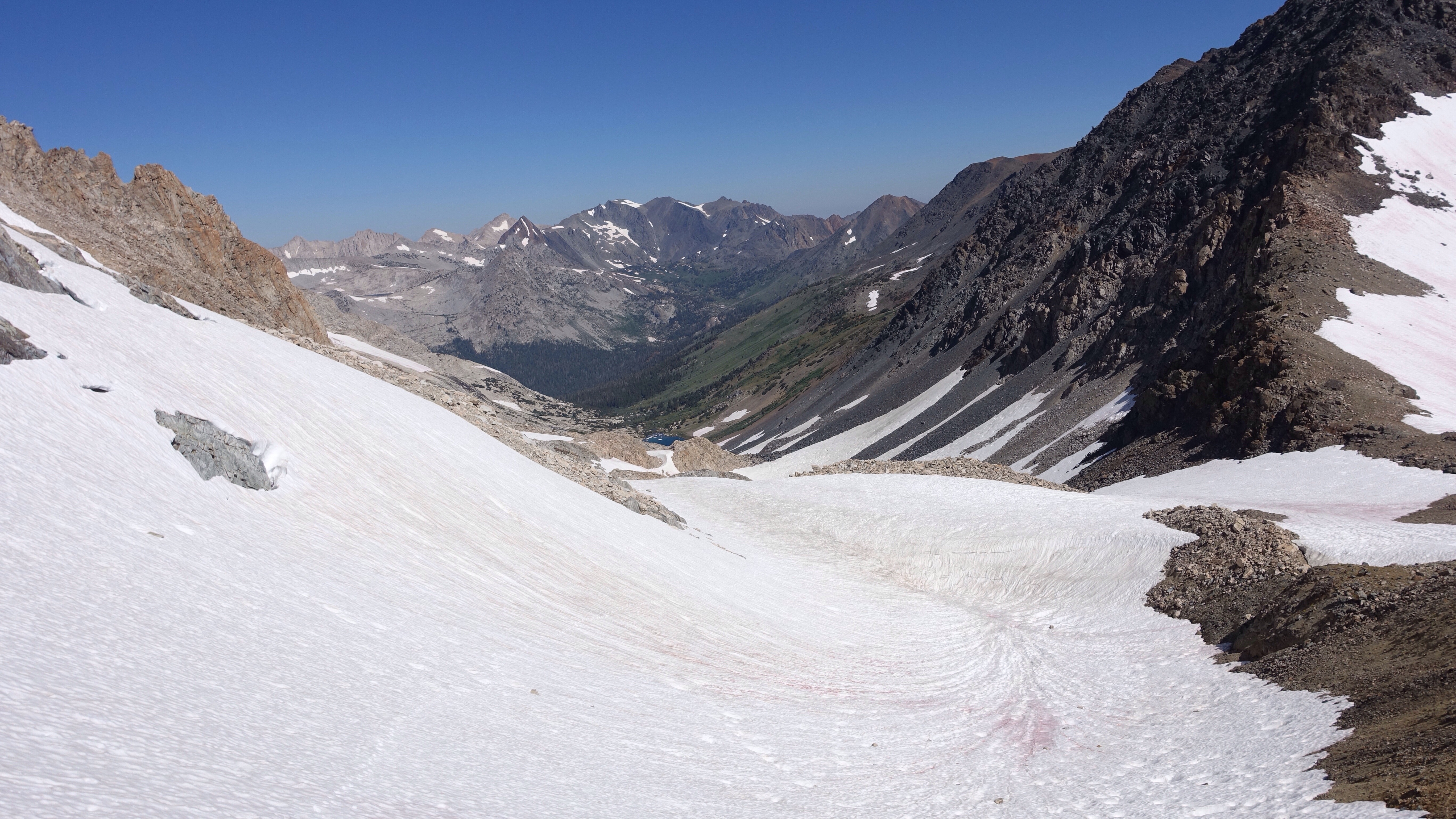
    Looking south from Sky Pilot Pilot Col, my direction of travel. The first major ridge in the distance is Mt Conness’ East Ridge. The patch of snow right in the foreground is the flat top of the steep snow wall I slid partway down before arresting my fall.

    On the south side, I expected to see a steep scree field I could slide down, but instead there was a blanket of snow that nearly hung free off the edge of the pass. I had my ice axe in hand, and began descending carefully, hoping I would be able to use the snow softened by the sun to control my descent. Turns out, NO.

    I took a fall only a few feet from the top and quickly began accelerating down the slope, which ended fifty vertical feet below me in a jumble of rocks. Self-arrest! Self-arrest! That’s the term among climbers for stopping precisely such a slide using an ice axe, and I was able to stop myself after sliding about ten feet, though the snow was incredibly soft and slippery and I struggled to arrest the fall. Harder snow would have been easier. As long as it’s not a solid ice sheet, snow with a crust holds the pick of the ice axe. This sun-softened snow was treacherous stuff. Every place has its own rhyme: the quality of the snow, the places it tends to gather, the typical pitch of the slopes, the time of day the snow is more or less manageable. I’m learning, slipping into the rhyme of these mountains, and so far it seems the snow is easiest to traverse in the morning, when it’s icy and hard, with micro spikes on.

    After the arrest I gingerly slid my way across the slope, sprawled out like a snow angel to gain as much contact against the snow as possible. Slipping a few times but managing to avoid repeating a  proper fall, I made it to a steep talus field on the shoulder the slope, hemmed in by a granite wall, after a few tense minutes. The descent from there was slow, painstaking, a mix of rock and sliding on my butt in the snow between rocks like islands in a sea. Down down down steep down, feeling the work of gravity on the body. Feeling it by resisting. Resisting makes one tired.

    I dropped into a beautiful, snowy basin of many lakes, climbed the curving spur arm off Mt Conness’ east ridge (the curve of this long spur was oddly touching, cradling a small lake at the bottom the way a mother curls her arm around a baby), descending into another beautiful snowy basin of many more lakes. And, in this second basin, many hungry hungry mosquitoes. I wished desperately to flee them, but by that late afternoon hour, I was so tired I couldn’t take but a single step uphill without having to stop and gasp for air. Downhill and flat terrain feel great: I’m energized and bouncy (unless I’m in a carefully controlled steep descent, in a heated discussion with gravity). But uphill is singularly difficult. Waiting for acclimation. Waiting for easy breathing.

    At the top of the crossing of Mt Coness’ East Ridge.

    Achingly slow, I climbed away from the lakes and their clouds of mosquitoes, and now I’m camped on the side of a mountain, a stalwart member of the ridge I’ll cross tomorrow morning heading southwest. One of many many mountains on whose sides I’ll be sleeping in the coming weeks. The sun has just descended behind this mountain and pulled its warm light behind it. The surrounding snowfields are starting to ooze a chill across the meadows. It’s just me and the mountain now. And the snow. And the determined mosquitoes who followed me.
  • Day 1: trying to figure out what I’m doing

    Day 1: trying to figure out what I’m doing

    I woke up periodically through the night to the sound of the honky-tonk bar across the street. Finally I put in earplugs but then I was cold or uncomfortable or just awake for no reason. I tried to sleep in past the brightening dawn but felt I was fighting for those last few minutes. Exasperated and finally rising and packing, I headed off to get my permit from the ranger station. I got there about 20 minutes after they opened at 8am, and when I tried to change my permit to start a day earlier (mine is for beginning on the 10th but since I’m here and ready, why not begin), they said the quota was already full for the day, all filled up that very morning! Most of the trailheads in this complex of parks and national forests that contain the Sierra Nevada operate on a quota system to limit the number of people entering the wilderness each day, and even then there are astonishing numbers of hikers out there. Wilderness use is skyrocketing, growing year over year in most jurisdictions, almost as though we all know there is something important we are beginning to miss in modernity.

    View of the Sierra Nevada range from Owens Valley, to the east.

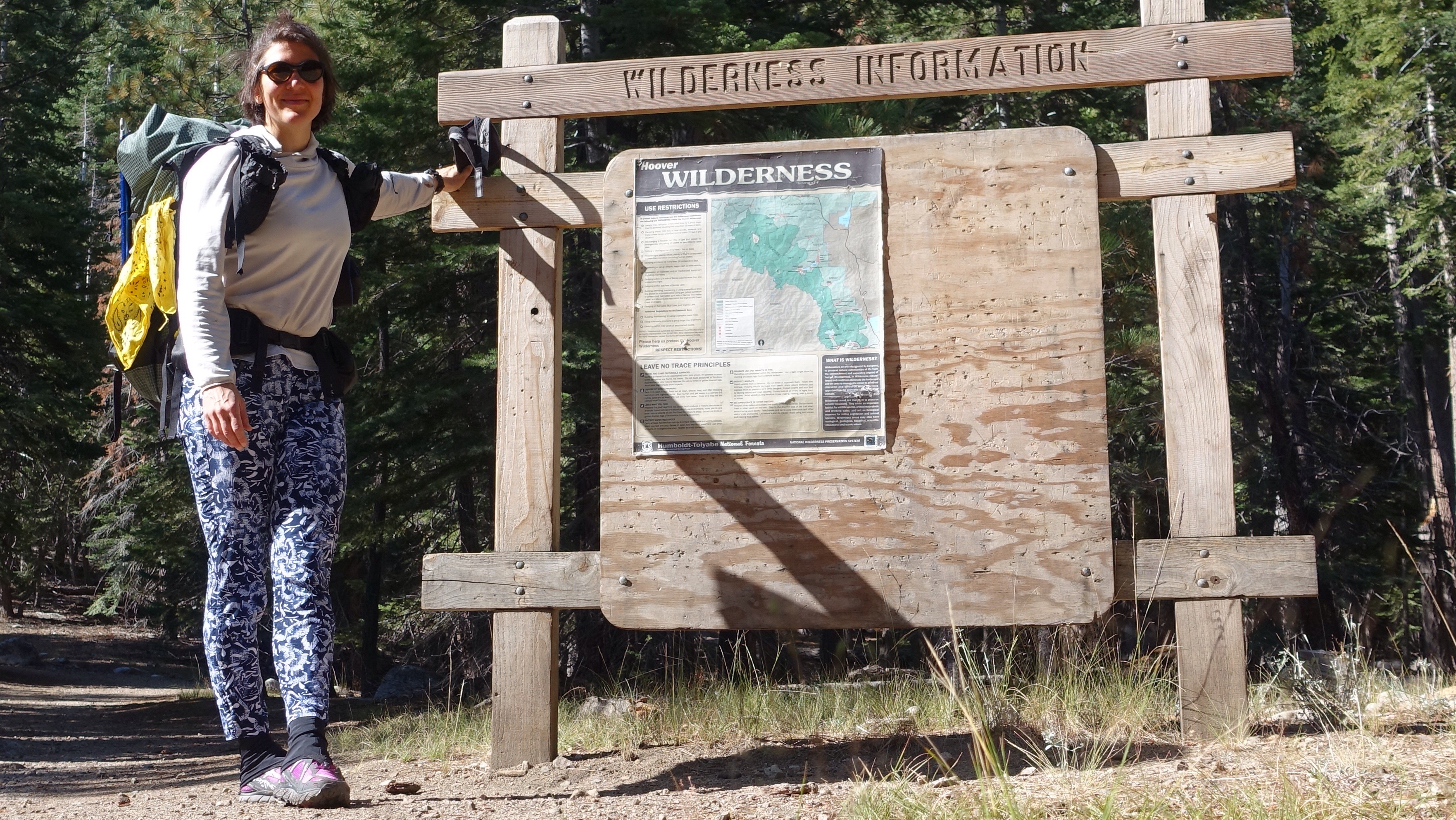
    I picked up the permit I had reserved months ago, without changes, and hitched back through Bridgeport and then up Twin Lakes Road to its end at Annette’s Mono Village, a camping zoo packed wall to wall with RVs. I was eager to get out of there quickly–it would have been a limp start to the trip to linger among the tin can campers–and decided to start hiking up Horse Creek trail, even without the right permit, because I knew I would shortly be leaving the trail and disappearing into the rarely visited alpine regions in this part of the range.

    The humble beginning

    I passed many day hikers as I climbed who were hiking up to the pretty Horse Creek Falls. Eventually there were fewer people, and then none at all, and then the trail itself disappeared too, the start of many miles over the next two months of trailless navigation. Gleeful for the many beginnings of this day, I made my way up to Horse Creek Pass on patches of snow and talus fields, climbing slowly and laboriously. My pack is heavy. I’m not acclimated. I haven’t trained as much in the last month as I would have liked to. I am confronting my slow body, my resting body, as I make the long climbs up to passes.

    Hiking up Horse Creek


    Horse Creek Pass under a blanket of snow.


    Flowers on Horse Creek Pass.


    Looking south into Spiller Canyon from Horse Creek Pass. I’m heading east out of this canyon, crossing the ridge seen left in the picture.

    The Sierra High Route, which I’m hiking on now and for the next couple weeks, follows a particular pattern: ascend valleys and meadows to a pass that allows for crossing a substantial ridge line, and then descend for a little while before repeating. Remember this, because I will often be talking about my struggles and joys with these climbs, these descents. In some way, it strikes me as a tango, the mountains leading and me following with the greatest sensitivity I can offer day upon day upon day. Today I crossed two such passes, dragging my slow and tired body up a few steps, stop to rest, up a few steps, stop to rest. Horse Creek pass eventually laid beneath my feet. I stopped to celebrate my first pass of the trip.


    From there, dropping down beautiful green meadows blooming with wild flowers, I got my first taste of smoke from fires in the area. The smoke may be a constant companion over the next weeks, as fires burn the flanks of the mountains. The views are therefore hazy, but still, I could see massive granite peaks rising above the sides of the valley. After a pleasant descent I left the valley floor and began a long and also tiring ascent to Stanton Pass. Stanton Pass is supposed to be technical class 3 scrambling, and I was worried that there would be snow further complicating the ascent. Scrambling is a bit like climbing–I am using my hands to pull myself up, balancing on small footholds, and coordinating supports between all four limbs to move upward. With snow on the rock, it would be dangerous and perhaps impossible. I was relieved when I finally crested a hump a few hundred feet below the pass and I could see the rock cliffs just below the pass were bare and dry. As I climbed the talus field below the cliffs, I considered my line, the route I would take upward. I looked up in study so intently on the approach that hours later my neck hurts. Nonetheless the pass was easy enough, and I enjoyed the rhythm of climbing with my whole body, feeling my pack weight me backwards and my hands pull me forwards. Before getting to the cliffs I took two falls, and on one of them I smacked my wrist hard on a rock. A bruise marks the spot, like a smear of lipstick left behind after a kiss. I was distracted, looking upward not downward. Both require attention, the long-range view of where to go when and the short-range view of the angles and surfaces of complex ground under foot.

    Class 3 scramble over Stanton Pass.
    The top of Stanton Pass, looking southeast.

    The rest was downhill dancing, stepping lightly and precisely on talus blocks, navigating a series of ledges interspersed with short granite cliffs and patches of white bark pine, the occasional snow patch. Eventually I passed a remote alpine lake, and then dropped like a slow-tumbling stone fourteen hundred feet to the bottom of Virginia Canyon, not too far below its headwall. Rock and meadow gave way to pine forest and thick green grass. I stopped down here, among the grass and the flowers, to camp, startling a dappled fawn from a nest of grass as I was looking for a flat place. It’s the lowest camping option I have, and I’m trying to ‘climb high, sleep low’, at least for the first few days while I acclimate. My highest point today was 11000 feet, at Stanton Pass, and I’m now tucked in to a cozy 9200 feet.

    I feel like I’m getting my sea legs. Except instead of a sea of water, it’s a sea of rock, sky, snow, and meadows. And of climbing forever, and then descending forever, all the while balancing on exacting, unstable rocks.


    What a cool rock!


  • Heading Out/Up/Away

    Just a quick note to say I've got my permit and I'm setting off. Look for blog posts to appear in six to eight days, when I pop out of the mountains at Red's Meadow Pack Station to resupply. Until then!

  • Precedent Day

    Nothing much has happened. I left for the airport in the early morning hours, after feeding my goat and watering the garden, noting as I did each that I wouldn't again for some time and feeling as though I ought to bring a special kind of attention to my chores, to appropriately mark a goodbye. And noting that I didn't know how to do that. It is the confusion of saying goodbye. Perhaps there is nothing to do but simply say it.

    My day consisted of many small steps towards a beginning, a pre-beginning: the trivial indignities of air travel; a long wait among the flashing lights of gambling kiosks in the Reno airport; a sleepy bus ride down the eastern flank of the northern part of the Sierras. The eastern side is the dry desert side, sheltered under the rain shadow of the mountains, and sage brush and cattle blurred by out the bus windows. I got off in Bridgeport, a small town with a frontier look, just minutes too late to pick up my permit from the ranger station here that I need to begin my hike. So I'll stay overnight in town, have a burger, and take this extra time to begin acclimating to elevation. I'm at 6500 feet now, from 0 feet in Seattle, and an extra night at mid elevation in the front country can only be a boon. On the first day of hiking I'll surpass 11,000 feet, and the possibility of altitude sickness lurks in such dramatic changes of elevation. Us sea-level dwellers are oxygen hungry.

    From this flat, desert-dwelling town, the Sierras rise dramatically to the east. They are close enough that I can see ridge lines, valleys, contours, and lots and lots of snow. The Sierra Nevada had a near record amount of precipitation last winter, and the fact of snow has been deeply on my mind. To be honest, I'm not sure the routes I hope to take will be passable. I won't know until I'm trying of course, and that illustrates one of the fantastic humblings on a trip like this: going forward even when we don't know. How do we respond when we don't know. How do we marshal our courage.

    Early tomorrow morning I'll go for my permit and then hitchhike to the trailhead, up Twin Lakes Road to the Horse Creek Trail, the footpath on which I begin this curious expedition. With some luck I'll spend tomorrow tonight up up up in the mountains. I am eager to begin, and a little trepidatious, and also hot and restless and overfull on French fries. My backpack is ready. My body is willing. Gonna get to it.

  • Welcome!

    Welcome to the blog for my High Sierra hike of 2017.

    I’ll be spending most of August and September hiking in the Sierra Nevada, the prominent mountain range in California that contains Yosemite National Park, Sequoia National Park, and Kings Canyon National Park. I’m stringing together a number of proposed routes for my trip: the Sierra High Route by Steve Roper, the Southern Sierra High Route by Alan Dixon and Don Wilson, and the Kings Canyon High Basin Route by Andrew Skurka. Each of these routes in turn are made of previously known passageways, documented in various books of hiking and climbing routes in the Sierras and many traveled by humans long before white folks came to the area.

    The nature of each of these routes is to hew closely to the high country of the mountain range and to visit the less frequently traveled places. Consequently, the routes privilege cross-country travel, and trails are used primarily when they seem to provide the only viable means of connecting one cross country area with another, without getting into technical climbing. Many of my days will be spent on class 2 or class 3 scrambling routes over passes and mountains, interspersed with lake-dotted valleys, basins, and cirques.

    Please read the blog, and please comment or email if you have the impulse to do so! Your time and attention are meaningful contributions to my trip. By clicking the ‘follow’ button on the landing page, you can receive an email notification whenever there is a new post without worrying that you’ve missed something. So very relaxing.

    Where do I begin?
    At Twin Lakes just west of Bridgeport, CA, on the eastern flank of the Sierra.

    Where do I end?
    At Road’s End, a trailhead in Kings Canyon National Park.

    How many days will I be hiking?
    My current plan is to spend around 50 days. Humbly I go – plans are easily derailed.

    How many miles will my total trip be?
    Around 470, plus or minus 10-20% (mileage is hard to calculate off of trails).

    Am I hiking with others?
    I’m going alone. Alone!

    How will I deal with food?
    I packed up boxes with food and will have them mailed to me. Three of my resupply stops are small resort areas high up in the mountains, relatively close to my route (Red’s Meadow, Parcher’s, and Lodgepole). Two of my resupply stops involve hiking out to a trailhead and hitchhiking into a town (Lone Pine and Independence). There will be five resupply stops all told.

    How will I maintain a blog while in the wilderness?
    Every night, I write a blog entry on my smartphone and save it. When I get internet service, typically at resupply stops, I’ll upload all the saved entries. This means a number of days will pass with no updates, and then many updates all at once.

    If there is no trail, how will I know where I’m going?
    Map and compass, and written descriptions of the routes I’m attempting to follow. An example, from Steve Roper’s book “The Sierra High Route”:

    From the basin ascend north up grass-covered ramps and gullies alongside the cascading stream that originates near the ridge far above. After a gentle climb of some 800 feet … the hiker arrives at an extensive flat area at 10,900 feet. To the northeast, about a quarter of a mile distant, lies a broad, grassy saddle. But instead of aiming for this obvious gap, turn slightly left and proceed due north up a rocky slope that ends on the east ridge of Mount Conness.

    What is the terrain like?
    I’ve read that it is quite a lot of talus and scree, ie accumulated broken rock debris. Typically the terrain would be mostly snow-free in August when I begin, but the winter of 2016/2017 saw over 200% of normal snow in the Sierras, so there may still be quite a lot of snow lingering in the high country. I’ll be traveling with microspikes (like mini crampons) and an ice axe.

    Why am I doing this?
    The answer is complex. I hike to live in relationship to myself, to illuminate my senses of joy, fear, loneliness, freedom. I do it to see what it feels like to just take the next step, especially when I’m bored or frightened or resistant. Hiking puts me into the wild and also pulls from me my own inner wilderness, and that is an invigorating place to make a life, for a time. This blog is, of course, my long answer to the question of why I hike. Thanks for reading.