I was a bit worried that I wouldn’t sleep well last night after seeing White Bear Pass (11800 ft), the very vertical and snow-patched wall right in front of me that I would be climbing this morning. Sheer, vertical, intimidating: all apt words. However, even though it looked difficult or impossible, I found to my surprise (and delight!) that I wasn’t that worried about it. If it didn’t go, I wouldn’t go. No big deal.
So it was a good night of sleep after all, and as I was breaking camp the sun was just starting to illuminate the tops of the peaks ringing the west side of my small lake basin. Immediately I began the climb, a scant 800 feet, but of rather dedicated verticality. A steep talus slope was followed by a short bushwhack up steep willow-covered ledges which was followed by more steep talus and steep ledges. In other words, steep. (That’s the same word, I know, but it does the job.) I did the job too, cresting the top of the pass with no major problems, and immediately skirting a huge snow drift blocking most of the top of the pass (I could see it from the bottom, and climbed far to the left to avoid encountering it at the top). White Bear Lake sits perched right at the top of the pass, a small pond with dramatic drop offs on two of its sides. I scooted around the east shore and began traversing the labyrinthine Bear Lakes Basin, where every lake is named for bears: Teddy Bear Lake, Brown Bear Lake, White Bear Lake, Black Bear Lake, Ursa Lake, and Bear Paw Lake are just the ones I passed. The map shows also a Claw Lake and Tooth Lake and Den Lake and Beartrap Lake and so on. Cute, cuddly Bear Basin, very remote and can’t be accessed by trails, and I very much doubt it’s accessed by bears either, who don’t tend to visit the higher regions of the range which are difficult to get to and lacking in food. I came into the basin by way of a pass. I would of course leave by one.


I maneuvered up and down and around and through (and over and under and in and out) the convoluted terrain of the basin until I was in the primary drainage that I would climb up to Feather Pass (12375 ft). Snow plastered the way, paving over the talus and making for a straightforward ascent. I stopped to rest often, as I do climbing up all these passes out here because even though it’s been so many days I still gasp like a fish out of water, but I was at the top by 10:30a and looking south over gentle grass-covered granite benches. The passes are typically steep and rugged on their north sides, when I am climbing up them, and gentle and comfortable on their south sides, when I am descending them. I think this works ok in my favor, because when the terrain becomes more technical, going up is usually easier than going down. There is reason behind this natural patterning, which is that north sides hold snow longer, so freeze and thaw more, and over millennia these contractions work like a mechanical pump to slowly lever free rock from the mountain side, pulling down more and more of it until the north sides are steep and rugged. At least I think this is true.


And yet, even while going down such gentle benches among the grassy clumps and wistful colonies of flowers, I rolled each ankle. Neither amounted to a full sprain, but my ankles are quite delicate and are suffering under the abuses of this hike. Even if it were just climbing without the rolling incidents, they would still be under duress. I was tired this morning, getting sloppy as I thudded down the hill. One ankle rolled twice. I’m sorry, I whispered to myself. I could be more careful. I should be more careful.
As I came above Lake LaSalle, I began to look for the ‘obvious cleft’ in the headwall above the lake that Roper mentions. Of course he mentions it for travelers headed northbound. I am headed southbound. He mentions nothing for me. It’s very hard to find such a cleft from above, especially in the hummocky tundra with snow-filled gullies blocking every view. I never found the cleft and ended up slithering down some cliff bands along with a small creek, which made the rocks slippery in addition to being steep. Eventually I debouched onto snow below, and began traversing around the edge of the lake. Almost immediately the traverse was steep, slippery snow fields plunging straight down into an ice-filled lake. This has become my least-favorite kind of obstacle on this hike. The consequences of an accident are rather grim. The line from a song I once knew pops into my head every time I do one of these traverses: ‘here’s a one way ticket to your watery grave’. I had my micro spikes on, but they are most helpful when the snow hasn’t warmed much. Once it’s softened in the sun, the passage is treacherously slippery.
I made it across without mishap, of course. Though surviving is always an active endeavor out here, I am well committed to treading far into the staying-alive side of the divide (that mysterious divide, the ultimate rubicon). After the traverse, I gained some sandy benches and was able to easily find, from below, the ‘obvious cleft’, which would have allowed me to avoid the treacherous traverse along the snow banks, but all is well that ends well. Some clefts just aren’t meant to be found.
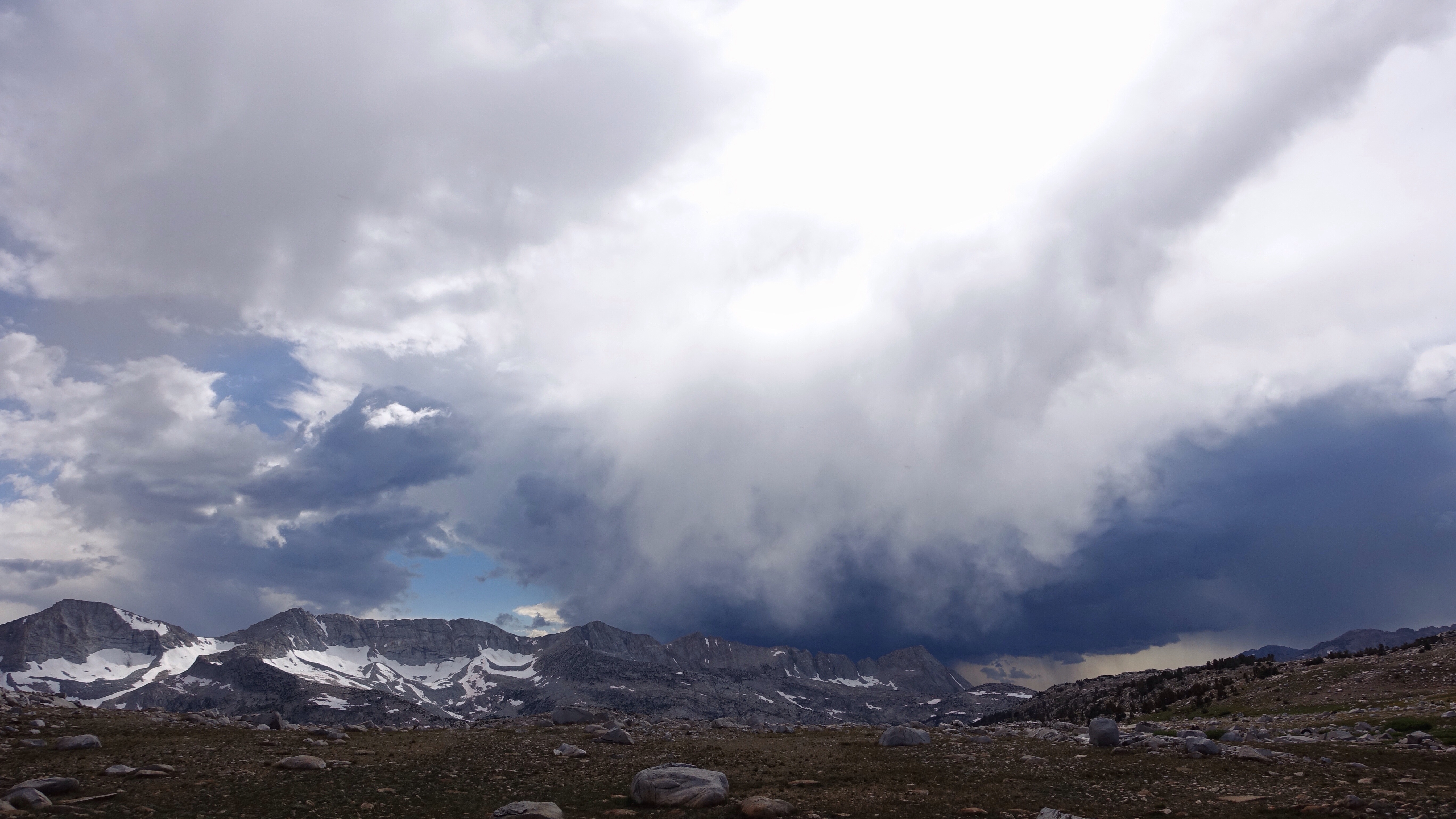
A chain of lakes, dropping into a lush meadow below Merrimack Lake, and a steep drop down a canyon wall brought me to French Canyon and a short stretch of trail before leaving it to cut cross country again, this time climbing up to Puppet Pass (11800 ft). For the last three days, the afternoon skies have blocked out with gray storm clouds, and as I neared the final climb to the pass, 300 vertical feet of steep talus, the sky overhead was uncompromising. I waited at the bottom of the last and steepest part of the climb to see if I would hear thunder–a ridge line is exactly where I don’t want to be if there is a lightning storm–but firmament was eerily silent, heavily gray. I pushed up through the climb, taking far fewer resting breaks than I usually would, and began a fast descent as soon as I made the top. On the way down, wind and rain finally rushed in and around and accompanied me, and I donned my rain suit as all the individual gray clouds gathered together, west of my location, and let rip quite the storm. The sky was a heart of darkness above the mountains. Thunder beat out across the land, and while the storm was far from me, I was still in its aura of rain. Grateful to be spared the full intensity of it, I made my down into what turned out to be the most mosquito-dense area I’ve visited so far. Mosquitoes and gnats, so thick they surrounded me in clouds. Even after the rain stopped, I left my rain suit on as a barrier between their little suckers and my skin. A few miles later, at camp, I endured the constant whining cloud as I set up my tent and cooked dinner in my rain suit, with my head net on. This is a day I would have used my Deet, but when I went to dig it out I found I had lost it.
Tomorrow I climb Snow-Tongue Pass, the pass that I’ve been thinking about for the past few days, mentally fencing with it as I draw near. The snow conditions have me worried. I’ve coordinated my travel the last few days to arrive here, near Piute Creek, on this night so I can approach Snow-Tongue while the snow is firm. No knowing like being there in person though. Otherwise it’s all thoughts like buzzing, electric storm clouds.


Leave a Reply