Half of the day I continued to walk on trails, working my way southeast through Yosemite’s eastern side. I followed Lewis Creek as it slid over curving granite and made elegant water falls, then climbed up to the north rim of the Merced River canyon. Eventually I dropped down to cross the Lyell Fork of the Merced River, then climbed up the steep, tree-studded, mostly granite wall on the other side, making use of a fissure in the rock that ran from river to sky, the whole way up. All of this was on trails, my walking cadence so regular that it made my legs ache.
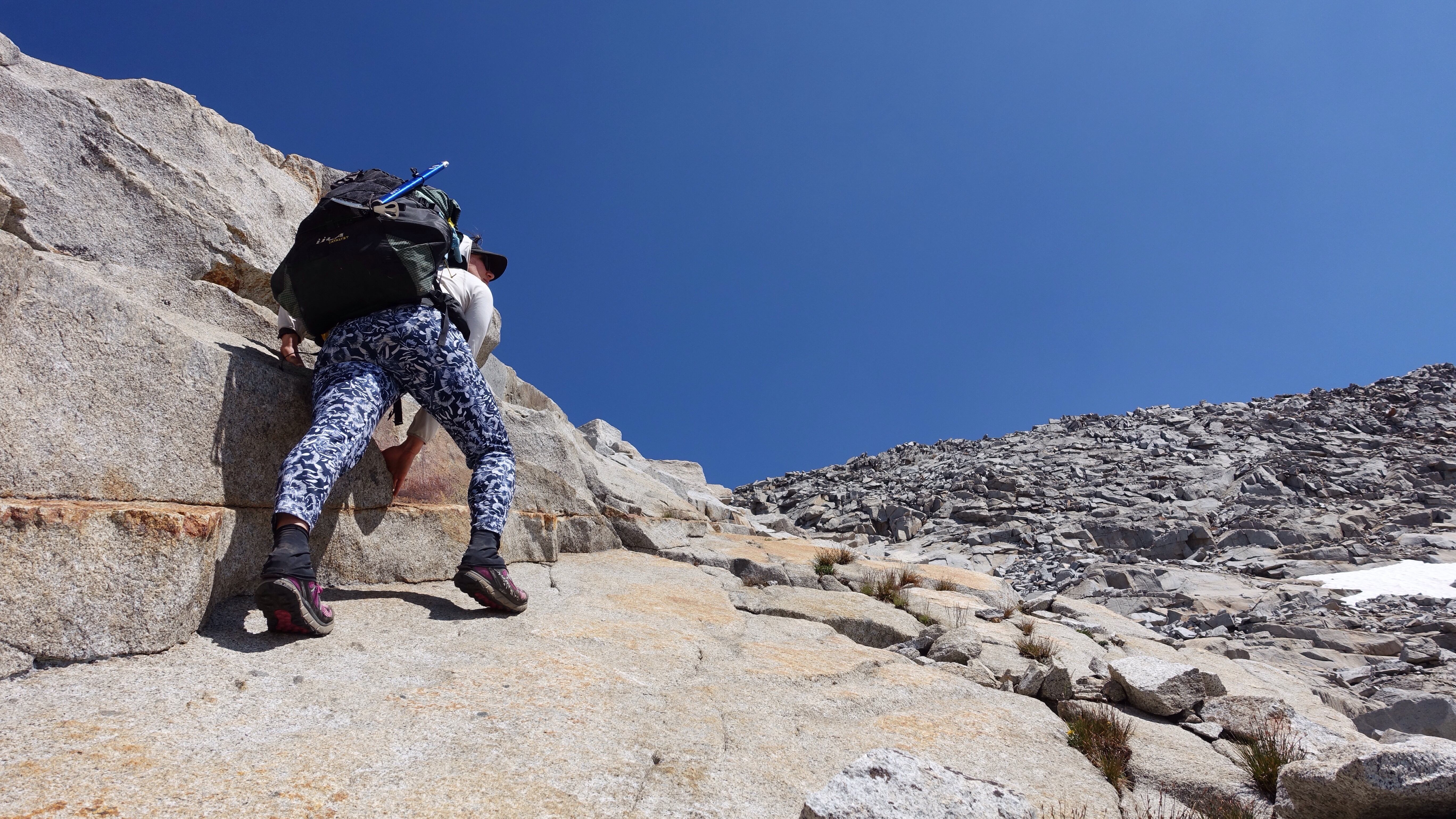
Around noon, I happily left the trails and my heart fluttered, a mix of nervousness, light fear, and excitement. It was time to pay attention again. Time to wake up. Grassy benches interspersed with tan granite outcrops led upward, and I held an unnamed peak to my left for orientation as I preceded up a long valley until I came to the rocky approach to Blue Lake Pass. It looked straight forward, even easy. I was to cross it heading east, towards the Ritter Range. However, I didn’t look closely enough at my maps, and missed that there is a small canyon holding a lake just 400 vertical feet below the pass, tightly boxed in on three sides. I climbed to what I had thought was the pass but actually was not. It was a false pass, a low point on the wall of that small canyon which, from below, obscured the view of the true pass. Upon reaching the top of the false pass, ready to be triumphant, and instead saw a a long, steep sidehill comprises of talus and scree followed by an intimidating wall of rock rising a few hundred feet up on the other side of the basin. The pass was at the top of this rock wall, and I would either drop several hundred feet down to the lake and then climb straight up, or I would contour steep talus walls. Never climb when you don’t have to, that’s my motto, I decided just then. I took the contour, accompanied by nervousness about the dramatic rise of the rock wall ahead. From my perspective, a wee bug skittering along the rocks, the wall didn’t look particularly passable. Yet again, the appearance was deceiving. Once I was near nose-to-nose with the steep swooshes of slabs seamed by talus, it turned out to be easy enough to find passage through the cliff bands, and delightful too because hopping from rock to rock has its own kinetic joy.


I sat up at the top for a while, comparing the view to my maps. It is important to reconcile as much as possible the real world ahead with the abstract representations of the world that I carry, in the form of maps and words and data. Though I have a gps on my phone if I need it, I’ve so far been able to navigate almost entirely using the maps. I haven’t even needed my compass yet. There is something elegant in the simple translation of concept (the route) to abstract representation (the map) to concrete application (taking my body through the landscape, and all that entails). Also, this mountain range is so gentle feeling, easy to navigate, hospitable. So far anyway. No doubt I’ll eat those words later. But for the time being, I’m in a relaxed exchange between mountains and information.
The descent from the pass was complicated by the fact that there was often snow where I wanted to be. I had to find other ways, other ramps and rock noses, other fissures and flaws and breaks to squirrel my way down. After a time of this fitting of myself to the realities of the terrain, I arrived at the shores of aptly named Blue Lake, a startlingly blue body of water held between rock walls. I passed a grassy shore with a perfectly placed rock jutting into the water, and as it was only 4:30 and I didn’t have much farther to go today before stopping to camp, I decided to swim, and also rinse my pants, which are becoming stiff enough with salt that soon they will stand on their own. I stripped off everything and was about to put my pants in the water first when I heard voices. Human voices carry in the mountains like no other sound, and though they were hidden behind some rocks up the hillside, it was unmistakable. I looked up just as a head in a big hat appeared. Standing naked on the rock, I waved. A man waved back, yelled sorry! And disappeared again. How is it that I’m miles from a trail, in a difficult-to-reach mountain basin, and the minute I am naked is the minute other people appear? I don’t care–bodies are bodies are bodies–but I recognize it makes others uncomfortable. In any case, I dove in the water. It was exhilarating. It was freezing. I immediately scrambled out, toweled off, and dressed in my still-stiff pants, whose rinse would have to come another day. Shortly after, the man poked his head out from the rock on the hillside. I didn’t see anything he called across the stone-studded grass hill. It’s alright I yelled back. We had a nice conversation, shouting back and forth from our respective encampments. He and his friend are also hiking the Sierra High Route, a section of it anyway, but in the direction most people hike it (and the direction the guidebook is written): south to north. We traded beta, small bits though, neither of us wanting to have too much illuminated lest it compromise the surprises of the route.
I dropped a little over a mile down Bench Canyon next to a cheery creek and among vibrant green meadows, and made camp near where I’ll climb out of the canyon in the morning and begin heading for Glacier Pass on the shoulder of Mt Ritter.


I’m learning some things that I thought I would share, important lessons and facts about the conditions (and conditions are hugely influential in the work we do, of any kind, be it cubicle or math or teaching or dance or hiking). To wit:
- There are a lot of healthy, happy mosquitoes right now. I have many bites, especially on my scalp under my hair. Those head bites react differently than other places, developing crusts that remind me of the spots my goat Sid would get all over during spring and summer. I always thought he developed a strange seasonal rash. Maybe he had mosquito bites all that time and I never knew.
- There is a lot more snow than is typical for August in the Sierra, and the pattern of where it is lingering seems somewhat different than June or early July snow patterns (from what I’ve read and from talking to locals). It is making some parts of my route more challenging, such as when it covers stretches of very steep talus, and other parts easier, such as when it covers long stretches of not-too-steep talus. I have used my micro spikes every day, and critically my ice axe once when it saved me from grave injury.
- Did you know that high altitude causes increased flatulence? True fact! It is known in medicine as High Altitude Flatulent Expulsion, or HAFE. There aren’t many effective cures. Hike alone.
- Nights have been cold enough to interrupt my sleep, but I think that is more about me, since it’s not dipping much below freezing.
- Speaking of interrupted sleep, my ground pad has a leak and I must reinflate it once or twice per night. I can’t find the leak. This small act of reinflation is becoming part of my regular rhythm.
- Much of the water I’m drinking comes directly from melted snow. It tastes of a metallic sky: slightly sweet, sharp, and very clear.
- Route-finding is often deeply satisfying and occasionally worrisome. I’ve decided that above all on this trip, I don’t want to be in hurry. Which means a half day spent going the wrong direction is still a half day lived well, deep, and full. (That hasn’t happened yet, but I’m staying I’m open to the possibility).
- I have yet to acclimate to the altitude: ascending anything is curiously exhausting. I stop often to pant, rest, groan, before continuing up.
- Speaking of up, the climbs on this route so far are rarely more than fifteen hundred sustained feet at a go, though those are often steep steep feet.
- Leave those crusty boogers in your nose where they belong, even though they feel like small boulders. No good will come of removing them.
Leave a Reply