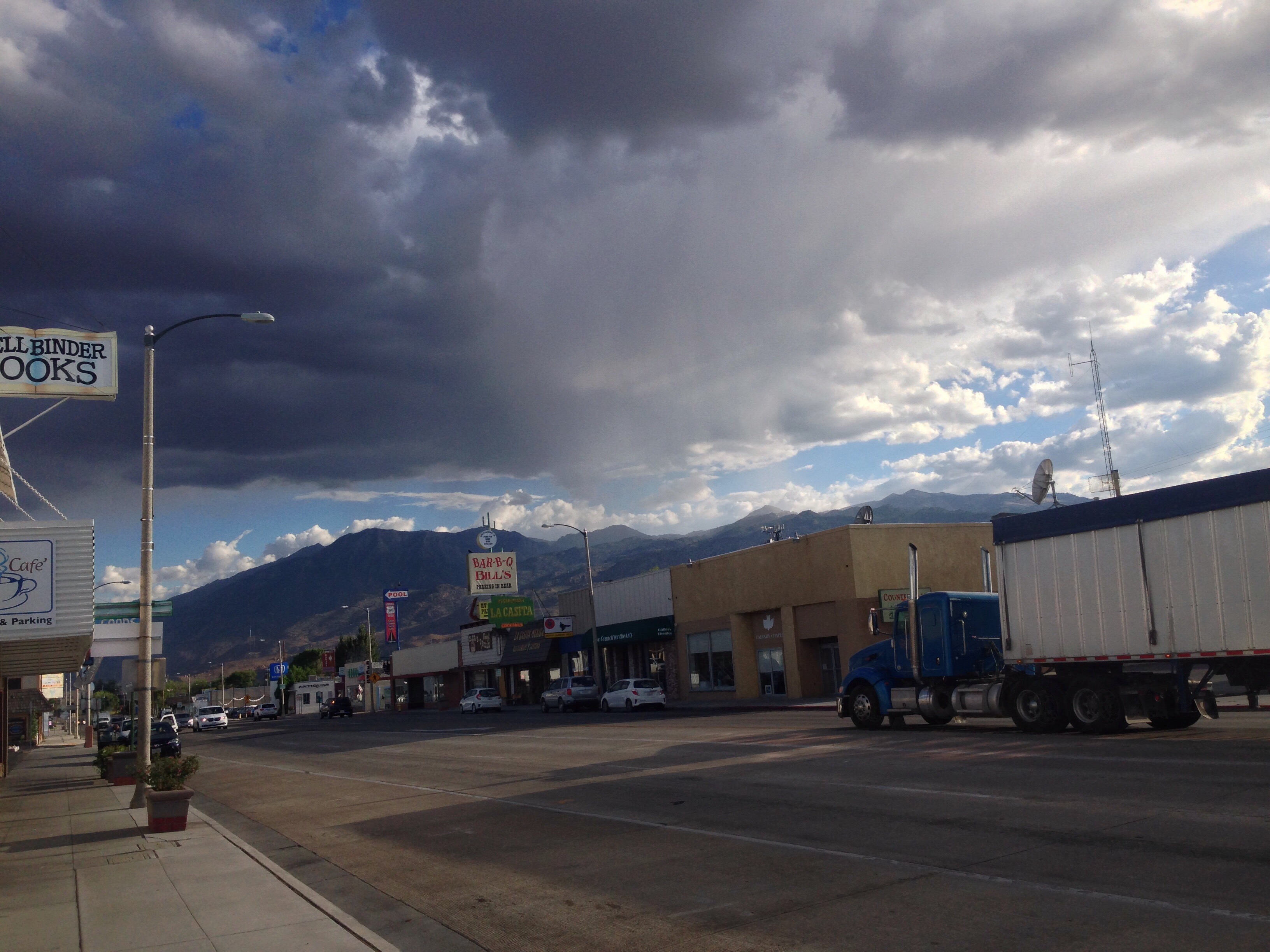
I have some old history with Lone Pine from many years ago. Being back here is like tugging on a historical thread and seeing how the past moves. Some of the specific places that are sharp in my memory–the Mobil Mart gas station which used to be a Chevron, the motel across the street with the two story addition in back–are still here, and paid small visits to them. I remember sitting with my back against the gas station’s cobbled wall for a few hours, not having any idea how long I would be there. Unmoored in time.
There is much about a rest day that feels like waiting too, but in this case for an obvious end: out of town, back on the trail. Which is not to say the waiting is unpleasant. On the contrary, it’s downright luxurious as long as the town tasks aren’t too onerous. Mine weren’t. Most were done relatively quickly. I had some work-related tasks that I tended to. I ate oversized meals. I talked to beloved husband Dan and beloved mother Pam.
Tomorrow I’ll hitch a ride back in, along that steep and winding road up to Cottonwood Lakes Trailhead. For the next three or four days I will follow trails, and be relieved of the challenges of cross country travel, as I head west to Lodgepole, which is a campground and store on the western side of Sequoia National Park. I pick up a resupply package there and then begin the Kings Canyon High Basin Route, following this last, 124 mile high route northeast, then west, then back south to finish my hike at Road’s End in King’s Canyon National Park. That’s many days from now still. Many more days in the range of light.
If I have internet access at Lodgepole, I’ll update the blog. But it’s possible there won’t be, in which case I’ll update again when I come out to Independence CA to resupply some five days later. So look for new posts in either around 4 days or 9 days.
Would you believe me if I said I had a most excellent night of sleep last night? I mean world class, solid, heavy, self-obliterated kind of sleep. I treated myself to 400 mg of ibuprofen before bed, something I almost never do out here (only once before on this trip have I taken any), because I’ve been dealing with stomach trouble the last year and I’d rather not irritate it. But an ankle tendon was perturbed enough to warrant it. I don’t know if it was the ibuprofen but that sleep was delicious. I finally broke one of themes of this leg of my journey. I didn’t even wake to reinflate my ground pad until it was about time to rise.
After stretching out, packing my near-weightless backpack now that I’ve eaten all the food, and setting off, I quickly made it over New Army Pass, down to the east side of the mountains past lakes and cliffs and drier, arid countryside. Past a lot of people as well, which bode well for a quick hitch out of the Cottonwood Lakes Trailhead and down into Lone Pine. By 11am, I had hiked the 9 miles and arrived eager to find a ride. Just as I was setting my pack down, a couple hikers came off the trail behind me. I asked if they were going to Lone Pine and might I get a ride, and they said they also were looking to hitch. I noticed they had ice axes strapped to their packs, which has become an emblem of high route trekkers in these mountains, and asked what they were hiking. Turns out they were also hiking the Southern Sierra High Route and I was a day behind them the whole time. They had a slow day yesterday and I must have passed them this morning. It was funny to discover that all those days when I felt I was the only human to be treading all these places, I wasn’t too far behind another pair of travelers. We compared notes about our experiences while waiting to hitch, and ended up securing a ride for all of three of us with a pair of hikers I chatted with on the trail earlier in the morning. The drive down from the trailhead to Lone Pine is exhilarating and terrifying, like a car easily just tip off the unguarded edge of the road and tumble several thousand feet down the mountain side to the valley floor below. Thankfully we didn’t. I was dropped off at the hostel in town and bade them all a fond farewell.
Then on to the tasks of town: shower, laundry, post office for my package of food, a bacon cheeseburger, and of course posting to the blog. I’ll take a rest day here tomorrow, for I have more bacon cheeseburgers to eat. Those things aren’t going to eat themselves.
I must confess (in case I haven’t already, which I have) that the Mountaineer’s Route ascent of Mt Whitney has had me concerned for some days now. Concern can be a quagmire we lose our bearings in. Perhaps here too. As with so many sources of concern, now that it’s over I can again say No Big Deal.
To keep with the theme of late, my sleep was imperfect. Throughout the night I was reminded why I almost never sleep in well-established and frequently-used camp sites, and that’s the opportunistic rodents who have learned (wisely) to make their living there. I could here mice crawling in and out of my backpack all night (I don’t put it in the tent with me because it wouldn’t really fit), and even though all my food was in the bearcan I must lug with me everywhere, and almost everything else was inside my tent, the rodents found plenty to keep them busy. I was warm inside my rain clothes inside my sleeping bag, the ground was very flat and ground-pad-friendly, and so when I woke up to the sound of scurrying, scampering, and chewing, at least I wasn’t suffering.
The strange magic of sleep is that you’re always awake when you’d rather be sleeping and you’re finally sleeping when it’s time to wake up. I ignored a couple alarms before deciding I had a big job to do, and might as well rise and do it. I was packed and ready to begin the climb when the day was still ashen, and just as I shouldered my backpack the sun crested a rise to the east and lit up Mt Whitney. I walked into that delicious, honeyed light and began the labor of climbing.
Mt Whitney in the morning sun.Sunrise from the couloir.
For a few hundred feet it was a steep scree slope, and then the entire couloir I was climbing, narrow and bordered by golden granite walls, was filled with very steep and wickedly-suncupped snow. The snowfield continued for maybe a thousand vertical feet. I shimmied over to a heap of rock hemming the gully on its right and climbed there for a long time, scrambling from one secure outpost to another, avoiding the snow until the rocks became vertical and I was forced into the couloir with the snow. I put on my microspikes and wielded my ice axe, and for the first time on this trip found it necessary to use it to climb, like so: swing the pick into the snow above your head, and then pull yourself up using the handle, kick a secure step with one foot, and repeat. It was tiring and exhilarating, but mostly tiring, both physically and because of the heightened amount of vigilance required to keep from falling. It’s a very high-tone body and mind state, but part of the joy of climbing things is that the body and mind become deeply synchronized, a way of being that often eludes us on daily living. Yes, high-tone, but also clarity. In any case, it only lasted a few hundred feet before the snow ended, and I had a few hundred feet more to climb before the notch at the top of the couloir. I climbed this last stretch of scree, glad to be done with the rigors of the snow, and turned my attention ahead. In the preceding days, I had been most worried about the last 400 feet of the climb, after the notch at the top of they couloir. It was supposedly steep and technical, and I heard that the exposure was intimidating. Yesterday as I climbed up to Iceberg Lake, I encountered a descending guided party of climbers, and when I was talking to the guide about conditions on the climb, he said they rope up as a group for the last 400 feet after the notch, for safety. (He also said they rope up on the snow in the couloir.) How risky could the 3rd class climb be to require roping up?
The snowy couloir.On the ascent of the couloir.
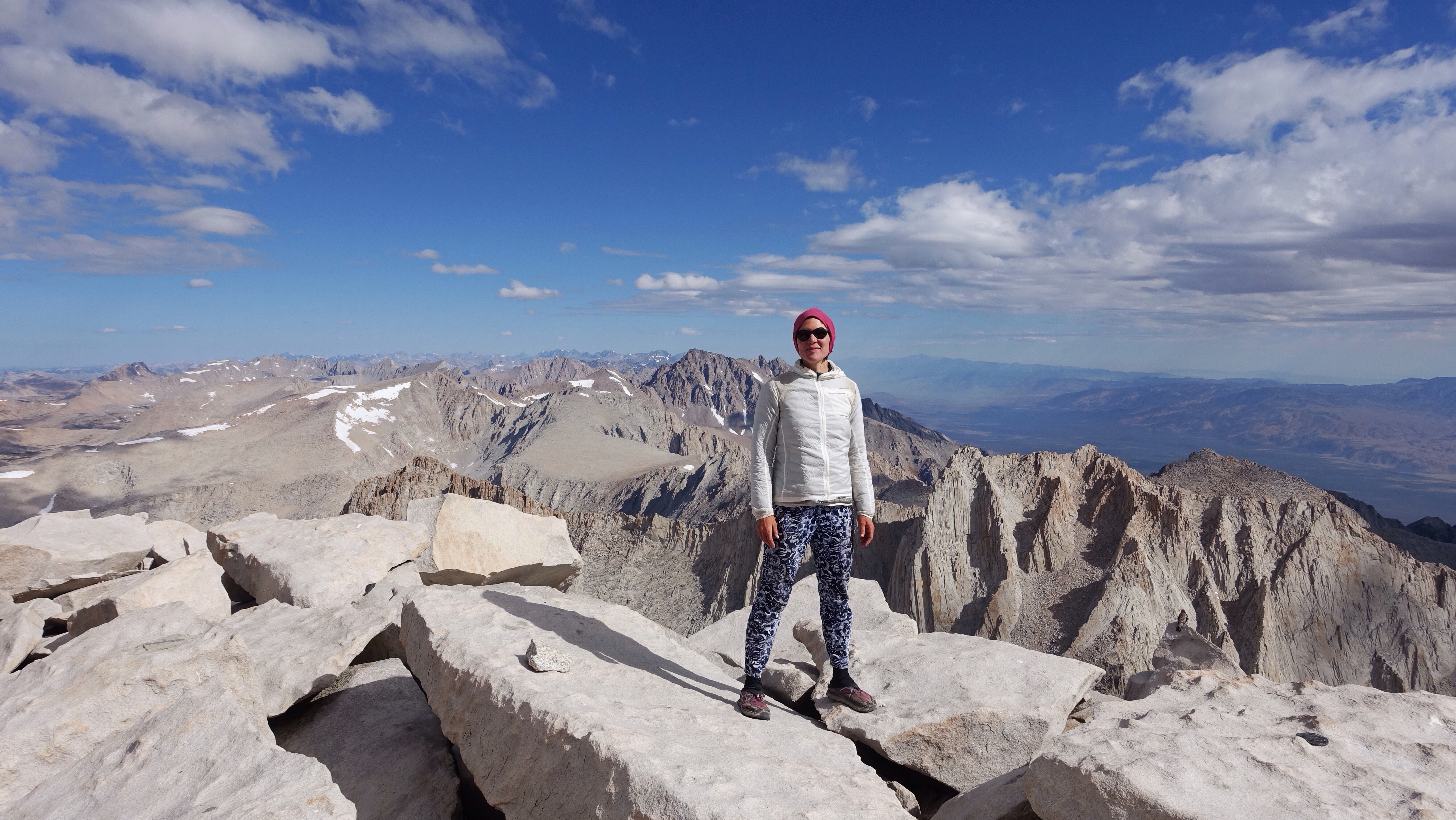
But guess what: No Big Deal. From the notch I dropped a few feet to the west and then climbed up the first gully to my left. I did have a moment of pause, wondering whether it was the correct gully, since I could see a couple more gullies lay beyond this one and a patch of snow showed a well-worn boot track heading that way. I decided to try the first gully and see whether it would go. Two things complicated this last part of the ascent. The first is a giant snow patch covered the upper right half of the chute. The second is the melting snow had frozen into ice on the rocks over night, making pretty little ice falls the hung down in columns. Even with these compromises, this last chute was stunningly easy. I felt like I had done harder and more exposed scrambling avoiding the snow in the couloir. It was 3rd class, yes, and there was some ice covered rock and I was forced left onto slightly higher angle terrain, but it was smooth and pleasant sailing upward. I quickly emerged blinking in the sun on the flat, broad summit of Mt Whitney, just shy of 14500 ft. There were already day hikers and JMT thru hikers up there who had taken the trail (Mt Whitney has a very well-built trail that climbs to the summit from the east and south), and I joined the cluster at the highest post of the summit, the highest in the land. I sat, I looked, I snapped a few photos. I was moved by the contrast of my days of fears and the reality of the climb. It is sometimes so much harder to not know that we decide we do know, but with bad outcomes. After musing and admiring the view, I packed up and headed south down the trail at 10am, still planning to get a full day of hiking in.
Standing on the summit of Mt Whitney.Growing throng of day hikers and JMT thru hikers.
I passed many many many many people during the 2.5 miles I was on the trail. Day hikers and thru hikers both, all planning to stand on very tall Mt Whitney and grunting their way up this trail that snaked along the gentler west sides of Mt Whitney and its neighbors, almost as tall and equally imposing. To the east the set is like a row of jagged teeth taking a bite out of the skyline. But the western sides are talus-strewn humps, still plenty steep but not the sheer escarpments on the east side. The trail slowly descended though not much, and then I left it abruptly at a switch back. I wondered if it was strange to those hiking up from below, to see me just leave the safety of the trail and climb straight up to the crest of the ridge on steep blocky talus, but if it was nobody said anything.
From the crest I had another very long, very sandy drop from a ridge to the valley below. This one was very similar to coming off Junction Pass or descending from the Russell-Carillon Col. It felt like miles and hours of sand. I know it wasn’t miles, but it also wasn’t fast to navigate small sets of cliff bands that created abrupt drop-offs. The instructions were to look left for ledges but I tried going left and got cliffed out, and had to go back right. I managed to come down to the edge of the lake sitting snug on the valley floor, but was too far west and had to cross a couple steep snow fields to get to the east end of the lake. Routefinding squiggles back and forth across the hillside, as the little hiker gets stumped by the humblest of obstacles. Anyway, I made it down all the same, eager for a rest at the bottom.
Just as I was about to unpack my lunch and take a break, it started to rain. So everything went back on my back and I continued, up to Crabtree Pass over slabs and loose rock, and then down through a labyrinth of rock and lakes and streams, carefully and successfully following the landscape down to Sky Blue Lake. Still it continued to rain, off and on, never as hard as it rains in Washington, my home state, but enough to keep me moving. I was getting hungrier and tireder, and my ankles were flared up from the steep climb up Whitney, so when I came to the outlet of Sky Blue Lake and the rain had ceased, I gratefully stopped to eat some crackers and salami, and to try massaging the throbbing tendon in my right foot. It was my first break since the summit of Mt Whitney. What a day, I thought. What a lot of up and down. What a lot of steps.
The terrain was about to change, from rock and water basins to gentler meadow. I expected to encounter a use trail somewhere in the meadowy descent along Rock Creek, and then pick up an actual trail, which would mark the end of my cross country for this section. It was a tender moment, sitting with my lunch and with the lake, at the transition between the rigors of the high route, the rocky and steep and challenging terrain behind me, and the soft ease of the meadow land and then trails to come. It’s only a temporary pause in the ongoing high route explorations, but a real one nonetheless.
As the Rock Creek drainage continued to the south, I almost could feel the change in the mountains. As though I could feel that I’m near the southern end of the range. It’s drier, the sky is bigger, and suddenly the mountain tops seem more timid. I eventually found my official trail, and began climbing towards my last pass of this section, New Army Pass, before pulling over to camp in a lovely sand-washed cirque just below the pass. Tomorrow I’ll come out at Cottonwood Lakes Trailhead and hitch into Lone Pine for resupply and rest.
For some reason I slept terribly again last night. The ground was flat and there were no sharp rocks. No bears, no wind. I was however very cold all night, and couldn’t seem to get warm inside my sleeping bag. Also my left hip has been aching no matter what position I lie in, and the pain wakes me. If you asked me in the middle of the night I would have said I didn’t sleep at all, but of course I did sleep, and probably just skimmed into it lightly, surfacing again and again.
Once awake and resolved, I tramped down the the Wright Lakes basin before crossing a ridge and dropping down to Wallace Creek and meeting there yet another unmaintained trail. Like the others I’ve followed in recent days, there were occasional cairns, occasional clear tread, and occasionally nothing. But it was easy, as easy goes, to rise up to head of Wallace Creek, its source, Wallace Lake. The sort-of trail disappeared there but I didn’t mind. I had a steep wall of giant talus blocks to climb. I like climbing these jumbled heaps of talus. The movement is similar to going up stairs, if stairs were made by chaotically throwing down a bunch of different steps and letting them land where they may. A stream rushed underneath the talus, and it was a nice soundscape to climb with. Once I reached the top, I had a long walk up a rocky, tundra basin towards Lake Tulyaino.
Pines in Wright’s Lakes Basin.Wright’s Lakes Basin.The gentle tundra approach to Lake Tulainyo.Lake Tulyaino.
Lake Tulyaino lies below Mt Russell, in a tight basin at 13000 feet. No stream feeds it from above, and neither does a stream release its water. It is just a deep deep bowl of liquid snow, and the largest lake of its size at its elevation in the US, which is a lot of qualification but that’s often the nature of being special. It was an eerily beautiful lake, so dark blue it appeared almost black and resonated with solitude. I skirted its southwest shore along deeply suncupped snowfields, and then assessed my next obstacle.
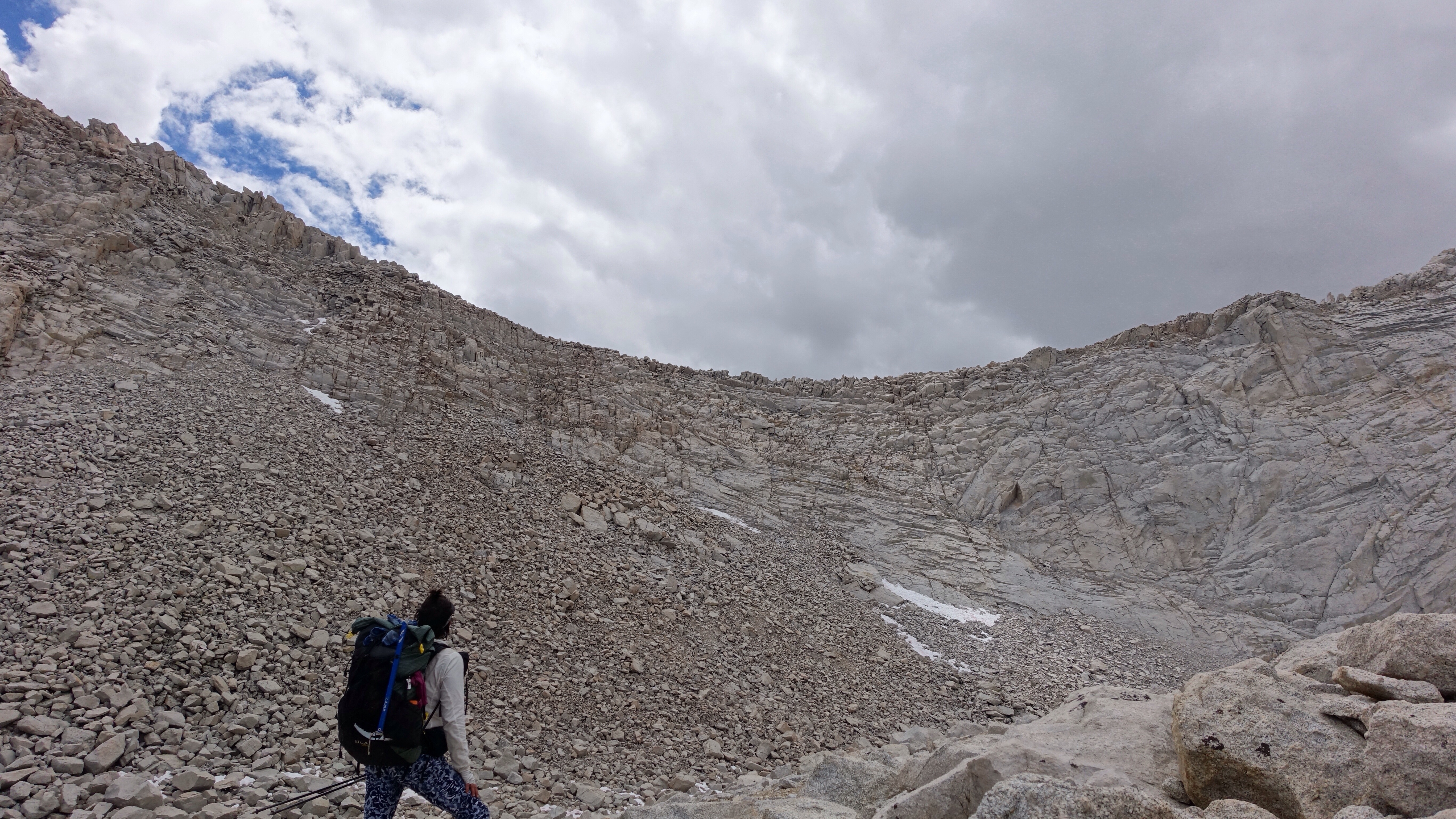
Forming part of the solid wall around Lake Tulyaino is Mt Russell and Mt Carillon. One’s ridge meets the other, and that general place of meeting is the Russell-Carillon Col (13300 ft), a pass that I would have to cross. The bottom half was a straightforward steep talus slope, one of those jumbled, chaotic, and sometimes rickety staircases I am so often climbing. But the upper half of the pass looked a little more like a vertical rock wall. I had heard about this pass, and of course spent much of my over-drawn energy worrying about it, so I had expected to see something that looked frightening and impossible. However, I could see the obvious flaw running down the rock that looked easy to climb. I had a moment of confusion: for so many days I had worried about this pass, yet now that I saw it I was not, in the present, worried at all. A residue lingered though, and I was both worried and not, neither not worried nor worried. The wolf of fear had been getting quite a feeding I think, and as it paced, the bars of the cage rattled.
Observing the Russell-Carillon Col. Look at this and think about how you would go up. Every such challenge is a fun puzzle.Climbing the Russell-Carillon Col.
Suspended between fear and calm, I simply climbed the pass. It took almost no time, and once I was climbing the vertical rock up the cracks and ledges, I felt perfectly at ease and even enjoyed the kinetics of this manner of upward motion.
From the top, I could see Mt Russell, Mt Whitney, Owen’s Valley, Lake Tulyaino. It was a breathtaking place to sit and eat some crackers and salami. I studied Mt Whitney, whose East Buttress I would be climbing (via the Mountaineer’s Route) tomorrow morning, another moment in the future that has held my anxious attention. But to sit there with my little mustard packet and lump of meat and Triscuits, at the top of a climb that was pleasant instead of terrifying, I thought the climb up Whitney didn’t look so bad.
Mt Whitney is the mountain on the right, and the long strip of snow is the Mountaineers Route.
After finishing lunch, I began the long, steep, and very sandy descent off the Col down to Upper Boyscout Lake, the most popular campsite for people preparing to climb Whitney via the Mountaineer’s Route. I dropped around two thousand feet down this sand hill, surfing on my feet and wondering how there is any sand left at the top if so much of it goes down with every traipsing hiker. At the bottom I emptied out my shoes and then immediately went to ask a group of campers what they knew about conditions on the Mountaineers Route, which I knew was holding late season snow. The people I talked to hadn’t climbed yet, were planning to tomorrow afternoon, but said they heard about the snow too and that most people were climbing it with crampons and an ice axe.
Emptying sand from my shoe after descending to Upper Boyscout Lake.
I thanked them and climbed around 1300 feet up to Iceberg Lake, the launching point for The Mountaineers Route. Climbers have shaped this place significantly. The lake is in a deep cirque at the base of the east buttress, and is surrounded by rocky hills or steep walls. Over the years climbers have cleared rocks and built protective barrier walls to establish little campsites around the lake. I must say I was delighted to choose one of these delineated spaces, and never before on this trip has setting up camp felt so much like playing house.
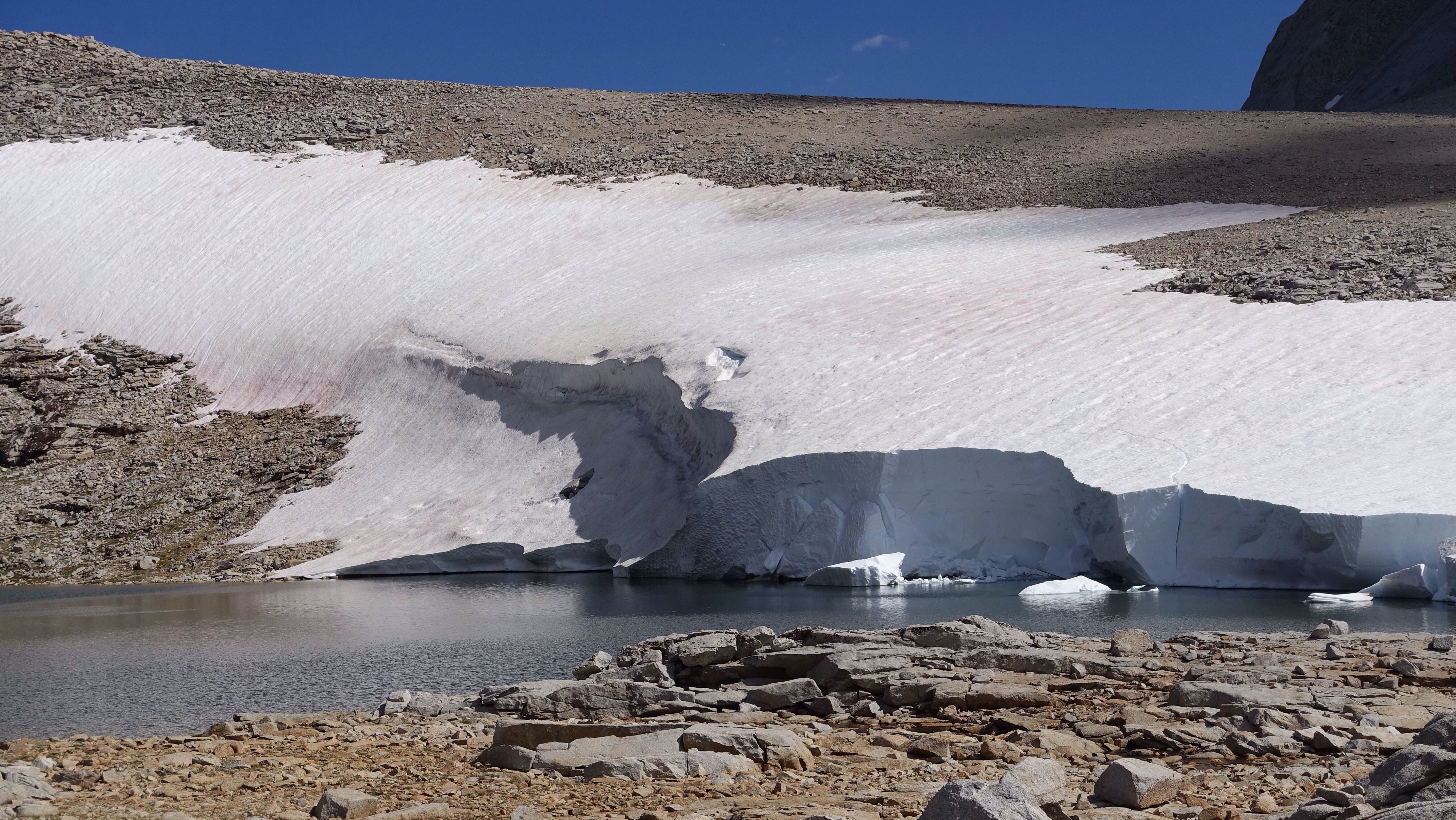
I’m camped at 12700 feet, and already, before it is even dark, it is quite cold. Iceberg Lake is well named, and half of its surface is snow and ice. Over the couple of hours I set up my tent and made dinner, the other of half of its surface went from mostly liquid water to mostly frozen, radiating structure in a lovely crystal pattern. I am on the east side of the mountain, so once the sun tucks behind its high peak, the temperature drops quickly over here. I’m sleeping in my rain suit for extra warmth.
Again I find myself unmoored in time out here. Drifting through this sea of mountains, carried along in the currents of passageways that admit me from one eddying basin to another. I bump along, bouncing off rocks and slipping along snow, trodding up and down and up and down as the tides go. And what day is it even? I ran into a pair of climbers today and couldn’t rightly say how many days I’ve been out. I said nineteen. Apparently it’s eighteen, so the blog tells me. This written record is an anchor draped over the many days out here that blend together so thoroughly that sometimes I feel I am living only in one tiny moment.
No bears bothered my sleep last night, but I had set up my tent on a slant and that, like bears, can be a sleep wrecker as all night I feel gravity sliding me off my ground pad and into the tent wall. Still, it was warm down there at 10,000 feet, among the pines and next to babbling Bubb’s Creek.
After rising and packing and setting off, I had only a few more miles of John Muir Trail, traveling up-creek past all of the camps of the trail’s denizens, many of them not up yet, their tents like giant colorful marbles dotting the glacier-polished granite slabs lining the cheerful waterway.
I was looking for an unsigned and apparently difficult-to-find turn-off onto what used to be the John Muir Trail around the east side of Center Peak, before it was abandoned and the trail rerouted around the west side of Center Peak and over Forester Pass. Though I thought I was prepared to look when the time came, the time actually came and I wasn’t looking (isn’t that how it always goes). I missed the junction and realized it when I arrived at a stream crossing the trail (this whole scenario–missing the junction and realizing it when arriving at the stream, is laid out in the route description by Dixon and Wilson). So I turned uphill, flitting among boulders until I intercepted the trail. It was decommissioned long ago and well-hidden at the junction, but a very obvious foot path where I found it, even sporting some foot prints. I climbed up along the trail for 3000 feet, passing beautiful Golden Bear Lake with a sign from a park biologist saying there are nets in the lake to remove nonnative fish, and not to swim there. I could see the nets bobbing along in the clear, shallow water near the shore, but no fish. I am impressed with human beings sometimes, the efforts and care we put into small scraps of land on this planet. Fighting the good fight they are.
I climbed and climbed, up past thick swarms of gnats that seemed to follow me in a cloud for several hundred feet up, flying into my mouth as a breathed, into my ears and buzzing around, and making me feel solidly insane. Once I gained a prominent ridge and left the gnats behind (hallelujah), I could see JMT hikers toiling up the long trail to Forester Pass, the highest pass on the JMT at some 13000 feet. Like little ants far below me, or perhaps Orcs on their way up to Sauron’s tower. Their bodies were just specks struggling across a rough topography. I wondered as I climbed the ridge toward my own pass, Junction Pass at 13300 ft, if they could see me toiling upwards in turn. Just as I was about to top out, I was surprised to see a hiker drop towards me, a guy from Portland out wandering around in the mountains with no particular plan. We had a brief chat, both amused at the unexpected encounter, and then I went up and he went down. I took a little break on top next to an old wooden sign still erected from the trail was routed this way, before it was moth-balled. Though it’s been many years since it was cared for, the trail had been in decent shape so far, with a mostly followable tread and even some cairns to clarify the overgrown parts.
Dropping off the other side of the pass, towards the eastern side of the Sierra Crest, was another matter. Though I could follow some semblance of the trail, or at least a morass of footprints in the sand for a while, very soon it was nothing but sand and rock dropping precipitously to a canyon bottom beneath Junction Peak. Going down was like tobagonning on one shoe at a time. I made it with nary a mishap though with abundant sand in my shoes. After shaking them out, I had the good fortune to continue on snow for much of the next mile as the canyon descended eastward, getting in some of my best glissading yet, feeling long stretches of ground slip quickly beneath my skiing feet and wind blowing in my hair.
The snow situation has changed dramatically from a week ago, north of Red’s Meadow, where there was an enormous amount of lingering snow. As I’ve traveled south, the snow has become patchier, less intrusive, and I’ve hardly needed my microspikes or ice axe at all. Partly there has been more time for snow to melt, but also it seems like there was overall less accumulation further south in the range.
Eventually this fortuitous snow at the bottom of the canyon ended, and I navigated some rolling talus heaps before the canyon spilled out into another, bigger one. The mothballed JMT reappeared briefly at this junction of canyons, and I followed it down into the bigger canyon before bidding it goodbye and cutting across a talus slope to pick up the Shepard Pass Trail, heads back over the crest and returns to the west side.
Even though there isn’t as much snow, still there can be some troublesome patches holding to life in inopportune places. Just such a large snow field covered much of the steep trail in the last 500 feet of ascent before the Shepard Pass, forcing me over onto a scree slope that became less and less supportive as I climbed higher. Nearing the top, I could see remnants of the trail, which looks like it was well constructed once but had been almost obliterated by a dirt and rock slide. All those hours of labor by a trail crew, slid away in one season. Human bodies are puny in the mountains, constantly getting pushed one way or another by the smallest of obstacles. A few extra degrees on a snowfield and suddenly it is impassable.
From the top of the pass the view east into Owen’s Valley was stunning. I always savor being able to look that way, down many many thousands of feet to the valley floor, and across to the arid White Mountains. After taking it in, I descended a high basin carpeted in tundra and dotted with stones before cutting off the trail to cross another pass, this one also blocked by a troublesome snow field. In exasperation, I microspiked my feet and just climbed straight up, though it felt precariously steep as I went and a slip seemed both likely and dangerous. I made it to the top without one, thankful my rashness went unpunished, skirted the edge of the snow, and had a sweet gentle descent into Wright’s Lakes basin, a beautiful and soft place of tundra, lakes, and gnarled old, dead pines standing in groves.
As I was looking for a place to camp, I leapt across an outlet stream for one of the lakes and slipped in lake muck on the far side of the jump, fell backwards, and covered my pack and legs in mud. After choosing a spot to camp, I stripped off my pants and rinsed them off in the lake, but as I was working them with my hands I felt a small object in the pocket. It was my MP3 player, stowed there earlier in the day. I don’t use it often, but it is powerful medicine out here when I’m exhausted and have a long climb, or am facing an extended section of dreary trail miles, or I’m feeling particularly lonely or sad. Losing it would be a shame. I pulled it out and have been trying to let it dry, first in the sun and then in my pocket, and tomorrow sometime I’ll try to turn it on and hope for the best.
I usually stand outside and write my blog posts as it gets dark, and though I begin as the sun is setting and the sky is richly hued, by the time I’m done the world around me has grown black, hulking shadows of mountains under a tent of infinite stars. The moon tonight is a hearty quarter, a bright crescent but not enough to shed any light here on earth. In the dark, the ever-present sounds of flowing water become more varied, with over and under tones, as though conveying information the way the murmur of speech does.
I tried to take it easy today, despite climbing three passes, and hope to tomorrow as well. I think the fatigue will endure until a good rest day, but it was a lovely day to spend walking, resting, walking, resting.
Golden Bear Lake along the decommissioned JMT.Pointing at Junction Pass.Prominent ridge dividing two basins, one heading to Forrester Pass and one to Junction Pass.
Old trail sing on Junction Pass. Looking south.Shepard Pass with that troublesome snow patch. I went up the scree on the right.Snow remnants fracturing.Ancient dead pine in Wright’s Lakes Basin.
A mix of being a little bit too cold, the wind, the sharp rocks beneath me, and a steady ache in my hips that made every position uncomfortable, all came together and conspired against good sleep. I recall a lot of timid and careful tossing and turning, so as not to grind my ground pad into the rocks. Many days ago I mentioned that my ground pad has a leak and I reinflate it at least once every night. I could have fixed it while I was in Bishop, but I didn’t get around to it. In the words of a blog follower from years back, patch your pad hole! Maybe in Lone Pine I will get around to it. Sleep is a precious resource out here. In the meantime there is a dependable, small midnight dance of weight shifting and lung-bellows and if I wake up having only done it once, I consider myself lucky.
So again I woke up tired, feeling almost like dried up pitch, sticky and crumbly both, slow to move. From Baxter Lake I had around three and a half miles of another unmaintained trail to follow until I again met up with the JMT. The Baxter Pass Trail seems essentially abandoned, and unlike the Sawmill Pass Trail of yesterday, which was unmaintained but clearly used, the Baxter Pass Trail mostly flirted with fading into obscurity as I tried to follow it down canyon. Occasionally there would be a cairn, but often they were in surprisingly unhelpful places, such as where the trail was already obvious or where they were invisible until you already knew to be standing there (and if you did know, what do you need the cairn for?). It took some time to get out of the canyon, with many stops to hunt for evidence of a trail lost in the bogs or sometimes to backtrack to the last place I knew was correct. It is tricky to know when to abandon the trail and simply cut cross country in the general direction you know you need to go, and when to spend quite a lot of energy trying to maintain a connection to a trail that doesn’t seem to want to be found. Keeping it at hand can save a lot of route finding headache later on when the easy cross country suddenly cliffs out and requires backtracking or difficult navigation. I almost bailed on the trail a couple times, this nearly non-existent path-that-was, but each time thought better to hold onto it, because it might come in handy.
Indeed, there were several places in the descent out of the canyon where the trail displayed future-knowing as only a trail can, heading early away from trouble before I could know what was coming. Eventually it plopped out of the Baxter side canyon and, after a long traverse along talus up high, descended to join the John Muir Trail at Dollar Lake. I was on that most famous of paths only briefly before cutting cross country again, this time up a steep gully through a notch in a ridge line, headed for Sixty Lake Basin. Though the climb up the gully was only 600 feet, I found it interminably exhausting. And this fatigue didn’t quit all day long. Sixty Lake Basin was beautiful, or the parts of it I saw, but I struggled as I climbed up into and through the basin, along many exquisite lakes surrounding by grass and pines. My time there was dotted with countless small breaks, and eventually I exited over an unnamed pass patched with snow, back into the main canyon and back to, of course, the JMT. Basically, with the climb over Mount Baxter and the trip through Sixty Lakes Basin, I made a big ‘S’ shape detour, beginning and ending with the John Muir Trail and touching on it briefly in the middle too, at Dollar Lake. After dropping a few hundred feet from the unnamed pass to meet the JMT, I joined a long train of people toiling up to Glen Pass along a series of steep switchbacks built into a rather severe scree escarpment. I felt like we were all part of a conveyor belt, only instead of us being conveyed, we were the belt itself, moving along all of our belongings up this mountain side. There was a snow bank at the top that troubled some of the hikers, as has every JMT pass with snow on it that I’ve crossed. Whenever I’m asked later about how difficult the JMT passes are by hikers who are approaching them, I always answer ‘it depends on you’. On this trip, I’ve felt rather cradled on the trail, but I guess that’s unsurprising. Challenge is in the eye of talus-stomping, tired-leg beholder.
Even if technically the trail is easy, my body was limp and ragged all day today. Though my pack is only getting lighter, it weighed heavy on my shoulders. My lungs couldn’t get enough air. The flesh on my thighs, belly, and upper arms all hurt like it’s been whipped and bruised. It dawned on me that perhaps I’m getting a little worn out, and that accounts not only for the enduring fatigue but also the air of melancholy that persists after yesterday.
After the razor-backed top of Glen Pass, it was JMT all afternoon for me, until I decided to stop, which happened some 6 or 7 miles later, passed Vidette Meadows. I’m in Kings Canyon National Park and have been for some time (and mostly will be in Kings Canyon or Sequoia National Park until the end of my hike many days from now), so the trail junctions are all well-signed, a typical feature of National Parks. Descending towards Vidette Meadow, each sign had a hand written note from Ranger Mike warning of bear activity all through the area, so I hope I’m able to sleep peacefully without interruption. I certainly could use it. The next few days seem to promise some difficult travel.
Looking from the Baxter Pass Trail across the canyon to the notch into Sixty Lakes Basin, that dark sliver of shadow in the low center of the opposite ridgeline. Dollar Lake and the JMT are unseen at the bottom of the valley.
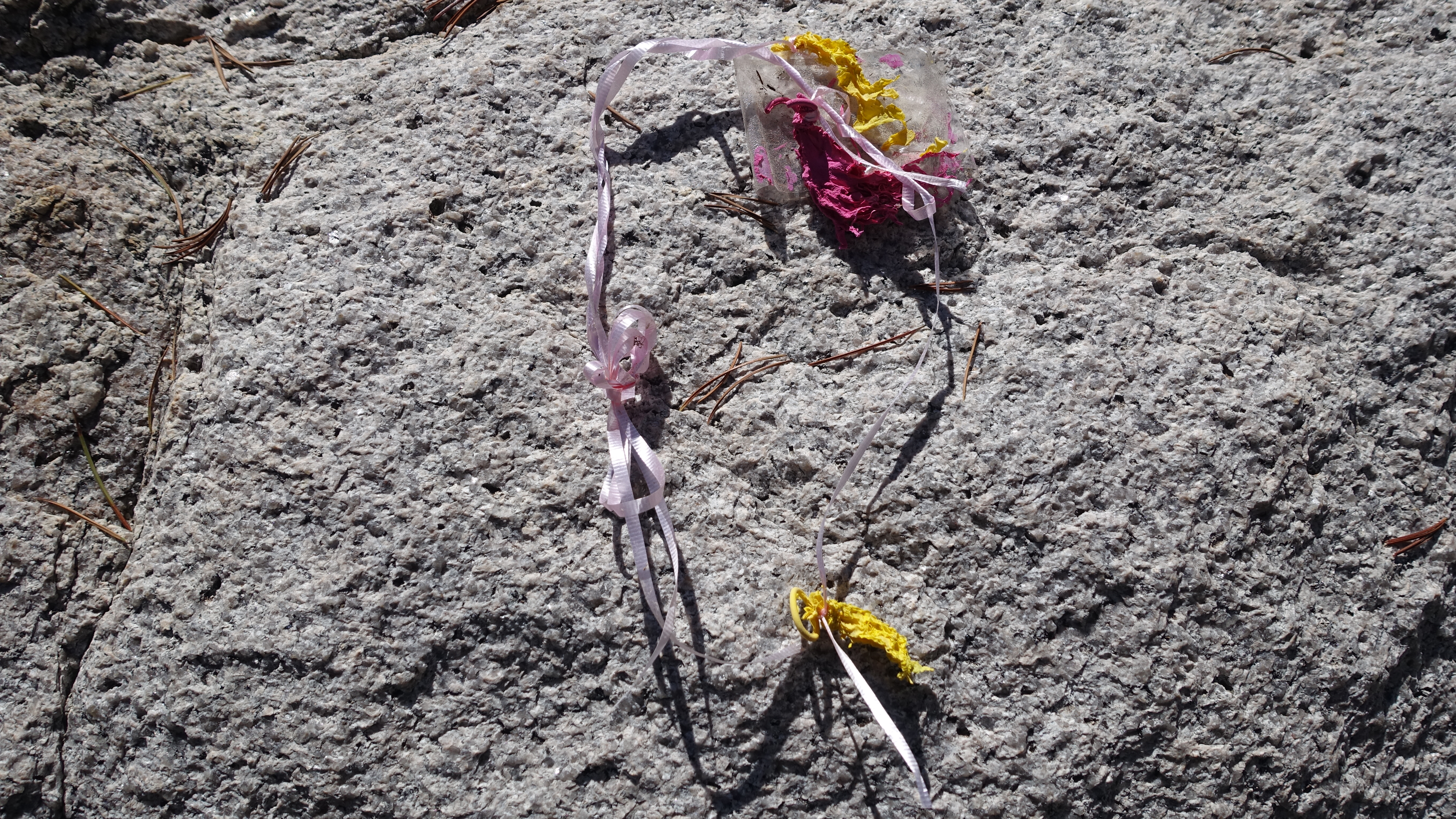
Balloons do go somewhere to die, and that place is the mountains.Sparkling water in Sixty Lake Basin.Unnamed pass that climbs out Sixty Lakes Basin and leads to the base of Glen Pass.JMT hikers on Glen Pass.Layers and colors of complex rock beneath Glen Pass.
I woke up tired. Silvery monochrome dawn changed to technicolor, and finally I struggled out of my sleeping bag and tended to my morning tasks, hoping the light would seep into me and fire me up.
Once walking, I was again on the John Muir Trail, for a number of miles, from my camp just at treeline below Mather Pass, down for several miles to meet the nascent South Fork of the King River, and then up for four or so miles to Pinchot Pass, then down for several miles until I took my leave of the trail and its crowded community of hikers.
I had the option to leave the JMT early and cut due south to climb the pass between Coliseum Mountain and Mount Cedric Wright, but I was able to eye the pass as I descended from Pinchot and it looked like a steep, 600 foot scree slope, and steep scree slopes are some of the worst kinds of walking. Instead I passed around Mount Cedric Wright on the west, following the JMT, until I came to the Sawmill Pass Trail, whose sign indicated it was unmaintained. Ah good, my favorite kind of trail. I left the busy turnpike of the JMT, wide and well graded, and began following a skinnier and overgrown trail but one that clearly was carefully constructed at one point in time, bearing all the hallmarks of a trail crew: switchbacks, rock steps, etc. The trail climbed among the granite slabs at the base of Mount Cedric Wright for a while, and as it leveled out amid meadows, it began to fade, in and out, in and out. A mule or a horse had come through the trail this season and left behind horseshoe prints and manure, now hard and brittle balls, but I took comfort in the imprint left by the animal’s passing. For some reason, perhaps lingering tiredness, perhaps simply the vagaries of a trip like this, I was very soft and tender-hearted all day. I felt like a small smudge of human melancholy. I am plumbing into loneliness, despite the multitudes I encounter when I am on the JMT, or perhaps in part because of. So there’s that too, step after step after step with an ache for something warmer, more familiar. You just throw it in the basket with all the rest, the sore ankles and endless talus and curry couscous dinners and so on.
In that basket also was the strange comfort I took in the absent pack animal. I could imagine its enormous liquid eyes, its patience as it navigated rocky, unmaintained trail. I kept on in this imagined company, a little sad, until it was time to leave this trail too and head south cross country towards Mount Baxter. The SoSHR offers this as an alternative to following the JMT for many more miles, but I get the impression it’s an option less traveled by SoSHR hikers. At first I couldn’t figure out the right place to turn, and the description was too vague to be helpful, so I turned on my gps for confirmation until I knew I was headed to the correct small, unnamed, L-shaped lake. From there I could see roughly the goal: the prominent north ridge of Mount Baxter, a class 2 scramble, accessed by a long series of granite benches, and then hills and gullies of talus, and then a very steep chute through a cliff band. T the L-shaped lake I dithered, wondering if I should stop for the day. It was 2:30, which was very early to stop, but if climbing up and over Mount Baxter proved difficult or slow, I was worried I might get stuck on the mountain with no camping options. I ultimately decided to climb upward, knowing there was another lake ahead I could stop at. By 3:10 I was high above the second the lake and just about to leave the benches and enter the talus when I encountered a small stream next to a little green meadow, an oasis among this land of rock. Again, I paused. Should I stop? It was still very early to stop and yet it felt a little late to embark on an uncertain and potentially difficult climb. For no reason I can understand, I impulsively decided to just go for it, climb the damn mountain. Once again I was racing time, and a thickening collection of gray clouds overhead, while ascending over two thousand feet. The way up to the chute was very steep talus, and upon approaching the chute, became a horrible loose mess of dirt, talus, and scree. The chute was maybe 50 vertical meters, hand-over-head scrabbling up this incredibly unstable slope, grabbing at anything for support and hoping it would hold. There wasn’t exactly a huge fall risk, more like a slip-and-slide down many feet of rough rocky slope risk. Funny, in the intense focus of ascending this awful chute, my melancholy slipped away and was replaced with singularity: survive the chute, and then get up and over Baxter before dark. Eventually I broke free of the chute and was able to walk upright again, following much more stable talus up to the long north ridge, with extraordinary views all the way down to Owens Valley east of the Sierras. Ascending the ridge was technically much easier, though I exquisitely tired by this point. My legs never seemed to regain their appetite after climbing Mount Sill yesterday, and each step was a labor.
I could see up ahead that the route I planned to take, all the way to the summit of Baxter via the north ridge and then one last steep chute at the top, was blocked by a large, steep snow field. Perhaps if it were earlier in the day, and I weren’t racing the clock, I would have been more willing to get up there and see whether some passage would be workable. But I was in a hurry. And tired. And I wanted something with a better probability of success. Instead of tangling with the snow, a few hundred feet from the summit I left the north ridge and traversed the northwest face of the mountain, across multiple gullies and loose, steep talus. Carefully, carefully. One small, conservative step at a time, a few slips but not falls, and then I was on the west ridge, and could see many hundreds of feet down across dinner-plate sized rocks to Baxter Lake, the place I needed to be. It looked close, but in reality was quite far away because the descent was terrible. Extremely steep and loose rocks, so that every step ran the risk of turning an ankle. As the descent wore on and my knees became wrecked, each step down was more of a small, uncontrolled fall, which was a less-than-ideal way to navigate all the loose rock. But again, after an hour and half of step-fall-step-fall, and of course one last ridiculously steep and loose gully to break through a cliff and near the bottom, I was standing on flatter ground and teetered onto the meadowy and buggy banks of Baxter Lake. There is an old decommissioned trail that comes up here from the JMT, but I doubt it gets much use. Once I left the Sawmill Pass Trail and began the climb, I haven’t seen any footprints or any other sign of people. It’s quiet up here, a quiet to match the deep fatigue in my body.
I didn’t have the stamina to search long for a campsite, and have set my tent up on a rocky hill. Everything is rocky around here, and while it was easy enough to pitch the tent, I’m nervous that the sharp rocks will puncture my ground pad, the central source of comfort for my nights. So I am writing this now as a kind of wish, a little prayer to the rocks below me to be kind and preserve my precious ground pad.
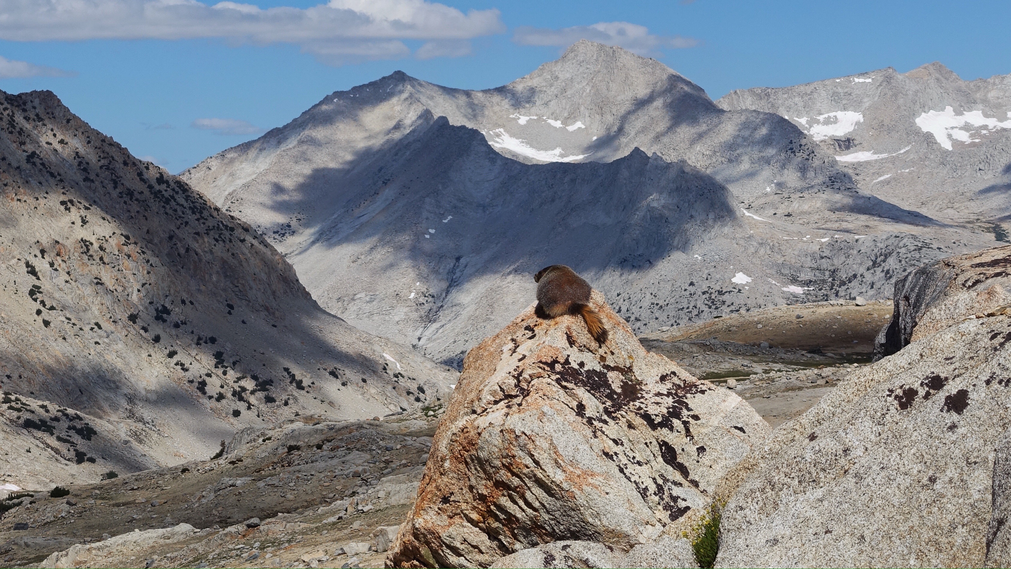
Marmot enjoying the view.Mt Baxter’s north ridge. The rightmost patch of snow near the summit is the one I avoided by cutting cross the face below the summit rather than going up and over.Snow just below Mt Baxter’s summit.The traverse of the face I did instead. I’m almost across.Baxter Lake is the larger, lower lake. See from Mt Baxter’s west ridge.Almost-summit photo taken on the west ridge, looking south.Looking back up at the breadbox-sized rocks on the descent.The descent, seen from the smaller of the two lakes. Mt Baxter is the peak on the right.
The nights are getting colder, and longer too as our little rock tilts farther away from the sun. Last night was the coldest yet, and in the morning the grasses and my pack were covered in a fine layer of frost.
I bounced out of bed at 5:30a, packed my bag with some snacks, water, rain clothes, and a map, and left my tent set up and my sleeping bag unstuffed, hopeful that the heavy moisture accumulated overnight would dry while I was away. By 6a on the very nose I was climbing away from my little camp at the base of Potluck Pass and headed for Mount Sill (14159 ft). It hides well from the west, tucked behind Polemonium Peak. Really well. As I entered a drainage hemmed by mountains, I thought that a tidily triangular one directly in front of me was Mount Sill. It was confusing because the southwest ridge I was supposed to ascend actually ran to the northwest, and it seems bad practice to call a mountain ridge the southwest one when it’s pretty much the opposite. Moreover, the summit looked lower than some neighboring peaks, which didn’t make sense because Mount Sill should be higher than most of its neighbors, but I wondered if it was simply a matter of the optics of where I was standing. As I drew closer, the ‘southwest ridge’, which was actually a northwest ridge, looked impossible to climb without climbing gear. All of this to say, I didn’t seem to know where I ought to go. I was confused enough that finally I turned on my GPS, just before scrambling up a chute of talus to gain the ridge, and realized that all my doubt was well-placed, because that triangular mountain whose ‘southwest ridge’ actually ran northwest was in fact Mount Jephson, not Mount Sill. I turned to the next mountain on my left and surveyed the real Mount Sill, the neighboring peak, and the correct talus slope that I would ascend to its southwest ridge. The ridge was supposed to border a cirque it shared with Polemonium Peak, and I thought I was in that cirque, so I climbed a steep talus and scree slope until I reached solid rock on what looked like a southwesterly ridge descending from the summit. It was hard to find a way to move from the talus to the solid rock at first since much of it was rather cliffy, but I found a way and began ascending steep blocky talus towards the top. When I arrived, I found it was not the top. It was a false summit tower with dire cliffs dropping hundreds of feet straight down on the other side. Again, I turned on my GPS and discovered I wasn’t on the west ridge at all. I was on Mount Sill’s face. (What have I learned about ascending faces?) Mount Sill’s face has multiple gullies, maybe six or so, most of them filled with talus and sometimes hemmed in by sheer walls. I made a long and confusing ascending traverse across the gullies, hoping I could connect to the southwest ridge. Eventually I was only two gullies away from the ridge, but I couldn’t cross the one I was in because of a cliff band along its edge. I ascended to the very top of my gully, skirting below the cliff bands, and my altimeter showed I was less than a hundred feet from the summit. I almost gave up there, but having come so close I decided to give a crack in the cliff one last shot. In a tough series of climbing moves involving a couple hand jams and foot jams up the crack, I managed to overcome this last troublesome obstacle and gain the summit, after three and a half hours of determined and tiring ascent. I signed the register. I took photos. I felt my breath raspy and thin when faced with the dramatic drop-offs to the east. And then I skedaddled, not wishing to linger too long, descending by way of the west ridge, the one I had been looking for (and seriously misplaced) on the way up. It was a steep descent, mostly class 2 but some class 3 thrown in near the summit, and after carefully picking my way down scree, talus, snow slopes, and finally meadowy benches, I arrived back at my tent a little over five hours after I left it. I was exhausted. More tired than I’ve been at any other point on this trip so far. I had a snack, packed my bag, and began hiking again, thinking about being lost, whether I ever was, and what the confusion of sense of place feels like. In this era, with our GPS devices and our emergency signaling devices, I’m not sure we can become lost in the ways of our ancestors. I suppose we’ve replaced those with our own modern means of disorientation and confusion.
Over Cirque Pass, itself requiring some complex navigation as result of all the snow, and down the other side. I was so tired, my legs had no appetite for movement at all, and I felt like every part of me had to be dragged along, which meant I also felt like there was no part of me with the capacity to do the dragging. (Is I the one dragged, or is I the one doing the dragging?) While descending Cirque Pass, my instructions from Dixon and Wilson (and from Roper, since the Sierra High Route and the Southern Sierra High Route overlap through here) were to keep right and look for ramps. I did ok for a while, but towards the end I bungled it up, another navigation misstep, and ended up descending steep, rounded granite cliffs ribboned with fat waterfalls. It was slippery, treacherous, slow, and tiring, and I was already worn out. Clearly I didn’t keep right enough, but the ambiguity of the instruction made it hard to interpret. Ramps can be hard to see from above. Indeed, much of the time I’m just walking towards what looks like the end of the ground out here on these very steep descents, and only discover what there is to walk on when I’m almost on top of it.
After I resolved that little navigation fiasco, the second of the day, I had many miles of John Muir Trail, along Palisades Lakes and over Mather Pass, where my navigation, indeed my attention, wouldn’t be required. But my tired body was necessary, and I dragged my ass along, one slow slow s-l-o-w step at a time. Once I dropped past tree line on the south side of Mather Pass, I stopped to make camp.
Not many forward miles today. One mountain climbed. One hard cross country pass. One straightforward but tiring trail pass. One beat up body. One sleepy hiker.
The low spot in the ridge line is where I first thought I was supposed to go, and then follow the ridge right to the summit. But right leads to Mount Jephsom. The mountain on the left is actually Mount Sill.
During the climb of Mount Sill’s many gullies.On the summit of Mount Sill.Panorama looking south from Mount SillThis very tall and very upright block stood near the summit. It looks like a shark I think.Long, skinny, distorted-looking cliffs on Mount Sill.Final descent from Cirque Pass, shortly before getting mired in a cliffy descent.A lot of grass-flanked streams against a backdrop of mountains in the later part of the day.
Climbing mountains involves going down, going up, and shaking.
Last night some folks at the hostel had quite a raucous party. There was definitely drinking, and definitely drunk screaming, for many hours late into the night. I put my earplugs in and fell asleep anyway, only rousing from sleep if the screaming surpassed whatever the decibel rating of my earplugs is (it happened only a couple times). Despite this amusing beginning, sleep was solid and I woke up early so I could pack up, get breakfast, and then catch the shuttle run by Eastern Transit Authority that travels between Bishop and South Lake Trailhead, 30 miles or so up into the mountains, twice a day. I first heard about the shuttle as I was hiking to the South Lake Trailhead before visiting Bishop, and I was very pleased to find out about it. Unless a trailhead is obscure and infrequently used, hitching from a trail to a town is often pretty fast. People on trails tend to feel an immediate kinship and desire to help one another. But hitching from a town back to a trail can be quite difficult sometimes: passing cars are much less likely to be headed to a trail than anywhere else that street might go. A shuttle makes that particular problem disappear.
I slipped out of the hostel past a few revelers passed out sitting up in the living room, and went to a nearby cafe for a coffee and a bagel sandwich, and was ready to catch the 8am bus from the stop a couple blocks away. I waited until 8:30, staring down the vacant street, and then called Eastern Sierra Transit to find out if I needed to have made a reservation first. No, said the man on the line, but yesterday we stopped running the shuttle on weekdays and went to weekend only service.
But of course. I’ve become unmoored in time out here, so easy to do. School is back in session in most parts of California, and once school starts again, hiker support services begin to wind down. I went to the dumpster across the street and ripped off a piece of cardboard to make a sign that said ‘South Lake’ and walked over to Line Street, which was the road out of town towards the mountain. It was South Lake or bust baby. Hitching was my one way out of town.
I thought I might have been there for hours. I walked a few blocks until I found a small patch of shade under a tree canopy and waved my sign, smiled, held out my very tan thumb. There’s nothing quite like hitchhiking to become aware of the gendered mannerisms we use, perhaps especially some of us women, to appear non threatening and charming. A kind of shrinking of stature, a retracted presence. Better to look harmless than powerful. I would guess many women have trained in this skill set since childhood, and many draw from it subconsciously on a regular basis. It’s a nuanced strategy while hitchhiking though, because demure gets you a ride, but badass keeps the sketchies away. In any case, I was there for maybe twenty minutes before someone pulled over, a guy who runs a personal shuttle service for hikers. He had some hikers to pick up from North Lake and could give me a ride to the turn off to South Lake, which was most of the way there. You’re lucky, he said, you’re getting the ride for free today. He dropped me off way up in the mountains, and minutes later I was picked up again, by a woman in her sixties whose license plate read ‘WMNHKR’. Not fifteen minutes later I was at the trailhead, preparing for the long uphill. It was 9:45a. Not bad at all.
The long hike back over Bishop Pass was quicker and much less painful than I was anticipating. Though my bag was full of food, it carried well and my legs felt energetic. My left ankle’s wee tendon is still a little tetchy, but overall my body was in good form. After getting to the pass in short order, I dropped almost a thousand feet down from Bishop Pass into Dusy Basin before leaving the trail and heading south cross country again, making my way along granite humps towards Knapsack Pass. The ascent of Knapsack was speedy and straightforward, though finding my way through the ribs and gullies of Palisade Basin on the other side took a little more time. The jagged mountains of the palisades stood to the east, many over 14,000 feet tall. I wandered past the Barrett Lakes, and an empty tent whose owners were probably climbing the nearby mountains. As I was climbing up past the lakes and heading for Potluck Pass, I slipped on a slanted piece of talus while scanning the route ahead and smashed my shin into rock. At first I though it would just be a bad bruise, but quickly blood began seeping through my pants. I pulled the pant leg up and saw a hole in the skin, the kind that generously bleeds deep red blood like an artesian well gushes water. My first aid kit is in the bottom of my backpack, so everything was sprawled across the ground and I was elevating my leg to stop the bleeding when two guys approached, always a genuine surprise out in the anonymous arms of nowhere.
“Everything ok?,” one of them asked.
“Yes, fine, I just slipped off this rock and gashed my shin.”
“Do you need help?”
“No, I think I’m fine, though I’m running out of bandaids.” I’ve used so many for just this kind of talus-related injury on this trip. My first aid kit has never gotten such a good workout on a hike before.
The guys gave me some extra bandaids because they were heading out tomorrow. They had ice axes and crampons, so I asked what they were up to. They’ve been on a twelve day traverse, roughly following a line similar to the Southern Sierra High Route, the route I’m now on, but from south to north rather than north to south, and they’ve climbed every 14000 foot peak along the way. They had just finished that very afternoon, with a traverse of Thunderbolt Peak, North Palisade, and Mount Sil, the jagged and imposing crest of mountains I had been skirting along. We talked about our respective trips (they seemed impressed with mine, but frankly their project seems to be in an entirely different echelon–still, it was kind of them) and I plied them for information about two climbs: Mount Sill (14153 ft) which I will attempt to climb in the morning, spending half of tomorrow on it, and Mt Whitney’s Mountaineer’s Route. Both are class 3 ascents, but both have me a bit nervous. I haven’t mentioned this before but I’m afraid of heights, and while I love the physicality of climbing things, exposure can be alarming. Sometimes when confronted with heights my feet begin to throb, and my body almost seems to manufacture a sense of vertigo as though to justify the sudden icy grip of fear. While my route doesn’t have to go up Mount Sill, Dixon & Wilson, the authors of the Southern Sierra High Route, strongly recommend the climb as a side trip and I did want to summit some mountains while on this hike. In addition, I want to see whether my nervousness coordinates with reality–I haven’t in general found the passes to be threatening, and many of those are class 3. All these specifics are to say that I’m exploring my trepidation. I am plowing my fear field. I am tilling that good, rich earth and finding out what grows there.
After we bade goodbye and my leg stopped bleeding (it clotted nicely), I repacked my bag and contoured over to Potluck Pass, being much more attentive with my steps. After a quick descent, I made camp in a little grass glen next to a stream. Tomorrow morning I’ll rise early and thread my way up into the tight cirque between Polemonium Peak and Mount Sill, and see what can be made of my feelings.
One sad note for the day is that I lost my yellow pee rag, that bandana always hanging off my backpack (a pee rag is a woman’s best friend in the wilderness). On this trip my pants have received many compliments, but I was most flattered when many days ago a JMT hiker called out to me ‘hey, I like your pee rag!’ as we passed one another on the trail. Godspeed dear pee rag. May your new horizons be as practical as your old ones.
Long Lake on the east side of Bishop Pass.Self-portrait # 2. This view, of my lower leg and foot stepping on rocks, is what I see of myself out here more than anything else.Palisades BasinLooking southwest from Potluck Pass.Sunset at camp
Oh how I love a good rest day. Hot breakfast burrito, relaxed blog posting, charging devices, doing laundry, picking up packages at the post office. Soothing prosaic tasks.
I woke up and went first to the laundromat next to the hostel so I could wash all my clothes before putting them on my clean skin. This means I have nothing to wear but a rain suit while they wash, which is awkward and uncomfortable, but it lasts for only a short while and the subsequent pleasure of slipping into clean, soft clothes is sublime. While I was doing laundry, a woman came in to do hers and we got to chatting. Her daughter, along with a friend, is hiking two of the high routes I’m hiking, which is a small-world coincidence since these routes aren’t hiked all that often. I was interested, though as the conversation wore on it became clear she was quite proud of her daughter, and would tell me of one her accomplishments and then ask have you done that? It became a little strange after awhile, as I attempted to honor her obvious love for her child while gently continuing to suggest that she and I lived different lives and would thus have different accomplishments. I would have liked to talk to her daughter, because apparently her party just finished the Southern Sierra High Route today and I’m embarking on it tomorrow.
I went to the Post Office after breakfast to pick up my resupply packages, and as I was walking back the eclipse was under way. It was fairly overcast in Owens Valley, which I understand is unusual for a summer morning. The world darkened nonetheless, not to civil twilight but on the way there. The scene in this town was probably similar to towns and cities all over the country: people out on the sidewalks, heads craned up, cardboard glasses being passed around. I encountered a man with a welding mask who let me look through it (and I know this is not safe eclipse-viewing protection, but it was very short), and I could see a black partial disk superimposed on the sun, even through the clouds. A half block later, I borrowed a pair of eclipse glasses from some other onlookers for a moment, but the lenses were so dark that I couldn’t see light through them at all. Perhaps they work better if the sky is not overcast. I loved experiencing the disconcerting feeling of reduced light though. It illuminated how intimately my body is connected to its environment, the levels and movement of light and shadow, in a way I don’t even notice most of the time. That is what it takes to notice what mostly passes invisible to us: disruption.
I brought my boxes back to the hostel in the gloom and sorted out my food for the next leg. I had to decide how fast I think I can move through the upcoming terrain. Originally I planned for nine days, but I’ve been faster than I anticipated and frankly I don’t want to carry all that weight back up Bishop Pass tomorrow. I figured eight days instead, though there are many unknowns. It seems like the daily amount of elevation gain on the Southern Sierra High Route could be greater than on the Sierra High Route. I’m also unsure of conditions in some places that could slow me down or even turn me around–snow in the gully on the climb up and over Mount Whitney via the Mountaineers Route, for example (which is included in my upcoming route). Go forth not knowing. Eight days of food will probably be fine, maybe even too much, and if not I can hike on an empty stomach for a time.
Eight days of food crammed neatly on a 2′ x 2′ table.
After sorting and packing up my resupply, I had the rest of the day to run small errands, relax, eat. I even managed to catch up on some political news. Yowza.
So tomorrow, on to the Southern Sierra High Route! It overlaps for about ten miles with the Sierra High Route, so I’ll only miss the last thirty miles of Roper’s SHR (and some of those miles I’ll get to visit on the last of my routes, the Kings Canyon High Basin Route, in a couple weeks’ time). It will be interesting to switch authors, from Roper to Dixon and Wilson. Different people, different tone, different lines. Following someone else’s route through the mountains is like reading a piece of music they’ve written and trying to play along, or following their math proof and filling in the missing details. The shape of the music or of the proof reveals something of the author, and yet how we choose to fill it in with ourselves is highly personal. Thus it becomes a joint affair, such a cross country traipsing, and as such the author of the route seems, to me, relevant to the nature of the route. So, new route, new author, new walk in the mountains.