Category: Sierra High Route

  • Day 4: accruing learning

    Day 4: accruing learning

    Half of the day I continued to walk on trails, working my way southeast through Yosemite’s eastern side. I followed Lewis Creek as it slid over curving granite and made elegant water falls, then climbed up to the north rim of the Merced River canyon. Eventually I dropped down to cross the Lyell Fork of the Merced River, then climbed up the steep, tree-studded, mostly granite wall on the other side, making use of a fissure in the rock that ran from river to sky, the whole way up. All of this was on trails, my walking cadence so regular that it made my legs ache.

    Around noon, I happily left the trails and my heart fluttered, a mix of nervousness, light fear, and excitement. It was time to pay attention again. Time to wake up. Grassy benches interspersed with tan granite outcrops led upward, and I held an unnamed peak to my left for orientation as I preceded up a long valley until  I came to the rocky approach to Blue Lake Pass. It looked straight forward, even easy. I was to cross it heading east, towards the Ritter Range. However, I didn’t look closely enough at my maps, and missed that there is a small canyon holding a lake just 400 vertical feet below the pass, tightly boxed in on three sides. I climbed to what I had thought was the pass but actually was not. It was a false pass, a low point on the wall of that small canyon which, from below, obscured the view of the true pass. Upon reaching the top of the false pass, ready to be triumphant, and instead saw a a long, steep sidehill comprises of talus and scree followed by an intimidating wall of rock rising a few hundred feet up on the other side of the basin. The pass was at the top of this rock wall, and I would either drop several hundred feet down to the lake and then climb straight up, or I would contour steep talus walls. Never climb when you don’t have to, that’s my motto, I decided just then. I took the contour, accompanied by nervousness about the dramatic rise of the rock wall ahead. From my perspective, a wee bug skittering along the rocks, the wall didn’t look particularly passable. Yet again, the appearance was deceiving. Once I was near nose-to-nose with the steep swooshes of slabs seamed by talus, it turned out to be easy enough to find passage through the cliff bands, and delightful too because hopping from rock to rock has its own kinetic joy.

    Gentle rocky slabs heading to the false pass.


    The view of Blue Pass from the false pass. Blue Pass is the prominent dip in the ridge on the left. I stayed high and traversed the side hill just below the cliff bands left left and below the pass.


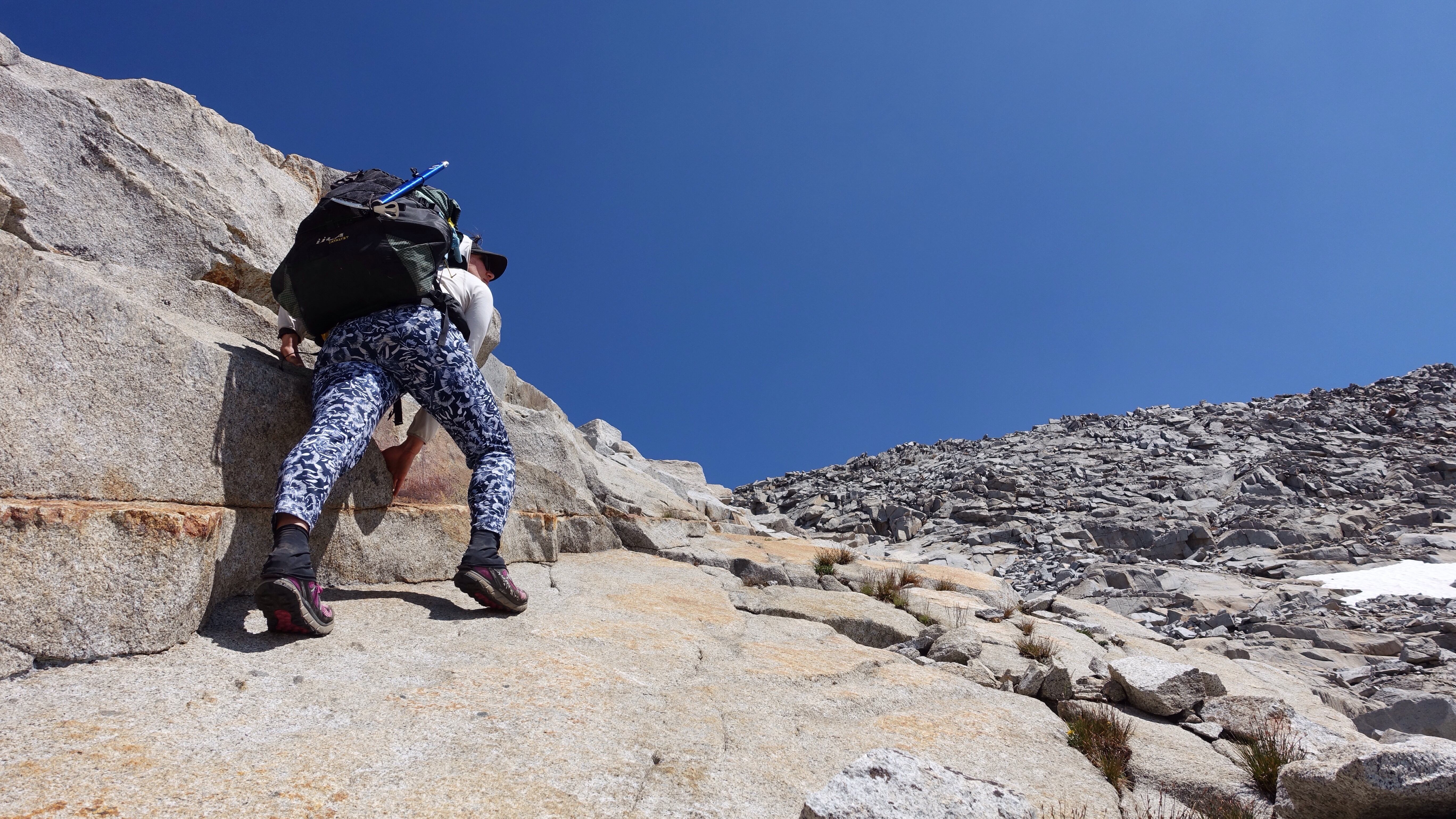
    Climbing up slabs just below the pass.

    I sat up at the top for a while, comparing the view to my maps. It is important to reconcile as much as possible the real world ahead with the abstract representations of the world that I carry, in the form of maps and words and data. Though I have a gps on my phone if I need it, I’ve so far been able to navigate almost entirely using the maps. I haven’t even needed my compass yet. There is something elegant in the simple translation of concept (the route) to abstract representation (the map) to concrete application (taking my body through the landscape, and all that entails). Also, this mountain range is so gentle feeling, easy to navigate, hospitable. So far anyway. No doubt I’ll eat those words later. But for the time being, I’m in a relaxed exchange between mountains and information.

    The descent from the pass was complicated by the fact that there was often snow where I wanted to be. I had to find other ways, other ramps and rock noses, other fissures and flaws and breaks to squirrel my way down. After a time of this fitting of myself to the realities of the terrain, I arrived at the shores of aptly named Blue Lake, a startlingly blue body of water held between rock walls. I passed a grassy shore with a perfectly placed rock jutting into the water, and as it was only 4:30 and I didn’t have much farther to go today before stopping to camp, I decided to swim, and also rinse my pants, which are becoming stiff enough with salt that soon they will stand on their own. I stripped off everything and was about to put my pants in the water first when I heard voices. Human voices carry in the mountains like no other sound, and though they were hidden behind some rocks up the hillside, it was unmistakable. I looked up just as a head in a big hat appeared. Standing naked on the rock, I waved. A man waved back, yelled sorry! And disappeared again. How is it that I’m miles from a trail, in a difficult-to-reach mountain basin, and the minute I am naked is the minute other people appear? I don’t care–bodies are bodies are bodies–but I recognize it makes others uncomfortable. In any case, I dove in the water. It was exhilarating. It was freezing. I immediately scrambled out, toweled off, and dressed in my still-stiff pants, whose rinse would have to come another day. Shortly after, the man poked his head out from the rock on the hillside. I didn’t see anything he called across the stone-studded grass hill. It’s alright I yelled back. We had a nice conversation, shouting back and forth from our respective encampments. He and his friend are also hiking the Sierra High Route, a section of it anyway, but in the direction most people hike it (and the direction the guidebook is written): south to north. We traded beta, small bits though, neither of us wanting to have too much illuminated lest it compromise the surprises of the route.

    I dropped a little over a mile down Bench Canyon next to a cheery creek and among vibrant green meadows, and made camp near where I’ll climb out of the canyon in the morning and begin heading for Glacier Pass on the shoulder of Mt Ritter.

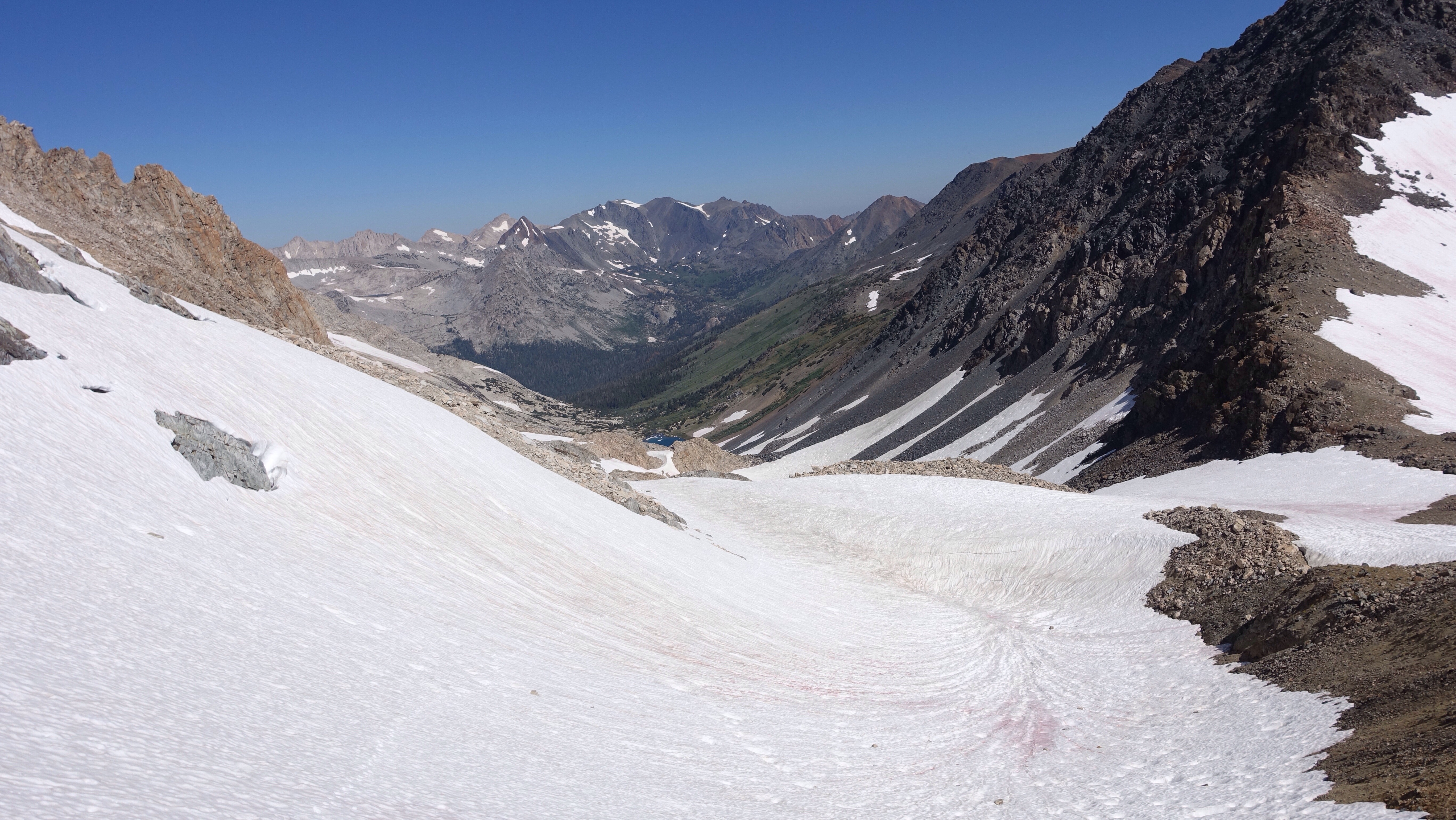
    Blue Lake Pass from near Blue Lake, after the descent. Blue Lake Pass is the subtle U-shaped notch in the ridge on the right before the ridge line climbs dramatically.
    Flowers in Bench Canyon.
    Near my camp at the end of my descent down Bench Canyon.


    I’m learning some things that I thought I would share, important lessons and facts about the conditions (and conditions are hugely influential in the work we do, of any kind, be it cubicle or math or teaching or dance or hiking). To wit:

    • There are a lot of healthy, happy mosquitoes right now. I have many bites, especially on my scalp under my hair. Those head bites react differently than other places, developing crusts that remind me of the spots my goat Sid would get all over during spring and summer. I always thought he developed a strange seasonal rash. Maybe he had mosquito bites all that time and I never knew.
    • There is a lot more snow than is typical for August in the Sierra, and the pattern of where it is lingering seems somewhat different than June or early July snow patterns (from what I’ve read and from talking to locals). It is making some parts of my route more challenging, such as when it covers stretches of very steep talus, and other parts easier, such as when it covers long stretches of not-too-steep talus. I have used my micro spikes every day, and critically my ice axe once when it saved me from grave injury.
    • Did you know that high altitude causes increased flatulence? True fact! It is known in medicine as High Altitude Flatulent Expulsion, or HAFE. There aren’t many effective cures. Hike alone.
    • Nights have been cold enough to interrupt my sleep, but I think that is more about me, since it’s not dipping much below freezing.
    • Speaking of interrupted sleep, my ground pad has a leak and I must reinflate it once or twice per night. I can’t find the leak. This small act of reinflation is becoming part of my regular rhythm.
    • Much of the water I’m drinking comes directly from melted snow. It tastes of a metallic sky: slightly sweet, sharp, and very clear.
    • Route-finding is often deeply satisfying and occasionally worrisome. I’ve decided that above all on this trip, I don’t want to be in hurry. Which means a half day spent going the wrong direction is still a half day lived well, deep, and full. (That hasn’t happened yet, but I’m staying I’m open to the possibility).
    • I have yet to acclimate to the altitude: ascending anything is curiously exhausting. I stop often to pant, rest, groan, before continuing up.
    • Speaking of up, the climbs on this route so far are rarely more than fifteen hundred sustained feet at a go, though those are often steep steep feet.
    • Leave those crusty boogers in your nose where they belong, even though they feel like small boulders. No good will come of removing them.
  • Day 3: people

    Day 3: people

    Polished and hard morning snow.

    Morning, rise to the sound of scuffling in camp, scare the mystery away, meditate, pack, and climb upward through alternating broken red shale and patches of snow, slick and hard and glossy from the cold night before. My micro spikes are working hard, and I don’t slip, even when the traverses are steep.

    Shortly I cross Mine Shaft Pass and enter Yosemite National Park, then descend more broken red rock and shiny snow to the Great Sierra Mine, active in the late 1800s. A few rusted machine parts, a falling-down stone house, and a terrifying hole in the ground are all that remain. My feet throbbed to be near the mine, that horrible hole. Timmy fell down the well kept running through my mind as I stood back from the edge and leaned over to see into the black pit. I picked up a rock and threw it in, thinking I would hear it clatter down for an eternity, like the hole was the entrance to the Mines of Moria (Lord of the Rings). But it splashed into water, and I was both more horrified and also perplexed: how did the miners in the 1800s, without pumps (true?), keep the water out of their horrible holes?

    The mine pit water hole.

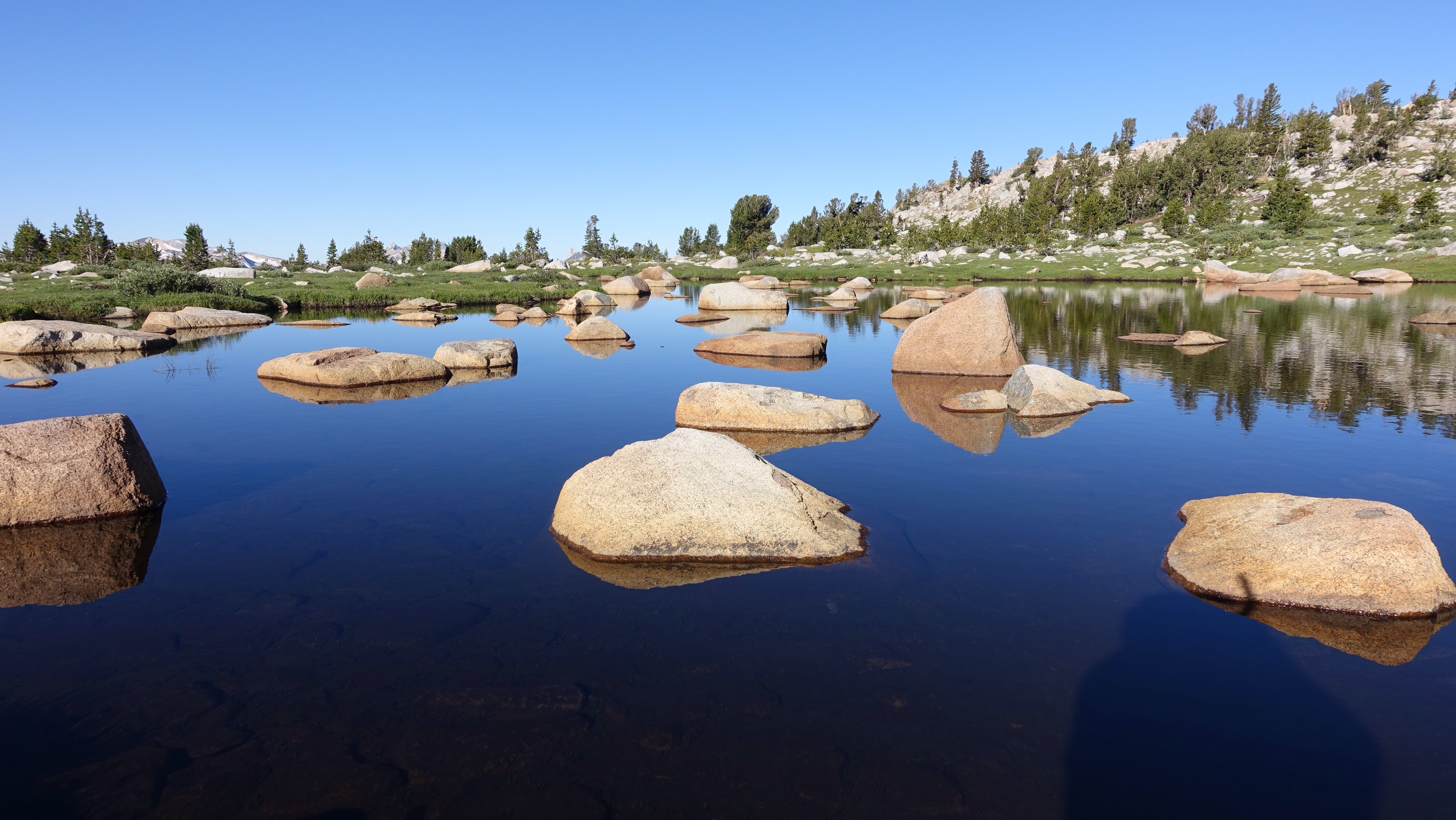
    Still pond on the way to Tuolumne Meadows.
    Traipsing through the land of green meadows, purple flowers, and gleaming white rocks.

    From the visceral ache of the Great Sierra Mine pit, it was a galumphing downhill through meadows, past lakes and ample mosquitoes to swat, and eventually a trail which took me to Tioga Road, the only road that crosses the mountains east to west in Yosemite National Park, and the only one that crosses the mountains that I’ll encounter on this entire trip. The particular music of cars breaking wind, of tires spinning on asphalt, filled the air as I darted across, feeling like a bit more like wildlife at that moment trying not to end up flattened on a ribbon of pavement, sandwiched between dense stands of Lodgepole pines. Right after, I had a quick river ford (knee deep but easy enough to do barefoot and keep my shoes dry) and then some more easy trail to Tuolumne Meadows Lodge, a kind of commercial encampment just off the highway. They have guest lodging in these little white cabin-tents, and people! Lots of people, needless to say. The man inside the lodge store let me charge some electronics and while I waited I used the sink in the bathrooms to wash my face, I ate an ice cream sandwich, I called Dan (beloved husband) on the pay phonem I ate a second ice cream sandwich. The brief stop there was functional and productive, if not exactly restful. As soon as my things were charged, I left, joining the Pacific Crest Trail/John Muir Trail briefly south among many more people before turning off on another trail.

    Pay phone booth is on viewer’s left, in case you were wondering.


    The amount of navigation paper I get to throw away after just 2.5 days.

    I hiked the PCT in 2005, and I don’t remember stopping at Tuolumne Lodge back then (so much of that hike has receded into the unstructured fog of memory), though I’m sure I would have certainly resupplied there. Over these last couple days, my thoughts are often returning to that hike and time, in part because I’m back in the same mountains as then, albeit on a very different kind of hike. I am a different person, an accumulation of many more stories collected over twelve years. Maybe the mountains are different too. Twelve years is a long time and not a long time at all. Time has no fixed meaning. We all just endure its slippery shifts as we change perspective.

    Speaking of changing perspective, I will say that a marked difference between then and now is that I don’t recall having so many pains in 2005. My feet, my ankles, my hips, my neck, all achy or angry or sad or something. I’ve been managing a set of recurring sprains for the last year in my right ankle, and they jammed up while hiking on the trail to Tuolumne Meadows. I must pay very close and precise attention to each footfall on talus and rock cross country, and of course it is the sleepiness of trail hiking that causes me trouble. I suppose this is not particularly surprising.

    After Tuolumne Meadows, I was facing many miles of trail, a compromise the route has to make to get around a series of mountains whose dramatic ridges require more technical tools than the typical scrambler has at their disposal. Miles of trail climbed up to Tuolumne Pass, where I  encountered yet many more backpackers out to enjoy the park. Before long I arrived at the jarring sight of Vogelsang High Sierra Camp, one of a network of hut-to-hut hiking stops where guests are fed, and some are even packed in on mules. But because the Sierras received so much snow this year, none of the High Sierra Camps will be opened at all. Framing laid on the ground, windows were boarded up. The place looked abandoned and trashy, an incongruence in this beautiful landscape. I climbed miles of trail further still, past more people and past Vogelsang Lake, nestled into a cirque below Vogelsang peak, miles of trail up and over Vogelsang pass (names come in clusters), and then dropped miles of trail down past timber line into a pleasant Lodgepole forest along Lewis Creek. I’ve been on trail for almost the entire day, since a little before Tuolumne Meadows, and already I’m hungry for the unknowns and dynamism of cross-country travel.

    Beefy constructed trail heading gently up to Tuolumne Pass.

    As I made my dinner and watched night creep up between the trees and listened to the chattering small creek nearby and the hiss of my simmering pot, I passed a small stone from one bare foot to other using my toes. I’m trying to proactively rehab my feet on this trip, keep them strong and healthy. They are such tiny pieces of real estate, to handle so much. The major bone of the heel is called the talus, and as I hop from rock to rock across talus fields, at same time the enormously complex landscape of the ankle talus is sensing, navigating, adapting. Talus on talus. Dynamic structure on textured land.

    Putting on my backpack. It happens many times every day, so sometimes you gotta change it up.

  • Day 2: ohmyiamsotired

    Day 2: ohmyiamsotired

    I woke up before my six am alarm, and dozed in the gathering light for a while, wiggling my toes and ankles, feeling the efforts of yesterday. Eventually I rose and meditated in my tent. The only way I can sit upright in my very small and utilitarian tent is to sit with my nose almost touching the single support pole in the center, and even then my head pushes against the fabric. The image of the sitting form of the meditator encapsulated in a small plastic bubble gave a quality of mirth to the practice this morning. At home I sustain my practice fairly well, but I’ve never tried to bring it along into the wilderness with me before. So much of a hike feels like a meditation anyway, but it’s the beginning and I feel hopeful about establishing habits.

    After a short twenty minute sit, I crawled out the door into the morning. Behind me, from where I had just come yesterday, the sun was only barely a glow on the top of Gray Butte, a conic granite outcrop next to Soldier Lake. I packed as quickly as I could, given that I don’t have a rhythm established for this trip yet, so there was hemming and hawing about where everything should go. Compass in the shoulder strap pocket or the hip belt pocket? Snacks for eating while walking all together in one place or distributed among multiple pockets? How balanced is the bag? These first days are all about establishing habits, after all. Still, before too long, everything was strapped down and I was climbing up the south side of Virginia Canyon, through its lovely long green grasses and purple lupines.

    My morning was spent on a laborious climb up a rocky tributary canyon, at whose head lay Sky Pilot Col (11650 ft). I had to get there, get over it, and drop down the other side. I had heard rumors of Sky Pilot Col, that it was hard or terrifying or tedious or no big deal, depending on the source. As I dropped from Soldier Lake down the steep, granite-clad wall of Virginia Canyon last night, I had ample time to study the long approach to the Col, including an alarming-looking steep wall of snow at the top. In all the murmuring about this pass, no one had mentioned ascending the last section on snow. Last night I debated whether I should simply take an alternate route and avoid climbing the 2400 feet up there, assuming that if the head wall were made of snow, I wouldn’t be able to ascend it. But in life, and in the wilderness, one shouldn’t make assumptions, or at least not sometimes, and I have the resources and the time to make long approaches and failed attempts. To waste time, in the most delicious way, of suspending disbelief and going onward to find out. To not let the mind decide but rather to let the truth emerge as stars at twilight, one bright pinprick of information at a time.

    Meadows below Shepard Lake

    The approach was soft, willow-filled meadow for a while, gentle and graced by a lively stream cascading down. I walked among the trees, then between the willows, then climbed away from the stream where the willows became greedy and wanted all the spaces for themselves. I acquiesced, and continued above the stream on granite slabs. After a time I came to its source, a lake on a high bench in the canyon. Shepard Lake, where large icebergs were moiling about in the water, turquoise under the surface and white above. After the lake, the terrain jumped suddenly from meadow to rock and ice, and the rest of the ascent alternated between steep talus fields and steep snowfields. In turn, I was constantly shifting between my various tools: microspikes on for the snow, off for the talus. Trekking poles out for the snow and steep scree or sand, away for when I needed my hands to maneuver among larger talus blocks. There are many coexisting cadences: of the body in motion, and of the tools, both adapting to the matter-of-factness of the landscape.

    Shepard Lake and the way up to Sky Pilot Col


    Tools for the climb. The amount of snow on the approach is poorly represented by this picture.

    Eventually I arrived near the top, at the steep snow wall I had thought was the headwall, but in fact the canyon sneakily turned there and rose another few hundred feet to the Col. I was able to pass the snow by scrambling up a steep outcropping of rock, and when I saw the actual headwall, Sky Pilot Col itself, my first thought was “eh”. As in, “looks like no big deal.” As in, “hooray”. Snow led almost to the top, and it was steep, but I slowly kicked steps, resting every tenth as I counted them under my labored breath, and made it to the top without trouble.

    Take note, self: Don’t make assumptions.

    Looking back towards Virginia Canyon from Sky Pilot Col.


    Looking south from Sky Pilot Pilot Col, my direction of travel. The first major ridge in the distance is Mt Conness’ East Ridge. The patch of snow right in the foreground is the flat top of the steep snow wall I slid partway down before arresting my fall.

    On the south side, I expected to see a steep scree field I could slide down, but instead there was a blanket of snow that nearly hung free off the edge of the pass. I had my ice axe in hand, and began descending carefully, hoping I would be able to use the snow softened by the sun to control my descent. Turns out, NO.

    I took a fall only a few feet from the top and quickly began accelerating down the slope, which ended fifty vertical feet below me in a jumble of rocks. Self-arrest! Self-arrest! That’s the term among climbers for stopping precisely such a slide using an ice axe, and I was able to stop myself after sliding about ten feet, though the snow was incredibly soft and slippery and I struggled to arrest the fall. Harder snow would have been easier. As long as it’s not a solid ice sheet, snow with a crust holds the pick of the ice axe. This sun-softened snow was treacherous stuff. Every place has its own rhyme: the quality of the snow, the places it tends to gather, the typical pitch of the slopes, the time of day the snow is more or less manageable. I’m learning, slipping into the rhyme of these mountains, and so far it seems the snow is easiest to traverse in the morning, when it’s icy and hard, with micro spikes on.

    After the arrest I gingerly slid my way across the slope, sprawled out like a snow angel to gain as much contact against the snow as possible. Slipping a few times but managing to avoid repeating a  proper fall, I made it to a steep talus field on the shoulder the slope, hemmed in by a granite wall, after a few tense minutes. The descent from there was slow, painstaking, a mix of rock and sliding on my butt in the snow between rocks like islands in a sea. Down down down steep down, feeling the work of gravity on the body. Feeling it by resisting. Resisting makes one tired.

    I dropped into a beautiful, snowy basin of many lakes, climbed the curving spur arm off Mt Conness’ east ridge (the curve of this long spur was oddly touching, cradling a small lake at the bottom the way a mother curls her arm around a baby), descending into another beautiful snowy basin of many more lakes. And, in this second basin, many hungry hungry mosquitoes. I wished desperately to flee them, but by that late afternoon hour, I was so tired I couldn’t take but a single step uphill without having to stop and gasp for air. Downhill and flat terrain feel great: I’m energized and bouncy (unless I’m in a carefully controlled steep descent, in a heated discussion with gravity). But uphill is singularly difficult. Waiting for acclimation. Waiting for easy breathing.

    At the top of the crossing of Mt Coness’ East Ridge.

    Achingly slow, I climbed away from the lakes and their clouds of mosquitoes, and now I’m camped on the side of a mountain, a stalwart member of the ridge I’ll cross tomorrow morning heading southwest. One of many many mountains on whose sides I’ll be sleeping in the coming weeks. The sun has just descended behind this mountain and pulled its warm light behind it. The surrounding snowfields are starting to ooze a chill across the meadows. It’s just me and the mountain now. And the snow. And the determined mosquitoes who followed me.

  • Day 1: trying to figure out what I’m doing

    Day 1: trying to figure out what I’m doing

    I woke up periodically through the night to the sound of the honky-tonk bar across the street. Finally I put in earplugs but then I was cold or uncomfortable or just awake for no reason. I tried to sleep in past the brightening dawn but felt I was fighting for those last few minutes. Exasperated and finally rising and packing, I headed off to get my permit from the ranger station. I got there about 20 minutes after they opened at 8am, and when I tried to change my permit to start a day earlier (mine is for beginning on the 10th but since I’m here and ready, why not begin), they said the quota was already full for the day, all filled up that very morning! Most of the trailheads in this complex of parks and national forests that contain the Sierra Nevada operate on a quota system to limit the number of people entering the wilderness each day, and even then there are astonishing numbers of hikers out there. Wilderness use is skyrocketing, growing year over year in most jurisdictions, almost as though we all know there is something important we are beginning to miss in modernity.

    View of the Sierra Nevada range from Owens Valley, to the east.

    I picked up the permit I had reserved months ago, without changes, and hitched back through Bridgeport and then up Twin Lakes Road to its end at Annette’s Mono Village, a camping zoo packed wall to wall with RVs. I was eager to get out of there quickly–it would have been a limp start to the trip to linger among the tin can campers–and decided to start hiking up Horse Creek trail, even without the right permit, because I knew I would shortly be leaving the trail and disappearing into the rarely visited alpine regions in this part of the range.

    The humble beginning

    I passed many day hikers as I climbed who were hiking up to the pretty Horse Creek Falls. Eventually there were fewer people, and then none at all, and then the trail itself disappeared too, the start of many miles over the next two months of trailless navigation. Gleeful for the many beginnings of this day, I made my way up to Horse Creek Pass on patches of snow and talus fields, climbing slowly and laboriously. My pack is heavy. I’m not acclimated. I haven’t trained as much in the last month as I would have liked to. I am confronting my slow body, my resting body, as I make the long climbs up to passes.

    Hiking up Horse Creek


    Horse Creek Pass under a blanket of snow.


    Flowers on Horse Creek Pass.


    Looking south into Spiller Canyon from Horse Creek Pass. I’m heading east out of this canyon, crossing the ridge seen left in the picture.

    The Sierra High Route, which I’m hiking on now and for the next couple weeks, follows a particular pattern: ascend valleys and meadows to a pass that allows for crossing a substantial ridge line, and then descend for a little while before repeating. Remember this, because I will often be talking about my struggles and joys with these climbs, these descents. In some way, it strikes me as a tango, the mountains leading and me following with the greatest sensitivity I can offer day upon day upon day. Today I crossed two such passes, dragging my slow and tired body up a few steps, stop to rest, up a few steps, stop to rest. Horse Creek pass eventually laid beneath my feet. I stopped to celebrate my first pass of the trip.


    From there, dropping down beautiful green meadows blooming with wild flowers, I got my first taste of smoke from fires in the area. The smoke may be a constant companion over the next weeks, as fires burn the flanks of the mountains. The views are therefore hazy, but still, I could see massive granite peaks rising above the sides of the valley. After a pleasant descent I left the valley floor and began a long and also tiring ascent to Stanton Pass. Stanton Pass is supposed to be technical class 3 scrambling, and I was worried that there would be snow further complicating the ascent. Scrambling is a bit like climbing–I am using my hands to pull myself up, balancing on small footholds, and coordinating supports between all four limbs to move upward. With snow on the rock, it would be dangerous and perhaps impossible. I was relieved when I finally crested a hump a few hundred feet below the pass and I could see the rock cliffs just below the pass were bare and dry. As I climbed the talus field below the cliffs, I considered my line, the route I would take upward. I looked up in study so intently on the approach that hours later my neck hurts. Nonetheless the pass was easy enough, and I enjoyed the rhythm of climbing with my whole body, feeling my pack weight me backwards and my hands pull me forwards. Before getting to the cliffs I took two falls, and on one of them I smacked my wrist hard on a rock. A bruise marks the spot, like a smear of lipstick left behind after a kiss. I was distracted, looking upward not downward. Both require attention, the long-range view of where to go when and the short-range view of the angles and surfaces of complex ground under foot.

    Class 3 scramble over Stanton Pass.
    The top of Stanton Pass, looking southeast.

    The rest was downhill dancing, stepping lightly and precisely on talus blocks, navigating a series of ledges interspersed with short granite cliffs and patches of white bark pine, the occasional snow patch. Eventually I passed a remote alpine lake, and then dropped like a slow-tumbling stone fourteen hundred feet to the bottom of Virginia Canyon, not too far below its headwall. Rock and meadow gave way to pine forest and thick green grass. I stopped down here, among the grass and the flowers, to camp, startling a dappled fawn from a nest of grass as I was looking for a flat place. It’s the lowest camping option I have, and I’m trying to ‘climb high, sleep low’, at least for the first few days while I acclimate. My highest point today was 11000 feet, at Stanton Pass, and I’m now tucked in to a cozy 9200 feet.

    I feel like I’m getting my sea legs. Except instead of a sea of water, it’s a sea of rock, sky, snow, and meadows. And of climbing forever, and then descending forever, all the while balancing on exacting, unstable rocks.


    What a cool rock!


  • Precedent Day

    Nothing much has happened. I left for the airport in the early morning hours, after feeding my goat and watering the garden, noting as I did each that I wouldn't again for some time and feeling as though I ought to bring a special kind of attention to my chores, to appropriately mark a goodbye. And noting that I didn't know how to do that. It is the confusion of saying goodbye. Perhaps there is nothing to do but simply say it.

    My day consisted of many small steps towards a beginning, a pre-beginning: the trivial indignities of air travel; a long wait among the flashing lights of gambling kiosks in the Reno airport; a sleepy bus ride down the eastern flank of the northern part of the Sierras. The eastern side is the dry desert side, sheltered under the rain shadow of the mountains, and sage brush and cattle blurred by out the bus windows. I got off in Bridgeport, a small town with a frontier look, just minutes too late to pick up my permit from the ranger station here that I need to begin my hike. So I'll stay overnight in town, have a burger, and take this extra time to begin acclimating to elevation. I'm at 6500 feet now, from 0 feet in Seattle, and an extra night at mid elevation in the front country can only be a boon. On the first day of hiking I'll surpass 11,000 feet, and the possibility of altitude sickness lurks in such dramatic changes of elevation. Us sea-level dwellers are oxygen hungry.

    From this flat, desert-dwelling town, the Sierras rise dramatically to the east. They are close enough that I can see ridge lines, valleys, contours, and lots and lots of snow. The Sierra Nevada had a near record amount of precipitation last winter, and the fact of snow has been deeply on my mind. To be honest, I'm not sure the routes I hope to take will be passable. I won't know until I'm trying of course, and that illustrates one of the fantastic humblings on a trip like this: going forward even when we don't know. How do we respond when we don't know. How do we marshal our courage.

    Early tomorrow morning I'll go for my permit and then hitchhike to the trailhead, up Twin Lakes Road to the Horse Creek Trail, the footpath on which I begin this curious expedition. With some luck I'll spend tomorrow tonight up up up in the mountains. I am eager to begin, and a little trepidatious, and also hot and restless and overfull on French fries. My backpack is ready. My body is willing. Gonna get to it.