Category: Kings Canyon High Basin Route

  • Day 39: end/out/finish

    After a lovely warmer, drier night (my bid to sleep at a lower elevation paid off), I walked down the last few thousand feet, the last handful of miles, to the trailhead at Road’s End. Descending into Kings Canyon in the morning was beautiful as it was steadily illuminated in the strengthening morning sun. It’s a classic Sierra valley, u-shaped and flanked by steep granite walls, carved out of the earth by a glacier some 12000 years ago. And now here I was, a little wee atom moving slowly down its side, all these eons later.

    As I descended, at around 6000 feet I picked up a hearty cadre of face flies–so glad to know I would get one more chance to hang with them before ending, and I finished to the fanfare of their irritating whine in my ears and whipping them away from my face.

    I was walking toward the road, thinking I would start the walk in to Cedar Grove, six miles west, because it was early and it didn’t seem like a hitch would be forthcoming, when I ran into a pair of other hikers who were sitting by the side of the road waiting to hitch. We stopped to chat and as we were a talking a car drove by and stopped to pick all three of us up. (It was guy who had just started a long, twelve day trip into the wilderness but came out almost instantly to go buy a headnet because the face flies were so bothersome.)

    In Cedar Grove, I had a shower, did a load of laundry, and have eaten their snack bar meals for most of the day. Tomorrow I’ll catch a ride a couple hours west to Fresno and fly home–I’ll be landing in Seattle around 8:30p. Back home.

    Descending into Kings Canyon

    The end

  • Day 38: last full day, still slow

    Last night dropped below freezing, and was the coldest night of the trip. In fact yesterday and today the daytime temperatures feel like they’ve dropped meaningfully too. I woke up off and on throughout the night, aware that my sleeping bag was getting progressively wetter with condensation, and trying to find positions that allowed me to stay warm. When I packed up the tent this morning around 6:30, long before the sun crested the valley wall to the east, my tent was caked in frosty ice, inside and out.

    I had two passes on my route today: Goat Crest Saddle and Grouse Lake Pass, within a mile of one another and both straightforward and relatively quick. I wanted to spend one more night in the wilderness before emerging in the semi-civilization of Cedar Grove tomorrow, a major hub of campgrounds and concessions in Kings Canyon National Park, and six miles down the road from my terminus at Road’s End. Don’t get me wrong: I’m excited to take a shower, launder my clothes, and eat (I did end up being a bit light on food in this section and have been increasingly hungry) but I’m already likely spending tomorrow night there before hitching to Fresno on Sunday, and two nights seems unnecessary. I wanted one more sweet night in the backcountry before the end. I was easily a half day’s hike away from the end when I woke up this morning, and needed to go slow again.

    Lake below Goat Crest Pass, the deep dip in the middle of the ridge

    There was a lot of the waiting, sitting, pausing of yesterday. But I also decided to climb Goat Mountain, a modest-looking peak just over 12000 feet near Grouse Lake Pass. I easily spent a few hours on it, most of that time sitting on the top marveling at the view: I could see much of the land I’ve been through, if not in the entire last 38 days, at least the last 25 or so. I could see peaks I’ve come to know by contouring in and around their ridges and basins. Passes I remember crossing (including King Col). I could see the long, rust-colored drainage of Goddard Canyon and the mountains bordering Ionian Basin. The Palisades were there too, just barely shielding Mt Sill from view. I could just make out the ridge of Baxter Peak. Deep canyons in whose bottoms I forded their rollicking rivers. It was a fitting last big endeavor of the hike, to sit up there for an hour and a half and look over so much of my life in the last month, detailed in the crumpled and folded mountain landscape.

    Panorama looking east from Goat Mountain. I walked through most of this.

    Standing on Goat Mountain

    I descended to Grouse Lake and lounged on some warm rocks by the shore for another hour. If it were warmer, I would have swam, but the air nipped at the skin all day. Even in the sun I donned my hat and down jacket, listening to the birds and watching expressive clouds reach wispy tendrils towards one another, like fingers intertwining. Finally I moved on from there too, picking up a use trail and then Copper Creek Trail, a well-used and well-graded footpath that would descend over five thousand feet out of the mountains to Road’s End. I only traveled a couple miles down before stopping at an odd little collection of tent sites next to a small brook, each site a little depression scratched out of a steep hillside. It was early, 4:30. I read, made some warm dinner, and will turn in early. Tomorrow morning I’m out!

    Descending towards Grouse Lake

    Looking back up towards Goat Mountain from Grouse Lake. It’s the one on the right.

    Last camp

    A new way to put my pack on. Sort of.

  • Day 37: practicing slow

    The first thing of the day was a long climb, 4500 feet or so, away from the Middle Fork and back up into to timberline country so that I could cross the Monarch Divide, a major ridge of mountains between the Middle Fork Canyon and Kings Canyon where I end. There was no water for 8 miles, and in case it was a hot day I wanted to start early so I could do at least some of it in the beneficent shade. I was beginning the climb just as the morning made that clear change from dawn light to day light, even if the sun was long over ridges to the east. The climb was mostly light forest, with some open patches of manzanita that reminded me to marvel at the generosity of a trail. It was a steady climb and I made good progress, appreciating the ease of it, even though the footbed was pulverized to powder by stock (last night, I often heard the clattering cow bell hanging off the neck of a horse set loose to graze in Simpsons Meadow). I wasn’t in any particular hurry today. In fact, the opposite was true: I was trying not to get too far.

    Morning over the Middle Fork

    Looking at Goddard Creek from across the Middle Fork Canyon (it’s the left channel)

    By noon I had arrived at Upper State Lake, the first water since the small creek beside last night’s camp. I tried to take a long lunch there, envisioning perhaps a swim, resting in the sun on the warm glacier-polished granite slabs, stretching, napping. But the day turned out to be quite brisk, and by noon heavy clouds blotted out the sun for long durations before it would peek in again. It was a little too cold to linger for much more than an hour, but despite the chill it was a lovely lunch break. I walked slowly from there, down hill for a bit on a trail, before turning away from the trail into my last stretch of cross country. Whenever I had even the slightest impulse to, I would stop somewhere, sit on a log or a rock, and simply be there feeling the air and the sound of that place. After twenty minutes or so, I’d pick up and move on, and in this manner I went from rock to rock, place to place, slowly making forward progress. I heard flocks of birds in complex conversation; watched a hawk soar high above a canyon; listened to the wind hum as it passes over trees and then great rock escarpments.

    After following a stream up a valley for a time and then scrambling up a two hundred foot head wall, deliberately choosing a route that involved more climbing than walking, I arrived at Lake 10429, where I planned to camp, by 3pm. I tell you, practicing slow is hard for me. I spent the next two hours sitting at the lake as I had sat at various rocks and logs on the way today. I watched the water sparkle with such distinct flashes in the sunlight it was like watching the deaths of hundreds of stars. I listened to the harmonies between distant cascades and the wind in the pine boughs. I felt the sun. I felt the shade when the sun went away. It was an emptying kind of day. While I was certain it would rain, by four all the heavy clouds had blown away without a drop, leaving a crisp blue sky and sun glowing on grass that has become crisp and golden now that fall is here.

    Glacier Valley

    My route up the headwall

    Watching the lake

    I ate dinner around five, delighting as I do every night in the steadily dwindling contents of my bear can. Only one dinner remains. Shocking.

    Now that the sun has dropped behind the ridge west of the lake, I can feel how quickly the cold comes on. It will likely be a chilly night, and probably my last above timberline.

    I was asked what is happening inside my head as I walk, and I wanted to briefly answer that here. It is probably similar to the usual cacophony we all have in our heads, but I have very little out here to distract me from being acutely aware of it. There are lines of thought, fragmented and messy but usually headed towards a coherence that I can make sense of later. These thoughts are often interspersed among pieces of song running through my head. Random ones will just appear and then accompany me for a while, and I used to wonder where they would come from. Sometimes it’s an obvious phrase or play on words that inspires the song, but many times I think it’s derived from the rhythm of my footsteps. Apparently we are incredibly sensitive to tempo, a fact that has made CPR training more memorable by using the Beegee’s Staying Alive to help people administer chest compressions with the correct timing–counting out the time is hard for people, but everyone can almost precisely nail the tempo of a song they know. So my feet make a rhythm and my mind knows a song at that tempo, and then that song is with me, at least until I change speeds. Ultimately, with the chatter of ones own mind for companionship, it is hard to imagine how we ever get lonely, until we realize that perhaps loneliness is an expression of the desire for something else besides ourselves. Yesterday I spoke to no one, and only saw the horse packers, whose jingling horse I heard wandering in the night, from a distance. The day before I saw some folks in the morning but not again. Today I encountered someone early in the morning on the climb away from the Middle Fork but not otherwise. I’ve had a lot of time with myself out here (or perhaps I should say ‘selves’ in honor of our multitudes), and I will be happy to start spending some time with others again soon.

    Trying out a new way of putting my pack on

  • Day 36: bushwhacked

    It rained enough last night that again I woke up to a very wet tent and a very damp sleeping bag. Still, I rolled everything up tight and was hiking away from my little camp at 10,200 ft by 6:45. It’s only just light then, still a faded gray cast over every rock and tree and blade of grass. It was a cold morning, and wet condensation and rain clung to all the flora from the night before. Whenever I had to pass through bushes or long grass, my pants and shoes would get soaked in icy water.

    Broken granite slab

    Lake 9797

    After a couple gentle miles of winding through granite slabs and small meadows, I reached Lake 9797 (lakes are often named by their elevation) and knew things were about to change. From Lake 9797, my route would follow Goaddard Creek as it dropped three thousand feet in three miles through a narrow canyon to meet Disappearing Creek at their confluence. I had heard bad things: sharp rocks, primarily, but also some tricky route finding. I was imagining trying to traverse the side of a mountain made out of obsidian arrowheads, and was pleasantly surprised by the reality. It was steep, slow, sometimes tedious, and the rocks were both sharper and jumpier than the granite I’m used to. Indeed, sometimes it seemed like the rocks were already moving before I would even step on them. So the footing was slippery and treacherous, but overall it wasn’t a terrible descent. I had been prepared for worse.

    Beginning the steep descent into Goddard Canyon

    Midway down

    A harbinger of things to come

    As I neared the confluence, the terrain became increasingly brushier, marking the transition from the steep-hill-sharp-rocks part of the descent down upper Goddard, to the bushwhack down lower Goddard. Again, I knew it was coming, heard bad things. I took an early lunch at the confluence to mentally and physically prepare, and to lay out my wet things to dry and take advantage of the warm sun bearing down on the canyon. This was another thing I’d heard, that the descent was hot, but in this case I was appreciative. I briefly considered camping there at the confluence, since I have this extra day to use up somewhere, but in case it rained overnight I thought the bushwhack would be substantially more pleasant if it were dry. So once my tent and sleeping bag had dried and aired, and once I had drank some water and eaten my crackers and salami, I reshouldered my pack and headed into it.

    This last part of the descent was a little over three miles, and the terrain changed from brushy creek bed to brushy slope, from thorny bushes to stiff viny bushes to trees. Hikers are encouraged in the route description to link game trails to ease passage, and sometimes this worked so well for me I was blown away by the intelligent engineering of animals, the intelligence evident in the emergence over time of well-laid contouring paths that are easy and pleasant to follow. But they would end abruptly in a gully, or a patch of stiff brush, or where a rock slide crossed the way, or I would just lose track and be on my own again, pinched between gnarled branches that were, to put it mildly, unyielding. The manzanita is some of the worst: it’s hard, unbending limbs are at shin height, and after hours of fighting past it my shins hurt to the bone. (I read once about an old dueling style where men (always men) would don steel-toed boots and kick each other in the shins until one of them couldn’t take it anymore and the other would be declared the winner–I felt a little bit like I was the loser in a long duel with the manzanita).

    For the first two and half hours, I felt rather cheerful despite being thrashed by brush, despite the steady accumulation of a horde of the most despised Face Flies (I ended up having to wear my headnet because they were so bad, and bushwhacking with a headnet on is harder than doing it without). Up to and through a ford of Goddard Creek to its north side near the end of the bushwhack, a ford which I had been warned was challenging but where I ended up doing it was okay–mid thigh deep, swift but not too much–I felt generally positive. It was only the last stretch of some contouring and descending that I had trouble keeping game trails and the manzanita were beginning to shred me a little past my limit of good cheer. Then I grew a little irritated. But the arrow of time is magic: it deposited me three hours after leaving the confluence on a forested flat. I crossed it a little dazed, for I had just completed the last serious obstacle on this journey.

    Variations of brush

    This is a game trail–amazing travel through otherwise impossible brush

    Looking into the Middle Fork Canyon bottom

    Well, I had to ford the Middle Fork of the King River, whose headwaters I had crossed just below Muir Pass yesterday morning, and who now was carrying the flow of many tributaries from around the range. It also is supposed to be a difficult ford. I found a good place just upstream of the confluence with Goddard Creek–crotch deep, swift, and wide–and found the Middle Fork Trail on the other side. That was my moment of relief.

    A little over a mile later, I made camp. Grateful, and a little amused, to be through that strange and adventurous section.

    With that over, I’m feeling the end more clearly, like a clarion call carried on the wind. It is only a little over twenty miles from here to Roads End, my exit, a distance I could do in a single long day. But since I have the time, I’ll stretch it out over two and half days, as long as the weather holds. Speaking of weather, though dark gray clouds gathered in the afternoon, they blew away without so much as a drop. It’s windy down here next to the river, at 6,000 lowly feet, but the sky is almost cloudless. Perhaps tonight will be dry after all.

    About to ford the Middle Fork.

    I am rather bruised after the descent and bushwhack today. My feet, my ankles, my shins–anything that has a bone close to the skin seemed to get bashed at one point or another, either by me falling off something or tripping over something, or just in the steady fight for space that defines a solid bushwhack. My clothes are the dirtiest they’ve been in the last near-forty days. But I feel a sense of lightness, a kind of boyancy, at having all the worrisome or technical parts of the trip behind me. Now the No Big Deal is just a general haze hanging in the air.

    Resting in camp

  • Day 35: getting’ hard

    It stormed off and on all night long. The place I stopped to camp is a heavily used site along the JMT, and to get a little space from all the other tents, I was set up in a marginal site: exposed, thin soil on granite, and a slight depression. So when it began to rain hard, I had dirty backsplash, and water pooling under my tent all night. When you use a down sleeping bag, keeping it dry is one of the critical tasks during a hike, and while the weather is good of course this is straightforward. But if it gets wet, and doesn’t have a chance to dry, it will lose its insulating capacity. I had to make sure I was arranged in my very tiny tent effectively so that it wouldn’t get wet, and then because the humidity was so high, when I woke up everything was wet anyway. I packed up a very wet tent and a damp sleeping bag (and damp everything else) and hiked off into a cloudless morning, my first since probably the beginning days in early August. I was excited by the possibility that perhaps I wouldn’t have the near-daily afternoon or evening storm today. Given the terrain ahead, that would be a miraculous gift of nature.

    First, though, I had a 3000 foot climb up towards Muir Pass over roughly seven miles on the JMT. As the morning wore on under a crystalline blue sky, I wound upward in the tight canyon over granite benches and past small lakes. I passed far fewer people than when I hiked this same stretch of trail in August, and I suppose now that it’s September people are leaving the high country and returning to their lives, and allowing the mountains to return to their own business absent of hosting humans. I did pass one group of Sierra High Route travelers, headed north bound (so going in the same direction I was) and I encouraged them to consider Snow-Tongue Pass after learning they were leaning towards an alternate. No Big Deal, I thought to myself, a theme of my trip: things often sound much worse than they are, and turn out to be easier when we confront them with our bodies in real time rather than with our minds in imagined time.

    Landscape climbing up to Muir Pass

    As I climbed I also took stock of the dramatically different landscape from three weeks ago. The trail had been ravaged by snow and runoff in its higher reaches when I came through before. Now much of it has melted away, and it’s possible to almost never walk on snow most of the way to Helen Lake.

    Helen Lake

    Helen Lake, just below Muir Pass, is where I turned away from the John Muir Trail for the last time, and struck out south cross country towards Black Giant Pass,

    my entry into Ionian Basin and then the long and difficult descent of Goddard Creek.

    Black Giant Pass

    Looking north of Black Giant Pass, to the direction I had come from

    Looking south from Black Giant Pass into Ionian Basin

    Ionian Basin marked a change in the surrounding rock from white granite, presumably the brightness of which is responsible for Muir’s name ‘range of light’, to black and red angular schists. I descended to the first snow-studded lake, slipping on the loose shards of this richly hued rock on the way down. Once on the bank, I took an early lunch. I could see clouds beginning to gather to the southeast, and I wanted to dry out my tent and sleeping bag before the weather turned again. I had a nice time there, in the sun but still quite chilly at 11,800 feet. I didn’t linger long though, because I wanted to be sure I made it through Ionian Basin before camp, down to Lower and less exposed environs. One never knows in advance how slow or difficult the terrain will turn out to be. Better to prepare extra time.

    In this case, the terrain turned out to be both slow and difficult. I would expect even in normal conditions it would be slow to cross this basin of broken rock pieces. There is a fair amount of steep climbing and descending to do, and lakes to pass with complex cliff structures complicating their shores. But the snow was really the main obstacle today. Especially around the lakes, huge and steep snow fields clung between the cliffs. Sometimes it was straightforward to sidehill across, even though the snow was soft and quite slippery. Other times, the snow was too steep, or too marred by great cracks, or went straight down into the lake, or was too undercut, or all of the above, and then I had to find a detour. In one case it particular, I had to go around the lake in the opposite direction and climb up and down through cliff bands on that side in order to avoid a particularly dramatic and difficult snow field. All this time, I felt my soft body a visitor in this land of rock, ice, water.

    (Following are many pictures of Ionian Basin. The landscape was stunning and I had a hard time choosing which to include.)

    It was a slow passage. I thought once or twice about stopping in that dramatic and harsh land, but I decided to press on, recognizing that there would be a storm this afternoon after all and still hoping for a more protected sleeping place. After that last difficult lake navigation, and one more snow-clogged transition beyond a small tarn, I was looking over a dramatically steep descent out of Ionian Basin, around 11,800 ft, down to a large lake at 10200 ft in less than a mile. It was a cliffy affair, lots of zig and zag required to slowly find a connected path down. Meanwhile, thunder clapped overhead and the rain began, my daily friend. It was a tiring descent, occasionally slick as the rain wet the rocks, but I made good time. I was hurried along by the weather; a cliff is an unpleasant place to get stuck in a storm. I crossed a few near-waterfalls that were like arteries for heavy brush, descended a large scree slope, and then I was contouring along just above the lake shore on a game trail. All the snow was confined to Ionian Basin: this lake had trees, meadows, and was blissfully snow free. I went just a bit beyond the lake outlet and made camp in a grove of pines for some protection.

    Looking down at the lake at 10200 feet

    The valley I camped in, containing Goddard Creek

    This is the third night in a row that my camp has terrible mosquitos. Tonight is the worst: thick clouds of them are hovering around my head, my hands, my backpack. Perhaps this is the fall bloom. It rained off and on as thunder storm after thunder storm rolled by overhead, but I was able to set up, cook, and eat mostly in the drier space between the storms. I’m grateful for that.

    Tomorrow I continue the descent along this creek, whose waters started high in Ionian Basin above me (among other places), all gathered into this large lake at 10200 feet before being sent on its way to the low country. I’ll have a couple easy miles first thing tomorrow morning, but after that begins the most difficult roughly seven mile stretch of the whole route. Given that, with the snow, this was one of they more challenging days that I’ve had in awhile, I’m anticipating a long slow day tomorrow.

  • Day 34: turning west

    In my mind, this current high route I’m on (Kings Canyon High Basin Route) can be divided into three distinct sections: the first part navigates a series of high divides between Sequoia and Kings Canyon National Parks; the second part plows north through a series of high lake basins separated by low rivers; and the third part is the turn southward that will eventually end up at Roads End. Today I finished the second part of the route when I dropped down to Palisade Creek and crossed it to pick up the John Muir Trail. But I’m getting ahead of myself.

    Sunrise in Lake Basin

    Because first, I woke up. The nights are getting so long now. It gets dark at 7:30 and doesn’t become day again until 6am. What that means is a lot of sleep, a good ten hours or so every night. Even then, it can be hard to rouse myself, but I didn’t sleep in this morning. The dawn calls me, sucks me from sleep and into the world of the stirring.

    I had a nice jaunt from camp at one of the higher lakes in Lake Basin over to Dumbell Pass, an invigorating yet considerate climb of some 1200 feet on tundra, some talus, and gravel. At the top, I met a patch of snow that was startling slick. When I first started 35 days ago, the morning snow was always very hard, but not sporting a coat of ice on top as though it had been zambonied. A few weeks later, it often wouldn’t even be hard in the morning because temperatures wouldn’t quite get cold enough overnight. Now, these snow patches seems to be melting enough during the day and then freezing overnight to make snow fields become ice sheets. I was startled by how slippery it was, and glad for the first time since Mt Whitney to break out my good old microspikes. They bit right into the icy snow and allowed me to descend what turned out to be a fairly substantial snow patch on the north side of the pass. It was quite steep in places, so even with my microspikes I proceeded with care, but before long I was off the snow and leaping through talus like a gazelle down to the lake

    below. (Ok, not like a gazelle.)

    Looking over the icy snow on Dumbell Pass

    Snow on Dumbbell Pass

    Gazelle-ing down talus

    From the lake, a quick contour and another, shorter climb took me up to Amphitheater Pass. Along the way I casually stepped on a small chute of snow to cross it, forgetting the iciness, and immoderately sprawled out, limbs akimbo, just barely managing to avoid sliding down and away even though it wasn’t that steep.

    Carnage from a slip on the ice. Don’t worry, it’s only watermelon snow exposed by my thrashing about.

    At Amphitheater Pass, again I was greeted by a generous-sized snow field clogging up the descent chute. It was too steep to descend, so I scrambled around the north side of the pass down loose rock and sand, crossed beneath one snow patch and then hopped talus down beside another. It’s nice that there are still places of troublesome snow out here, a testament I suppose to the vigorous winter. Though I thought about sending my ice axe and microspikes home in Independence, I am glad I’ve kept them both, even though I’ve hardly used them in the last ten days or so. Well, I’ve used the axe once a day. It digs a mean cat hole.

    Snow blocking the top of Amphitheater Pass

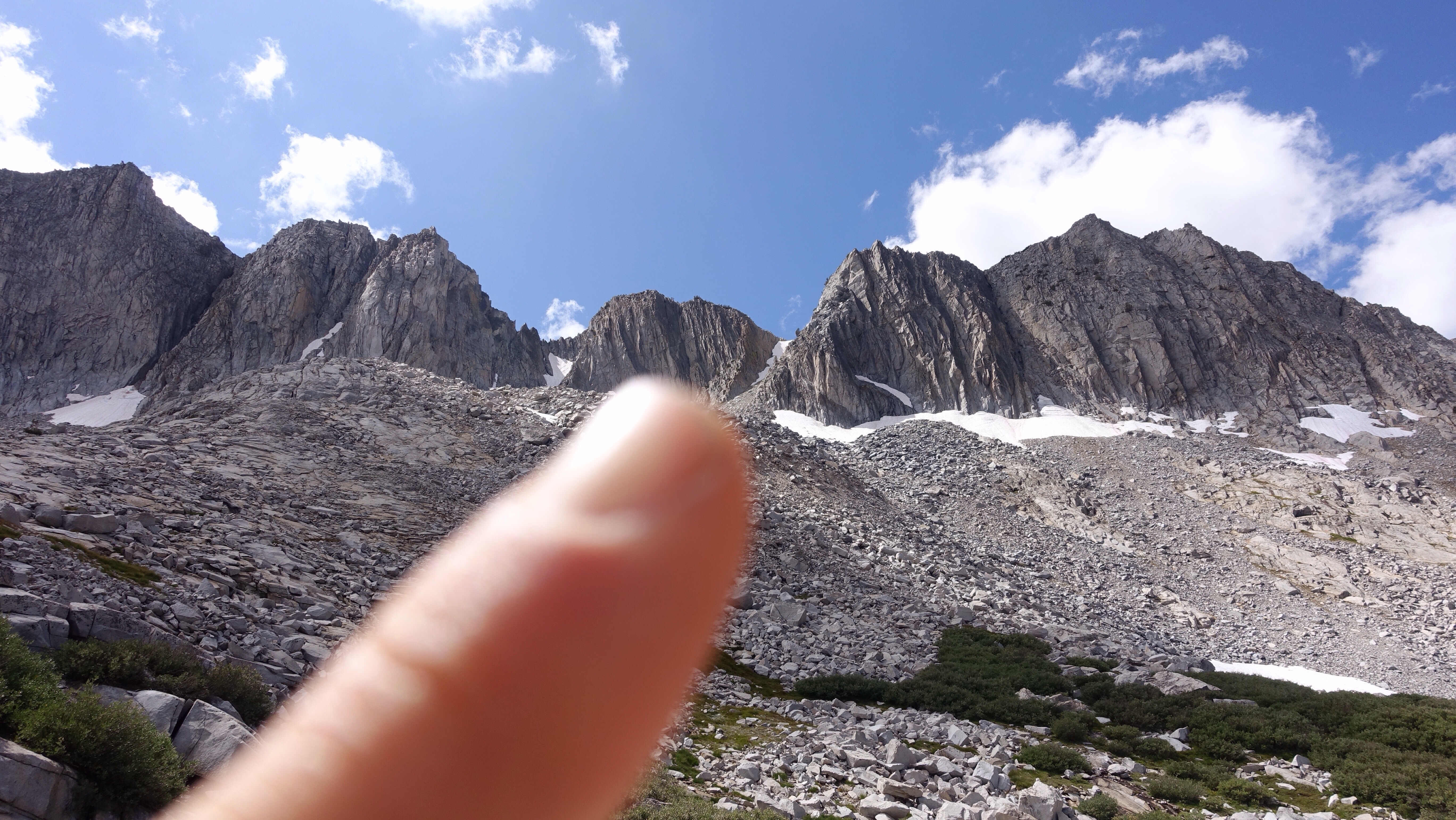
    Amphitheater Pass from partway down the descent. I scrambled down rocks out of view on the right.

    Amphitheater Pass is the triangle of snow in the middle of the ridge line.

    After the snowy pass, I scrambled down a maze of ledges to Amphitheater Lake, and then began the long descent along Cataract Creek which would take me to Palisade Creek. There is something labyrinthine about the ledges-and-slabs kind of terrain because it can be hard to see how one ramp connects to another from above. Rarely does one have to turn around, but at one point I found myself on a little ledge that was hard to back up from, and only a few feet off the ground, so I jumped. One should never jump, and here is why. I sprained my left ankle, only a little bit but a little bit is a lot out here on all this unstable terrain. It bothered me the rest of the day.

    As happens sometimes out here, there was an old trail, long ago abandoned, that once climbed into the Amphitheater Basin, and once I found it I was able to follow it for a while. Or I would lose it and then find it again and then lose it again. This descent was fairly brushy and the trail was helpful, though at the same time the brush tended to be thickest where the faint tread disappeared. Towards the bottom of the descent, five hundred vertical feet above Palisades Creek, I lost it all together and delicately picked my way down the hillside between manzanita and a burned stand of timber. At the bottom, I crossed Palisade Creek where it forked into multiple smaller streams. By crossing on a series of logjams, I didn’t even have to get my feet wet.

    Small spray in Cataract Creek

    The morning started dry and sunny, but just as I was packing up from lunch in the middle of the descent I noticed the clouds blowing over the ridge from the southeast, dark and serious. I waterproofed my bag, pulled out my rain gear, and just then the rain began, with it a series of thunderstorms that lasted all afternoon and evening (as I sit here typing, a rather spectacular event is taking place above me right now, flashes lighting up the sky and instant thunder booming across the mountainsides, rain pummeling at the tent).

    Once I found the John Muir Trail where it runs parallel to the creek, I followed it east for a few miles, then north for a few more, before making camp deep in LeConte Canyon at the junction with the Bishop Pass Trail. I’ve been here before, some 20 days ago. In fact, tomorrow morning I’ll hike again the section of the JMT that I followed down from Muir Pass, when it was ravaged by snow and I encountered that family who was struggling mightily. This time I’ll be going up instead of down, and I expect there will be less snow. Also today, as I was descending Cataract Creek, I looked across the canyon and could see Potluck Pass and Palisades Basin, from many days ago, where I camped before climbing Mt Sill. I’m getting a chance for a little retrospective in these last days as this last route curves back north through, or near, places I’ve traveled before.

    I am still trying to make sure that I finish in four and a partial days from now, and that’s a little bit harder than you’d think. Between bad weather and logistics of campsites and long ascents, I keep ending my day on schedule to finish in three and a partial day. At the end of the trip, I may just need to hike a half day and then lay around and look at the clouds all afternoon. The ones that will probably be raining on me.

    Rain clouds over Palisade Creek

  • Day 33: up one big hill, down one big hill, up one big hill

    I did end up sleeping in. Relative to the civilized world, not a lot. But I wasn’t out of camp until 7:30, which is late for me. I wish I could say it was amazing, but I think I’m naturally inclined towards early morning hiking. I enjoy feeling the light slowly change as the world wakes. I like the quiet.

    The canyon of the White Fork Creek, looking down from whence I came

    White Fork canyon, chilled morning shade

    Right away I continued climbing, another some 2500 feet up to White Fork Pass. For most of the climb, the ground was tundra and rock, and the grade was determined but reasonable. Except the end. The last 500 feet or so were shading to the unreasonable: a very steep mix of sand, loose rock, crumbling rock, scree, and general rough footing. It took me awhile to climb it, many small pauses to huff and puff, but eventually, as always seems to happen, I was standing on the top of the pass. It had been quite a cold morning, near frigid in the shadowed creek valley approaching the pass, and I put on a jacket as I stood there surveying the land before and behind me. Standing on a thing you labored hard to climb is a savory moment, even if you don’t stay for long because the chill wind drives you off. But those fleeting moments where we kind of see where we’ve been and kind of see where we’re going are unique.

    Tarn on the way to the pass

    The long ridge of White Fork Pass, last 500 feet or so. I went up the right side under that thin sliver of snow.

    Looking east from the pass (the direction I came from)

    Looking west from the pass

    Granite, tundra, lakes, snow. what a blue sky!

    The way down was more steep, more sand, but in this kind of terrain down is easier than up. I slid several hundred feet down to a lake, and began a long descent down to the South Fork of the Kings River. The rhythm of this part of my hike goes like this: from a low point crossing a major drainage, climb many thousands of feet up to cross a series of trailless basins via passes of varying difficulty, and then descend many thousands of vertical feet back down to cross another major river/drainage. Yesterday I crossed Woods Creek, today I crossed South Fork of Kings River, and tomorrow I’ll cross Palisade Creek.

    After the crossing of the South Fork of the Kings River (where it separates into multiple channels, almost made dry on log jams until one rolled and my feet and calves plopped in the water), I joined another stretch of decommissioned John Muir Trail, from when it used to go over Cartridge Pass. The tread was clear enough to follow, though I am impressed by how steep they used to make some of those old trails. It climbed steadily over two thousand feet up to the pass at a much steeper pitch than any current section of the JMT (I think). Still, it was nice to be on trail, even if I did have to stop frequently to figure out which way it went, since it’s become quite faint in the intervening years.

    Looking south on the climb up to Cartridge Pass

    From Cartridge Pass, I followed the trail down a steep talus chute to Lakes Basin, a part of the range that the Sierra High Route also travels but that I missed due to picking up the Southern Sierra High Route after Mather Pass many days ago. I had heard this was a special place, so I’m glad to travel through. I camped near one of the lakes, in a gentle small sand flat. Today is notably the first day of my hike that I haven’t seen another person, even from very away. When the JMT went through here, there would have been many people. I’m camped near the old remains of a fire ring, seemingly from long ago. The trail, while much faded and in some places obliterated by the constantly shifting mountain landscape, is like a ruin, a human remnant lost to time. I feel much more as a transient here, almost transparent as I waft through this place that is being reclaimed in the spirit of the wild.

    Looking into Lake Basin from Cartridge Pass

    Lake Basin

    Camp

    Alpenglow

    I noticed today a kind of hot eagerness at the thought of home, and all that entails. Once I am back there, this time here will rapidly fade. Nothing can change that, but while I’m still here I wish to continue to be here, even if I’m beginning to feel like a horse that senses the barn. It’s a matter of attention I suppose.

    Sunset dance

  • Day 32: to see for oneself

    Day 32: to see for oneself

    Since my plane ticket home is on September 17, I have a fixed number of days to fill before the end. There is nothing to be gained by moving faster, other than perhaps a day in an airport motel in Fresno. As fun as that sounds, I’m aiming not to exit the wilderness until the 16th. Which means I can, nay must, go slower than I have been, slower than is my natural inclination. Consequently, I had a glimmer of thought this morning of sleeping in when my watch alarm beeped next to mywat 5:30 this morning.

    But I did not. When I checked the forecast in Independence before leaving, today had the grimmest outlook: snow, rain, thunderstorms after 11. The odds would seem low anywhere else, only 40%, but since I’ve gotten some rain or stormy weather most days when the odds are sunny or 20%, I thought 40% seems unnervingly certain. Today was the day I had to cross the long ridge running west of Mt Clarence King, either at King Col or somewhere else, and I thought it best to try to do so before the weather turned. I was walking out of camp at 6:45, waving goodbye to the considerate bears who left me alone all night.

    The climb up to King Col was oddly exhausting. Maybe not so odd–it was steep and several thousand feet, navigating a basin of somewhat complex topography and trying to make sure I was heading in the right direction. My plan was to try King Col first, and if it wouldn’t go, look at some alternates that maybe would allow to me access the same canyon at a different point. I wanted to be in that canyon eventually so I could follow it down to Woods Creek, and other ways of getting to Woods Creek sounded terrible. It’s a hard thing to climb forever to a pass that may turn you around, but when hikers aren’t prepared to practice turning around, trouble ensues. It’s like training in non attachment: even though it took hard hours and pain and suffering to get to this point, you may just have to give it up. Try not to throw good money after bad.

    The benign approach to King Col, hiding just behind that dip in the ridge.

    I had steeled myself to prepare to turn around for the last couple days. Honestly, I didn’t think King Col would be passable, and I had more or less been told so by several. When I finally arrived at the top and looked down, I saw what I expected to see: a thick snow field reaching from wall to wall in the narrow, steep chute. The chute was so steep that I couldn’t see down it all. I could only see the wide, white rim of the snow on top. However, I could also see that it would be possible to downclimb a rugged section of rock on the left and reach a small patch of bare dirt, and from there it might be possible to assess the condition of the rest of the Col. I stowed my poles in pack, not anxious, not fearful, just curious, and crawled down the rock right next to the wall of snow, putting my clawed hand into a few times for support. Once I hit the bare dirt and peeked around the corner, I could see a snow-free route down the chute along the left wall. It was a succulently sweet moment, to realize I wouldn’t have to detour around this pass, which would have been hard and time-consuming.

    Snow blocking the top of King Col

    But wait! What about that bare patch down there?

    Hallelujah! It’s clear!

    The descent is a little treacherous: extremely steep, and hardpacked dirt and loose rock. One must quickly dispense with notions of standing, because it is really too steep to walk down upright. Instead, I squatted and slid on my feet, using handholds on the wall and embedded rocks in the ground to slow my body down and keep from tumbling into the chute like a free-falling stone. But it never felt dangerous per se. Only that it required care and attention. Ultimately, during this slow and careful passage, I found myself more concerned for my clothes than for my body, because the ground was rough and abrasive and I didn’t want to tear a big hole in the seat of my pants. Before long, I was off this steep slide of dirt and rock and hopping on unstable talus blocks headed for the lakes below. I felt very uplifted to have made it through this pass, what I’ve been thinking of as one of the last hard obstacles of the trip (but fear not: there will be more challenges).

    Happy to be making it over and down King Col

    King Col from the lakes below

    It was around 11:15, and I stopped for a luxurious lunch break at the lake below the pass. My plan was only to make the descent to Woods Creek, some 2500 feet below down steep granite slabs, and camp, but it was early in the day and, though it never rained or snowed or stormed, it’s been pretty chilly, the air beginning to carry the bite of fall. Getting to camp early sounded cold, all that sitting around. So once I made it to the bottom of the descent, knees and ankles aching from its relentlessness, I forded Woods Creek (knee deep, somewhat swift) and then followed trails for a few miles to my next cross country rendezvous: following the White Fork creek up and over White Fork Pass. It was a fair bit of climbing over a few miles on these well-made trails from the ford at Woods Creek to where White Fork Creek crossed the trail, and I made my steps slowly. I turned away from the trail there and, still slowly, followed the White Fork upwards, back into the realm of pathlessness, through talus and open meadows until I reached a Lodgepole stand. I was able to make camp in a little sheltered area of trees around 5p. The entire climb up to White Fork Pass is near 4000 feet and I happily (slowly) made about half of it today before stopping.

    The view of the lakes below King Col

    Trees in a granite sea on the descent to Woods Creek

    The weather held today after all,to my surprise, and I’m a few miles ahead of my slow itinerary. Maybe tomorrow I’ll sleep in a little.

    Camp in a grove of pines

  • Day 31: the last section

    Since there’s not much in the way of restaurants in Independence, I bought a single-serving container of oatmeal and a yogurt cup, a banana, and some blueberries at the grocery store when I was in Lone Pine. This morning, around 6, I ate them all sitting at the small table in my motel room, among the anonymity of the floral print bed spread and the nameless framed vistas on the walls while the coffee maker percolated and hissed. I took my cup of coffee outside to feel the cool morning air on my skin after being indoors all night, and greeted the folks from the room next door, a father and grown son, putting bags in their car. They had a hikerly look, and I asked if they were headed up to the Onion Valley Trailhead. They were, they said, and would give me a ride. I quickly packed up, grateful to again be saved the wait of hitching, and we arrived at the trailhead back some five thousand feet higher in mountains by 7am. I bid them goodbye as they headed up the trail, and ended up spending forty minutes talking to some climbers in the parking lot who were preparing to hike in and climb Charlotte’s Dome, a dramatic granite horn that I would be passing later in the day. They gave me a cup of espresso with milk, and I was very pleased to have it because I find climbing a big hill with a full backpack is much faster and easier when I’m well-caffeinated.

    Finally, around 8, I shouldered my pack with its roughly 8.5 days of food and began the hike upward. It felt much faster than when I came down the same trail the day before yesterday, perhaps a byproduct of feeling eager to get somewhere in particular (when hiking out, that somewhere in particular is to town, and when hiking in the eagerness is more general and diffuse). Before long I was standing again on Kearsarge Pass, notably my last time crossing the Sierra Crest on this trip. From there, I would be spending the next nine or so days exploring more westward.

    As I hiked up the many switchbacks to Kearsarge Pass, I began to feel hungry, gut-rumbling like the thunder overhead kind of hungry, not just conceptually hungry, and then I began to worry that I am short on food. I’ve become more and more hungry in the last week, finding I could easily eat an entire day’s rations by noon, and already I am carrying slightly less out of Independence than I would eat in 8.5 days, figuring I could go a little hungrier on the last day. But my breakfast this morning was paltry, and the subsequent hunger substantial. I was hoping I hadn’t overly miscalculated when packing food for this section, but my stomach was clearly concerned. When I got to the pass, two guys were there just beginning a week-long hike on the John Muir Trail, and one of them mentioned they had way to much food, just said casually, off-handed. I pounced like a predator would. If you’re serious, I said, I’ll take some of it. So I picked up three tuna packets and a power bar, which will help cover some of the calorie deficit I am running. The trail provides, as they say. Provides views, elation, and tuna fish.

    Kearsarge Pass, my last time on the crest of the Sierras.

    From the pass, I followed a couple miles of trails down from the crest, across the JMT, and along Charlotte Lake. It was easy travel, and I saw far fewer people than I thought I would, following all these trails and passing Charlotte Lake which is lovely and supposed to be quite popular. I did decide to make a quick stop at the ranger station there and ask the backcountry ranger stationed in the homey little one room hut if he had heard anything about the conditions on King Col, figuring he might have crossed paths with someone who crossed paths with it.

    Bullfrog Lake from the upper Kearsarge Pass Trail

    Charlotte Lake

    King Col is tomorrow’s main objective, and as happens when a difficult crossing looms on my mountainous horizon, I am anxious about executing a successful passage. King Col is supposed to be treacherous in normal conditions. I think, with all the snow enduring in the high country, it may be impassable right now. It is a very steep, north facing chute between vertical rock walls, and the likelihood that it’s choked up with snow is high. I have heard two pieces of current (this year) information about it: one, from a guy I encountered below Mather Pass a few weeks ago who had just come off it, said it was terrible, dangerous, lots of snow and a waterfall to boot, and the fall risk was enormous; the other, in an email from some other hikers, who said it was impassable and that they chose an alternate way to cross the long ridge coming west off Mt Clarence King. That is the trick of this pass, that it gives a way from Gardiner Basin north to Woods Creek across this ridge. It may be the best option if conditions are right, but there are some alternatives, with their own drawbacks to consider.

    In any case, the ranger had no information about it. I don’t think it’s used much at all. Indeed, it seems to have a have a bad reputation in the online climbing forums. We had a nice chat anyway, and then I left and continued west past the end of Charlotte Lake, past too the end of the maintained trail. The rest of the day would be the ambiguity of an unmaintained and largely abandoned trail for me.

    I descended along Charlotte Creek for a few miles following this trail, well-cairned and easy to keep because climbers use it to access Charlotte Dome. After a few miles of winding between pines and then manzanita shrubs, I left the easy-to-follow climbers trail and cut up the steep hillside to Gardiner Pass. Ostensibly I could follow the old and abandoned Gardiner Pass trail over the pass and down into Gardiner Basin, and I found that in fact worked ok. For the rest of the day, I was sometimes on it and sometimes not, but often near it because I would stumble upon it and follow it until I’d lose it again.

    The climb up to Gardiner Pass was steep and slow, and thunderheads built up and spoke out to the south and to the west. I was lightly rained on from time to time as I reached the top and began the descent. It was easy travel.

    After some time, as I passed by one of many lovely lakes surrounded by marsh grass, I saw a black bear near the shore, puttering about in that way that black bears do who don’t know that humans are nearby. I watched for a time as the bear rounded the shore and then cut east in the direction I was headed. I waited to give it a chance to make some distance between us, then followed. Not too long later I startled it and it ran off. Shortly after that, I startled either it or another bear, this a mother with a little cub, and they also ran off.

    Shortly after that, I hemmed and hawed before deciding to make camp at a nearby lake. I cooked dinner far away from my tent, and will hope for an incident free night.

    Rain over Gardiner Basin

    The lake I camped at

    I’m aware of the ‘lastness’ of this section, that I’m walking to the end of this journey. That I’m flying along on the arrow of time. If I do my part, putting one foot in front of the other, time will do its part, and before long I will be standing on the road at Road’s End a bit stunned, like a bird flying into an invisible window pane.

    Keeping the bears away

  • Day 30: the cliffhangers

    As I take this last rest day of my journey, I thought I should return to some of the open problems I’ve brought up at various points in the story so far. In case you’ve been biting you nails (don’t! Bad habit!), here is a little bit of sweet resolution.

    1. Sleep: vastly improved over that strange restless stretch the third week out. However, I never was able to fix my ground pad leak. The hole is too small to find, even after submerging the pad in a tub of water last week in Lone Pine. So I reinflate it every night, but it’s become routine enough that I barely wake up to do so.

    2. MP3 player: I turned it on the day after I accidentally submerged it while washing washing lake goo off my pants. It turned on and has had no problems. As I said, I don’t use it often, but when I do I’ve been listening to Dan Carlin’s Hardcore History podcasts and they are amazing. I can’t help but feel that in the forward-leaning, fast-moving, deeply-confusing, saddening, and maddening times we live in, history is more important than ever.

    3. Animals: not exactly a cliff hanger, but I get asked this a lot. It turns out that many animals, like people, prefer lower elevations and gentler terrain than many of the places I’ve been. I have seen no bears at all on this trip, who I think prefer to hang out with the backpackers in the well-used JMT campsites. I have seen many deer. No Bighorn Sheep despite traveling through quite a lot of their protected habitat. I saw a bobcat. Birds and fish. A flash of something that looked like a weasel with a stubby, black-tipped tail. Either a very large fox or a golden coyote. And many rock-loving rodents. The marmots in particular have become dear to me over the last month. They remind me of my goat Myshkin, I think because they are very fat and he is very fat too. Something in the way they waddle-run is tender and honest.

    Myshkin, kin to fat animals everywhere.

    4. People: the animal I’ve seen most of. I was asked before starting this hike if I would see other people very often. I wasn’t sure, but thought that when I was off trail I wouldn’t much. It turns out that only one day on the last thirty have I encountered no other people, and that was on Day 6 or so when I crossed Glacier Pass on the shoulder of Mt Banner. Even that day, I did see a party of climbers far far below me, little specks on the landscape. Otherwise, I have crossed paths with and I think exchanged words with at least one person every day on this trip so far.

    5. Solitude: even with all those people, I have felt an abundance of isolation. Doing a hike like this solo is, to my mind, almost incomparably different than doing it with another person. Companionship changes everything, from decision making to feelings of safety. I find having a partner tends the mute the waves of emotional variation which can be somewhat savaging and heart-opening when traveling solo. But therein lie the riches: plumbing those depths of isolation draws me into these trips to begin with.

    6. Fear: I’m also asked about this a lot. You’re doing this by yourself? people ask incredulously. But aren’t you afraid? All The Time, I answer. All The Time. Coexisting with fear is part of the research. Some days it consumes me, swallows me whole like Jonah and the Whale, and some days it and I walk along together amiably and I think of its voice as one of a friend for whom I feel love but differentiation.

    I had a simple day today Around 7 I hitched 15 miles south to Lone Pine so I could get breakfast, and stayed there until after lunch. I lingered in the park and watched the steady stream of vehicles pulling trailers piled with fantastical objects, all of it covered in playa dust, of Burning Man attendees heading home. I was struck by the reminder that there are many journeys people take to enrich their lives. Riches are to be found anywhere one might choose to look.

    After lunch and picking up some groceries and a sandwich to go, I hitched back up to Independence. Tomorrow I’ll head out early and begin this last stretch of my trip. I’m excited, and also lightly vigilant about some crossings, both of mountains and of rivers, that I think might be challenging. In any case, you can expect to hear from me on September 16 or September 17.

    Self Portrait #4: my shadow across the four USGS quads I used in the last section, just before mailing them home.

    Lounging in the park in Lone Pine.

    Lying down and watching tv. As I said, there are riches to be found everywhere.